Double trouble as two fronts bring cold later in week
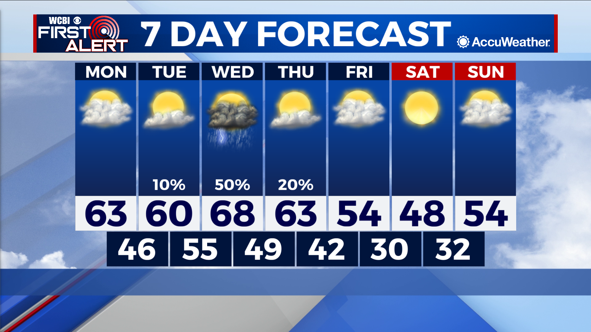
COLUMBUS – SUMMARY: Highs drop from the upper 60s Wednesday into the upper 40s by Saturday off the back of two cold fronts. Colder air means lows drop into the low 30s by overnight Friday. The week’s only rain chance on Wednesday brings scattered showers and storms.
MONDAY: Afternoon temperatures climb into the low 60s as mostly cloudy skies take the stage. Lows drop into the mid to upper 40s overnight. No rain is expected Monday.
TUESDAY: Highs reach the low 60s once again as the skies part somewhat to make way for more sunshine. The rogue shower cannot be ruled out but overall the skies will remain dry. Lows increase into the mid 50s overnight as warmer air is funneled into the region ahead of a cold front Wednesday.
NEXT WEEK: Two rounds of cold fronts will help brings highs down into the upper 40s by Saturday. A cold front very late Wednesday and into Thursday will provide the initial burst of cooler air, accompanied by scattered showers and storms across the region. The second front will arrive early Friday, reinforcing the already cooler air brought in Wednesday. During this period we really only see one major chance for rain on Wednesday, while the remainder the the week remains mostly dry. Lows drop close to 30 overnight Friday in the aftermath of our frontal passages.