Drier tomorrow, rain returning soon
COLUMBUS, Mississippi (WCBI) – Temperatures are hottest for the middle of the week. Rain moving in with a cold front will drop temperatures slightly for the weekend. Quickly heating back up!
WEDNESDAY NIGHT: Cloudy conditions do continue through the night, becoming slightly clear by early morning. Overall, a copy and paste type of night from the past several night. Mild, muggy, chance of patchy fog, with temperatures overnight in the middle to upper 70s.
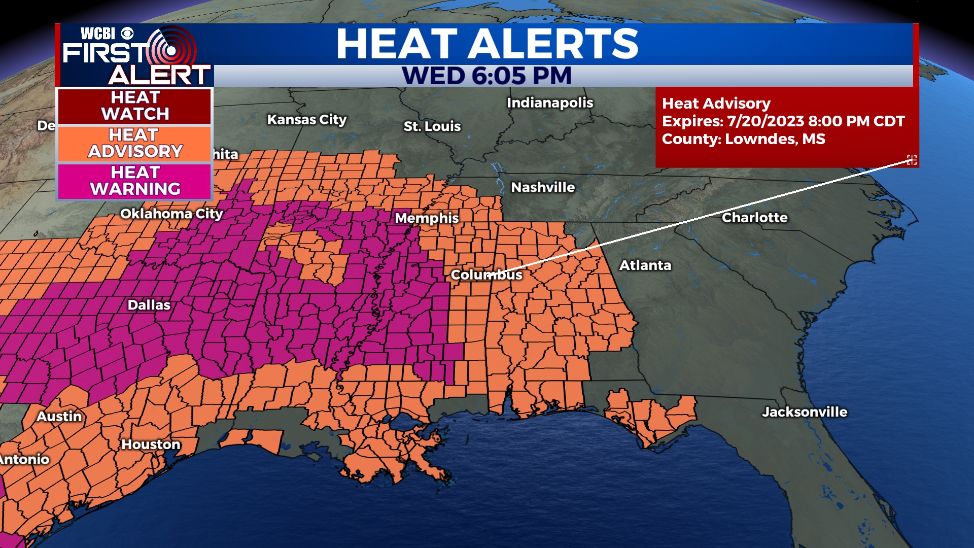
THURSDAY: Another hot day heading our way! Upper 90s all around. Some spots may even hit triple digits, and if they don’t, it is going to feel like it. The heat index will once again be between 105-115 degrees. With the hot temperatures and humidity making it feel worse, another HEAT ADVISORY has been issued. This advisory begins at 11am and goes until 8pm Thursday night. And another night with lows in the middle 70s.
FRIDAY: Staying hot, with high temperatures maintaining in the middle 90s. The rain chance does return with the chance for showers and storms at a current 40%. Cloud coverage will be mostly cloudy through until the weekend. Low temperatures do drop some, with help from a passing front, to the low to middle 70s.


