Drier weather coming back
SUMMARY: A few showers and storms are possible again Friday before the pattern takes a dry turn for the weekend and a good chunk of next week. Humidity levels will drop for the Saturday and Sunday and that bodes well for any outdoor activity or chore you may have planned. Typical summer heat and humidity is going to return by next Tuesday or Wednesday.
THURSDAY NIGHT: A few lingering showers and storms are possible. Lows in the low to mid 60s. Light wind.
FRIDAY: A 30-40% chance of scattered showers and storms, primarily during the heating of the day. Highs top out in the low to mid 80s. Winds SW to NW between 5-15 mph.
FRIDAY NIGHT: Clearing skies and quiet. Lows in the low 60s.
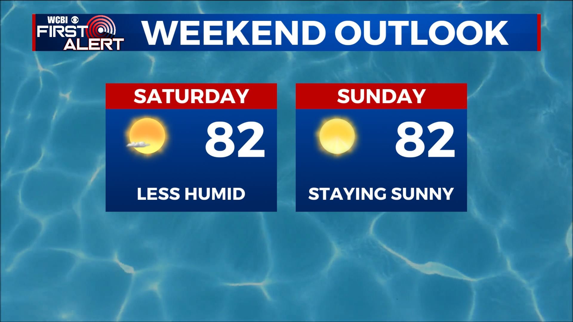
SATURDAY: Mostly sunny skies and lower humidity. Just about perfect with a northerly breeze. Highs in the low 80s.
SATURDAY NIGHT: Clear, calm, and comfy. Lows in the mid to upper 50s.
SUNDAY: Bright sunshine along with relatively low levels of humidity. Highs in the low 80s.
NEXT WEEK: Mostly sunny to partly cloudy conditions can be expected for the entire week. Humidity ticks back up starting Tuesday and that could spell a few spotty showers or storms at some point by the end of the week. Highs look to be around 90 from Tuesday onward.
Follow @WCBIWEATHER on Facebook, Twitter, Instagram, and the WCBI News App


Leave a Reply