Drying out on Friday; More rain is on the way Sunday
SUMMARY: Drier conditions are returning for our Friday. Expect a mix of sun & clouds for Saturday before another weather maker will bring another round of rain our way for Sunday and into Monday. It has the potential to produce even heavier rain in our area along with some storms too. We’ll keep you updated throughout the weekend.
FRIDAY: We’re starting off our Friday with areas of rain in our southern counties this morning, with drier conditions taking over during the afternoon into the evening hours. Highs in the lower to mid 50s. Winds NE 5-10 mph.
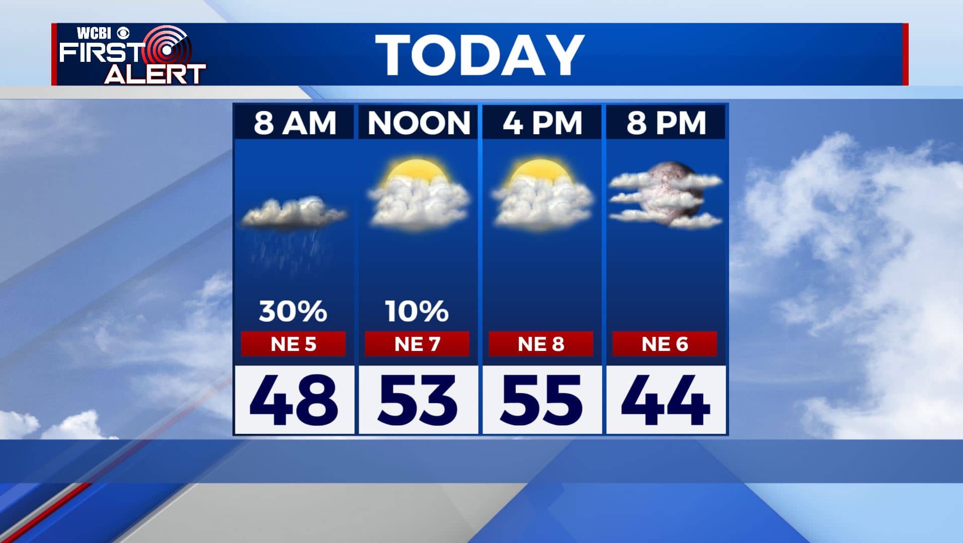
FRIDAY NIGHT: Skies clearing up a bit. A chilly night as overnight lows fall to the 30s.
SATURDAY: A mix of sun & clouds as we get a break in our weather pattern. Highs in the lower to mid 50s.
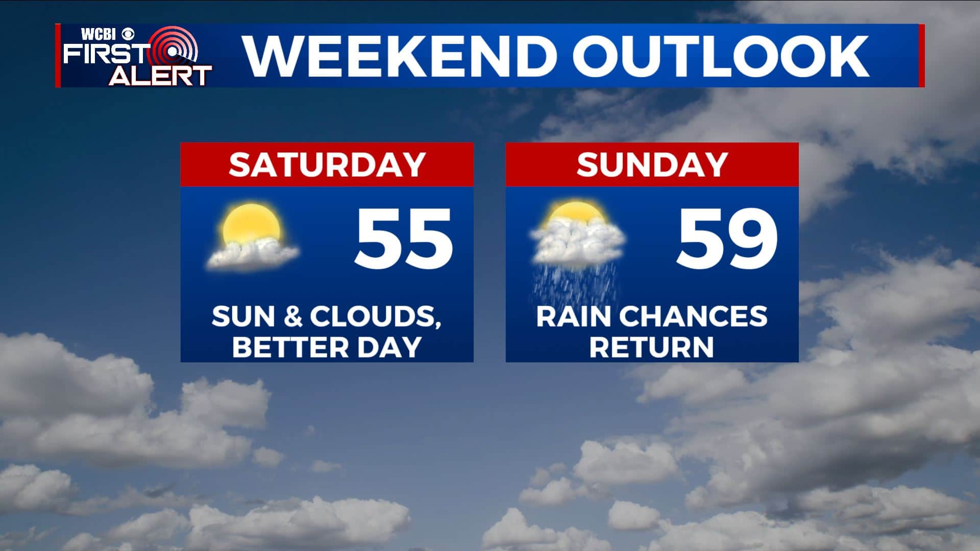
SATURDAY NIGHT: Increasing clouds. Overnight lows around 40.
SUNDAY & MONDAY: Areas of rain on Sunday. More rain and thunder on Monday. Not expecting any severe weather with this system, but something we’ll continue to watch. Anywhere from half an inch to over 2″ of additional rainfall is possible. Highs in the upper 50s Sunday. Warming up to near 70 degrees on Monday.
TUESDAY: Conditions should improve on Tuesday with a mix of sun & clouds as we get another break. Cooler once again with highs in the upper 50s.
WEDNESDAY: Mostly cloudy with rain likely once again. Highs in the upper 50s to near 60 degrees.
THURSDAY: Mostly sunny skies. Highs in the mid 50s.
Stay connected with @WCBIWEATHER on Facebook, Twitter, Instagram, and the WCBI News App


Leave a Reply