Early Friday storm potential, cooler St. Patrick’s Day weekend
COLUMBUS, Mississippi (WCBI) – Unseasonably warm, humid air brings early morning storms Friday before cooler air settles in for the St. Patty’s Day weekend.
THURSDAY: Early sunshine will give way to developing clouds by afternoon, and a few showers and storms should evolve in peak heating hours. Highs will range from the upper 70s to lower 80s with increased humid feels.
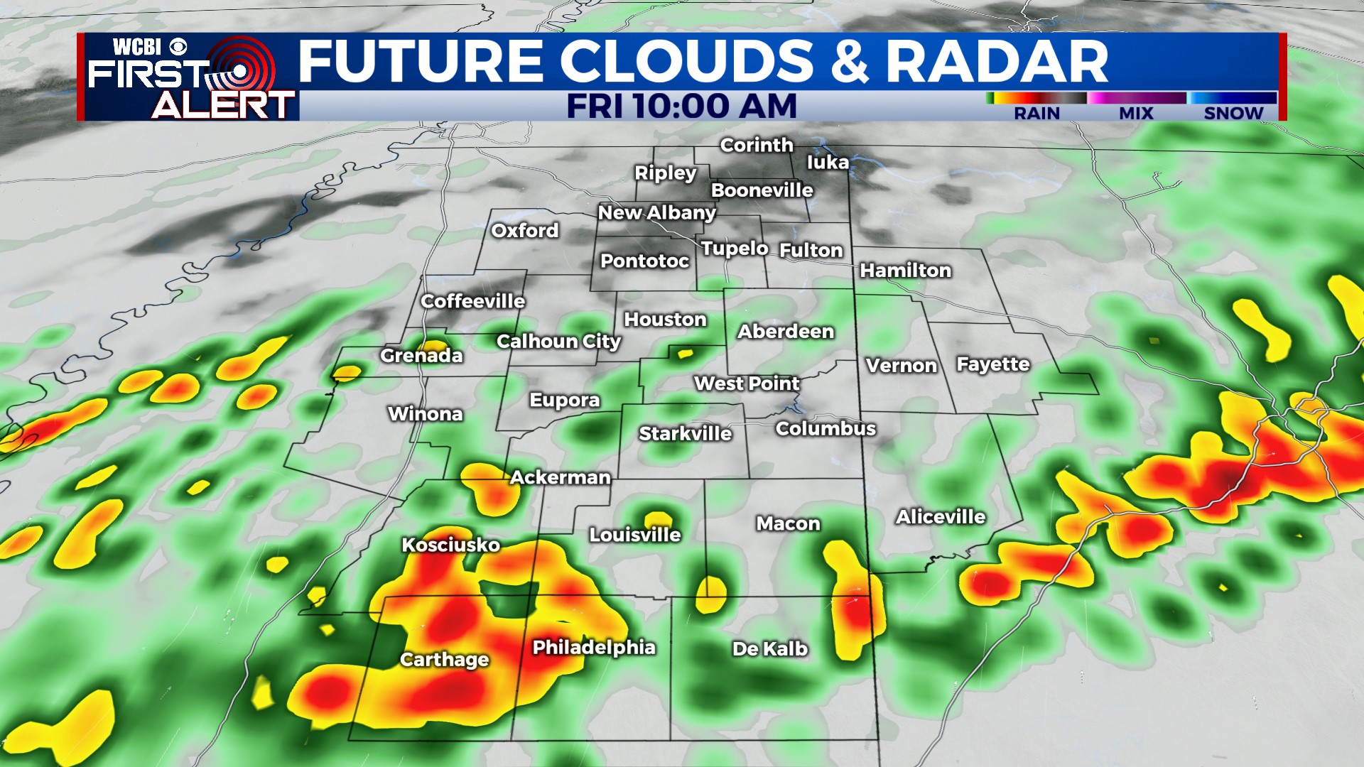
THURSDAY NIGHT: A cluster or complex of storms is likely to move in to north Mississippi after midnight, bringing severe weather potential through the area. Large hail and damaging winds are the primary threats, though a tornado cannot be ruled out as well. The most likely timing is 1 AM – 8 AM.
FRIDAY: Friday’s forecast is entirely predicated on exactly how the early morning storms play out. Assuming they’re cold-pool driven and move through most of the area by daybreak, it seems unlikely new storms will form later in the day. However, moisture will linger…and at least scattered to locally numerous showers may redevelop through the day. If morning storms weaken or are slower than currently anticipated, new storms could form…though this is not likely.
WEEKEND: Saturday looks fully dry, though a good deal of cloud cover is likely to remain. One last rain chance moves in Sunday morning, but any rain should be out of the area by Sunday afternoon & or early evening. Highs both days will be in the 60s.
NEXT WEEK: We still have decent confidence on yet another frost or freeze by Monday night. Temperatures near freezing are likely with highs in the upper 50s to near 60° Monday and Tuesday.


