Excessive heat continues next several days
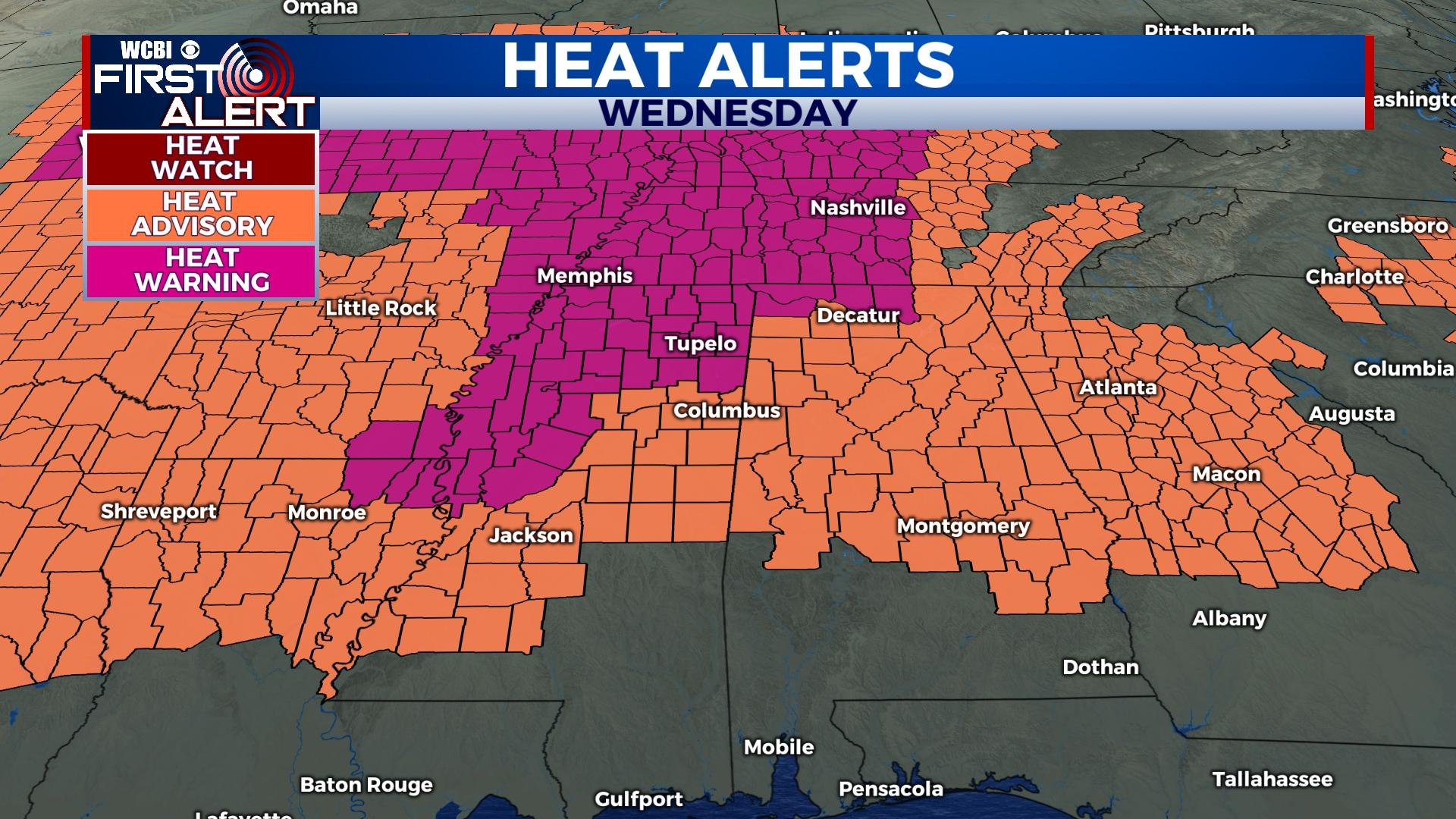
COLUMBUS, Mississippi (WCBI) – Heat advisories and warnings will highlight the map over the next few days. There remains hope for some widespread rain Saturday afternoon & evening.
WEDNESDAY: Under a mix of sun and clouds, highs will top out in the mid 90s to near 100 degrees across the region again today. Heat indices could peak as high as 112° in some locales. Rain coverage will be isolated again today, but a few downpours and storms remain possible after lunch.
THURSDAY: More excessive heat concerns will loom as rain coverage remains isolated in the afternoon. Expect a near-repeat of Wednesday’s forecast.
FRIDAY: This still looks to bring the worst of the heat. Highs will top out near 100 degrees area-wide, with peak heat indices potentially reaching 115 degrees. Rain coverage looks quite sparse to almost zero.
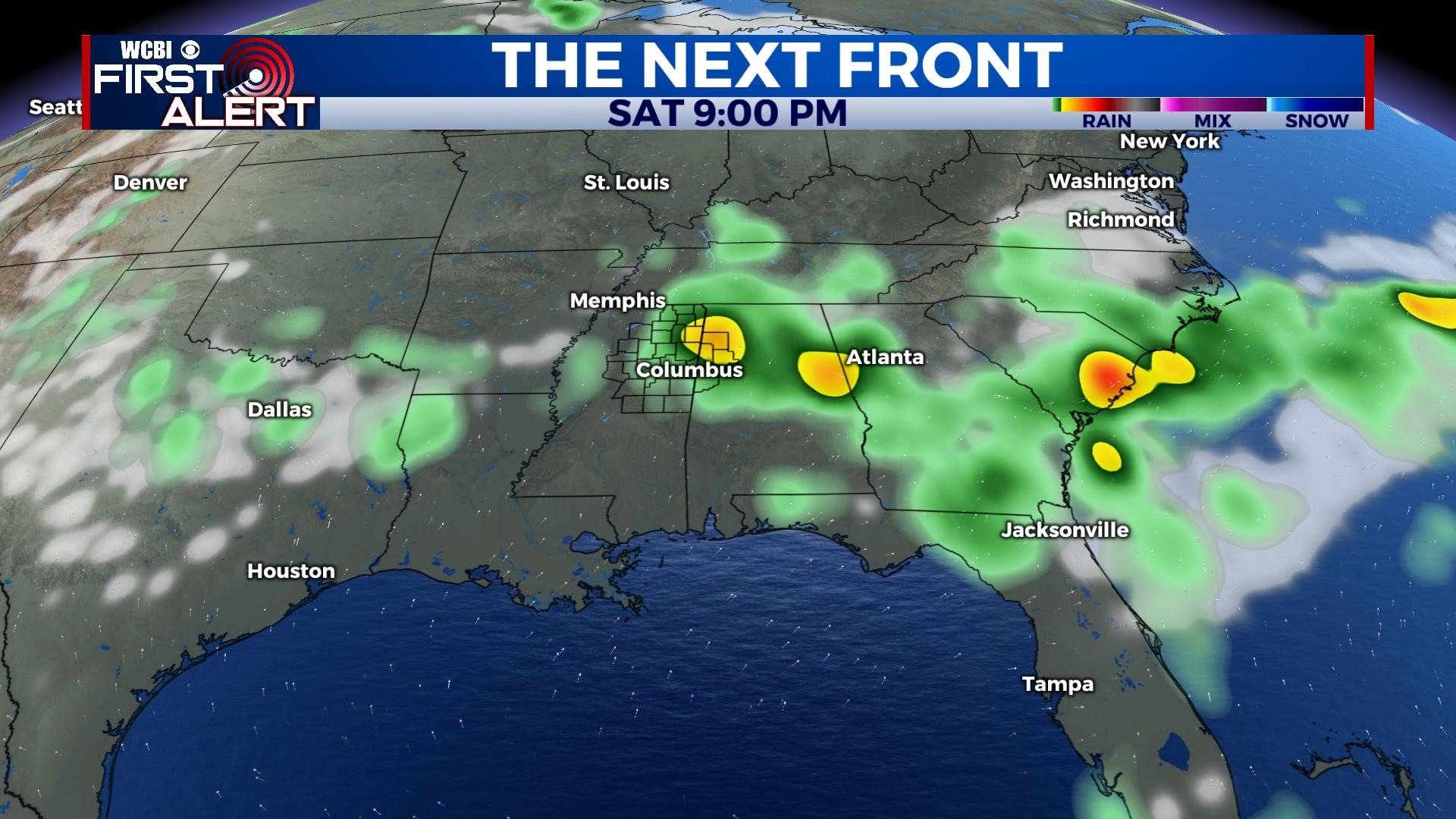
WEEKEND: Saturday stays hot & steamy ahead of a weak front set to bring increased rain chances. Showers and storms appear most likely Saturday late in the day, lasting into the evening hours. Most showers will weaken after midnight, leaving Sunday overcast to start the day. Gradual clearing with highs in the low 90s Sunday afternoon.
NEXT WEEK: July sun returns in fuller force and boosts highs back into the middle 90s.


