Eyeing a second round of severe weather next week
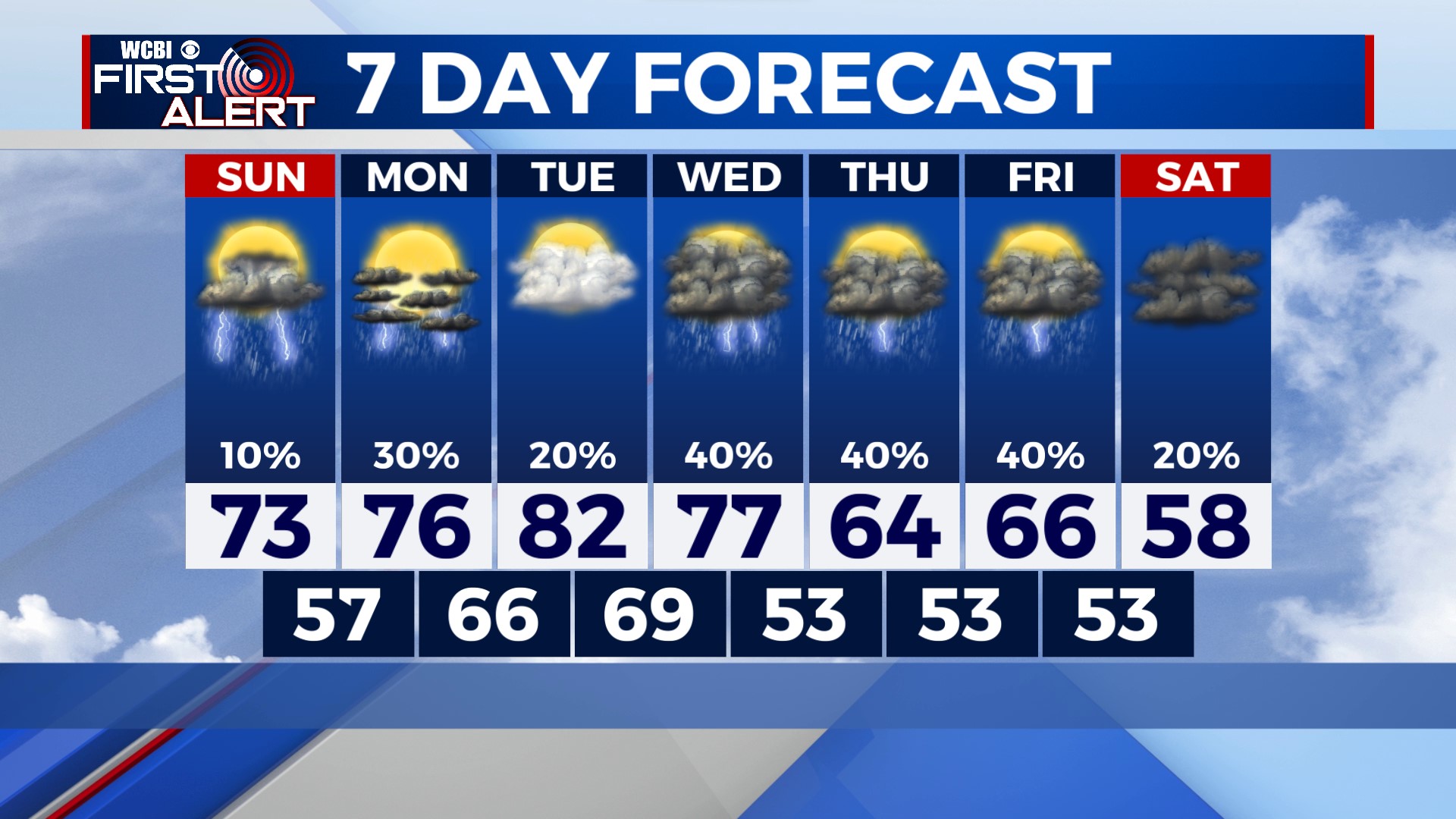
COLUMBUS – SUMMARY: A second chance for severe weather arrives overnight Tuesday into Wednesday, with what looks to be another strong squall line setup. Temperatures drop later in the week into the upper 50s.
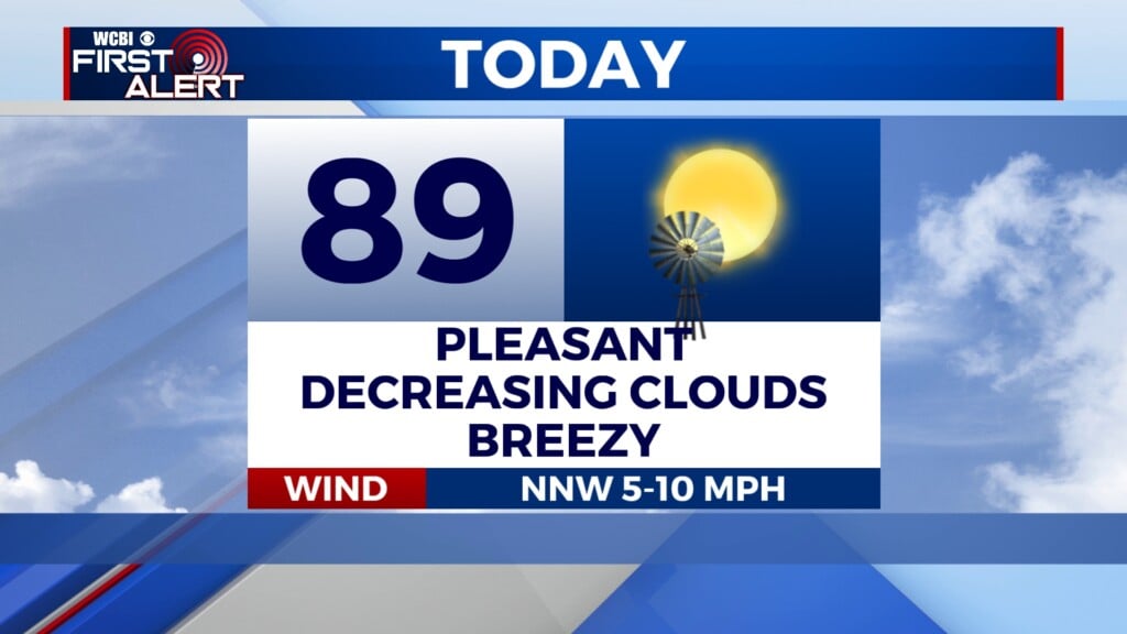
SUNDAY: Highs top out in the lower 70s as partly cloudy skies prevail throughout the day. Scattered showers and storms will move in overnight, bringing many of us yet another opportunity to tally up rain totals. Lows bottom out in the upper 50s overnight.
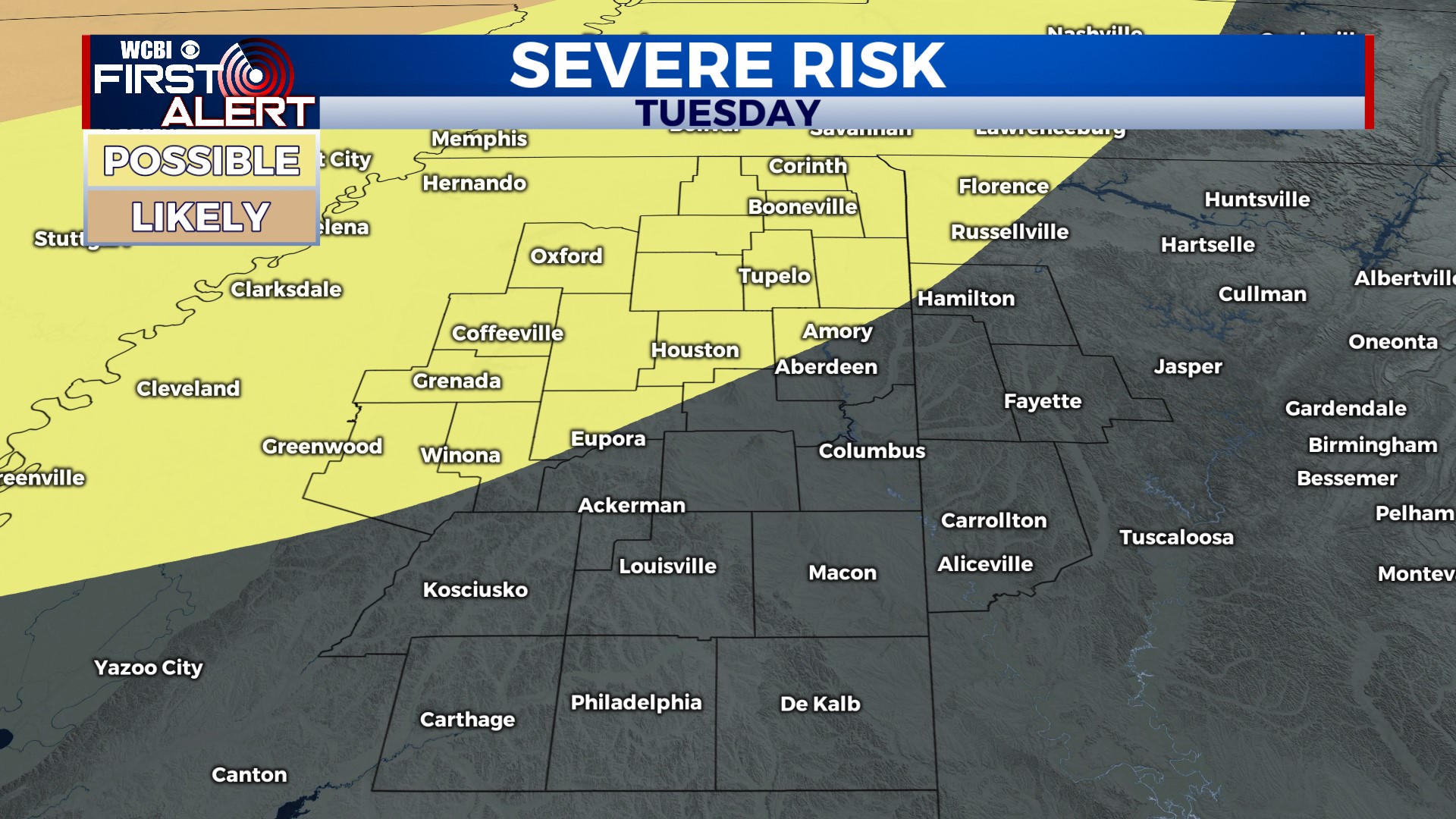
NEXT WEEK: The biggest story heading into next week is yet another chance for severe weather in the region late Tuesday into Wednesday. Parts of our northern and northwestern counties are under a 15% probability for severe weather coming up according to the Storm Prediction Center (SPC). We will of course keep you updated on the situation as it evolves so you know what to expect. More rain chances over the following days mean that only Tuesday and next Saturday contain no major rain chances. Highs will hover between the 70s and 80s before dropping into the upper 50s by next Saturday. Lows will hover in the 60s before dropping into the lower 50s later next week.