Few showers Thursday, late weekend front brings heat relief
COLUMBUS, Mississippi (WCBI) – After Wednesday’s extreme heat, temperatures back off slightly for Thursday with a weak front. A stronger front brings higher rain chances late Sunday and Monday.
THURSDAY: The weather stays plenty hot and humid today with highs well into the 90s, stopping short of the century mark this time around. An approaching weak front hopefully will trigger a few showers and storms between 3-6p across the region.
FRIDAY: Thursday’s front will bring some noticeably drier air to the region, curbing the humidity a bit! Highs still reach the middle 90s Friday with plenty of sun, but the heat index shouldn’t be a factor.
WEEKEND: Saturday brings back extreme heat and is another candidate for 100 degree temperatures for some. Sunday stays steamy in the upper 90s, but an approaching front will generate small daytime rain chances. Showers and isolated storms look to become more widespread Sunday night into Monday.
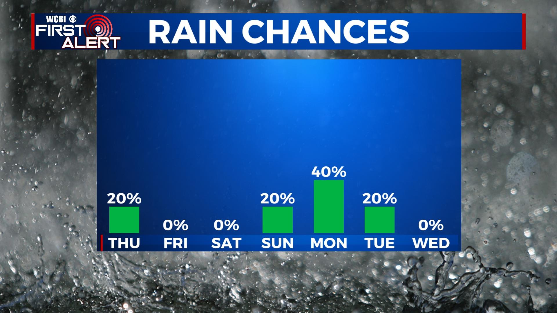
NEXT WEEK: As a result of higher rain chances, temperatures come down into the upper 80s Monday and Tuesday. While Monday holds the best rain chance, a few showers could linger into Tuesday. Drier and hotter weather returns Wednesday.


