Finally, a rain chance in north Mississippi
COLUMBUS, Mississippi (WCBI) – Welcomed rain chances are on the way the next couple days!
THURSDAY: Clouds will slowly fill in ahead of a weakening and shallow cold front. Afternoon highs will be split today, ranging from the low 70s in the far north to low 80s south of US 82. While a good portion of the daylight hours will be dry, a few showers are possible late in the afternoon…especially NW of the Natchez Trace.
THURSDAY NIGHT: A steady rain is expected to overspread the region with temperatures slowly falling into the upper 50s.
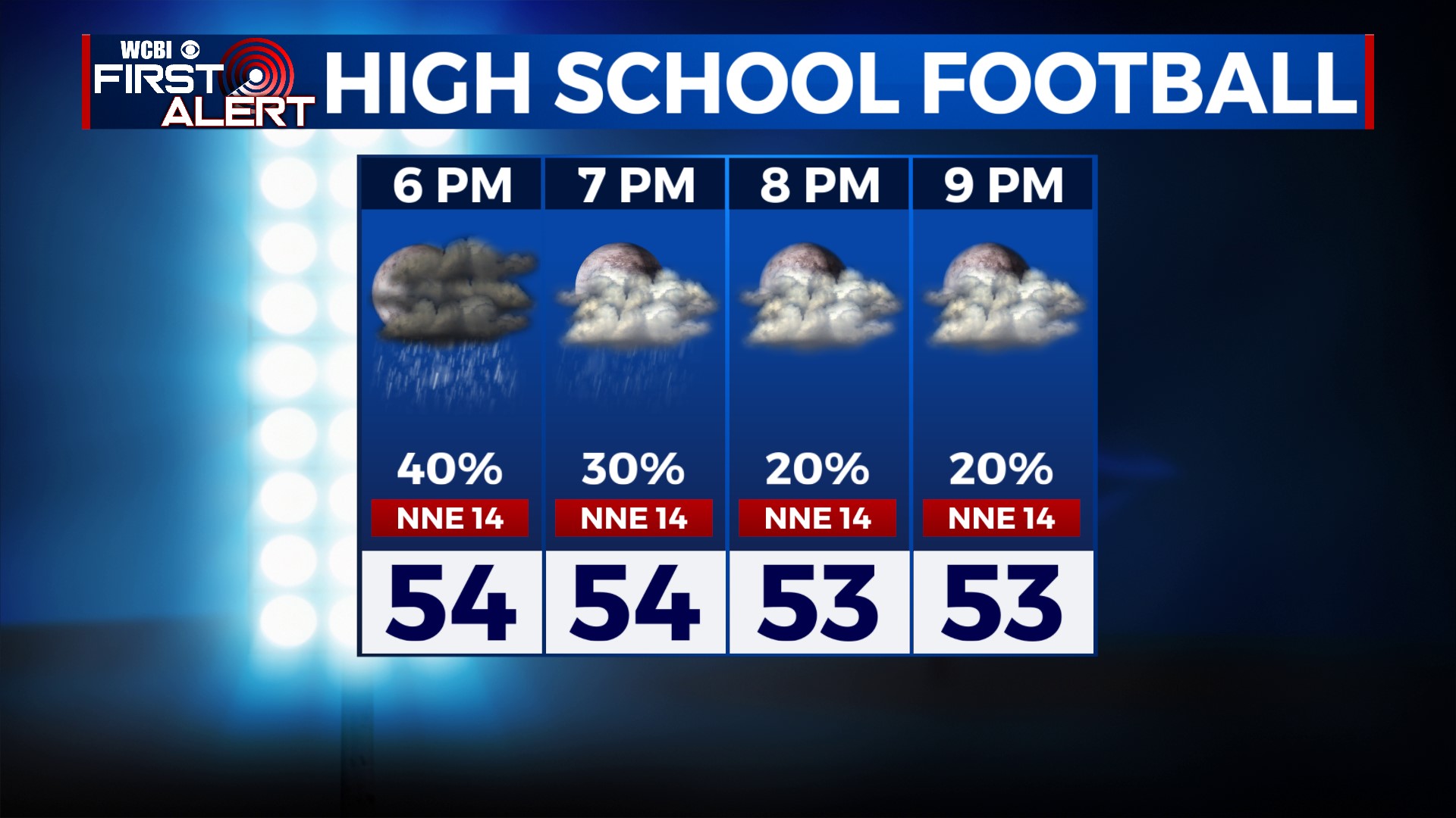
FRIDAY: Steady showers are possible to start the day, tapering to off/on showers into the afternoon. High temperatures will likely hold in the upper 50s to near 60°. Most rain should be done Friday evening – good news for high school football!
WEEKEND: Forecast confidence remains on the low side. A stalled front over southern MS/AL will serve as an impetus for additional rain, but how far north the rain chances comes is uncertain. We still expect a good deal of cloud cover regardless – highs will be near 60° Saturday and in the middle 60s Sunday.
NEXT WEEK: Forecast confidence continues to suffer thanks to medium range models being split. The going forecast is kept dry, but we’ll watch the European model’s trends closely as it continues to show rain Mon/Tue.


