Fred staying to our east but rain chances stick around
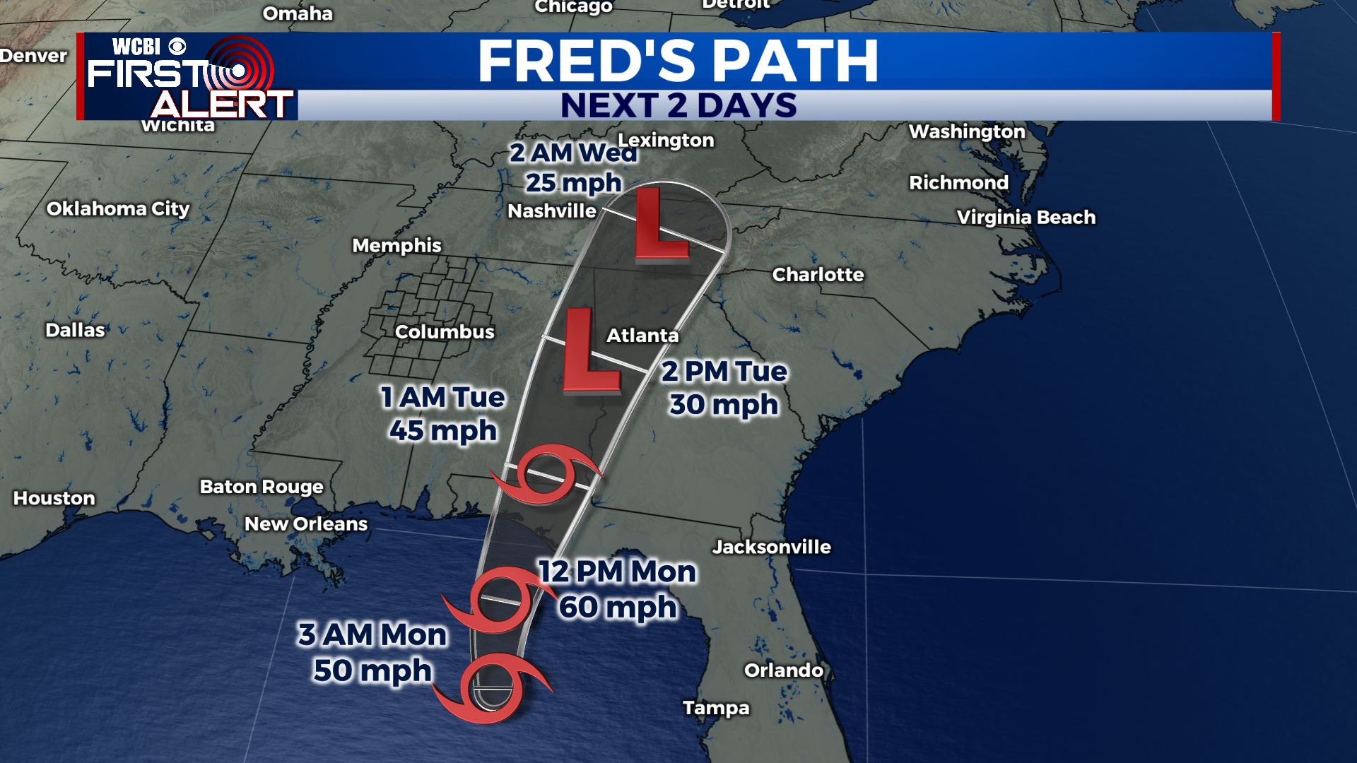
SUMMARY: We are starting off the new workweek on a rainy note with increased chances as we’re also watching Tropical Storm Fred as it’s hours away from landfall. We’ll be on the weaker side with minimal impacts. Rain & storm chances will stick around through the second half of the workweek into the weekend. TROPICS: All eyes are on the Gulf of Mexico this Monday morning as Tropical Storm Fred continues to move towards the Florida Panhandle. It will be making landfall later on today and quickly move inland to the north and east of us on Tuesday. Grace will be in the Gulf late week. Stay tuned! 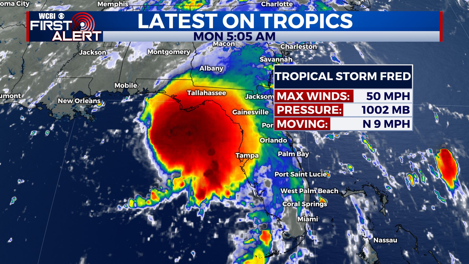
 MONDAY: It’s been a cloudy morning overall with some drizzle in some spots. Rain chances will continue to increase as we head into the afternoon. Temperatures will be cooler & below average in the mid 80s.
 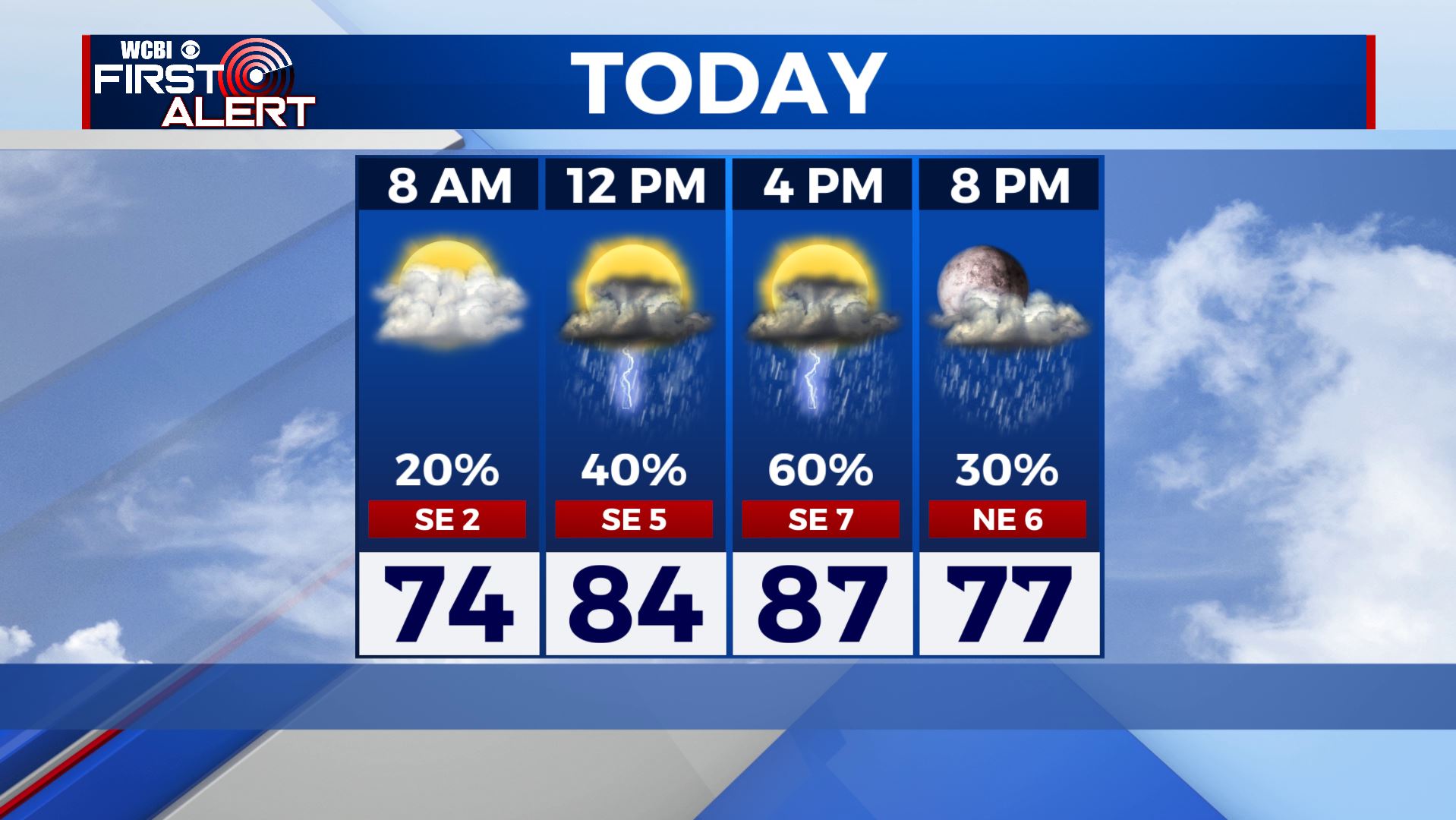 MONDAY NIGHT: Rain chances decrease. Mostly cloudy skies. Overnight lows in the 70s. TUESDAY: What’s left of Tropical Storm Fred will make its way to the region going into Tuesday. A mix of clouds with some peaks of sunshine and scattered rain showers are expected throughout the afternoon as Fred passes to our east. Upper 80s for highs. WEDNESDAY-FRIDAY: The rest of the week still has fairly high rain chances. Temperatures start climbing back up into the lower 90s. Stay connected with @WCBIWEATHER on Facebook, Twitter, Instagram and the WCBI News App


Leave a Reply