Friday night severe weather threat
COLUMBUS, Mississippi (WCBI) – A potentially significant severe weather event is possible across the Deep South Friday evening. More storms move in late Sunday.
FRIDAY: Clouds early will give way to sunshine by afternoon, allowing temperatures to climb into the 80s area-wide. Southerly breezes of 20-25 mph are also likely through the day.
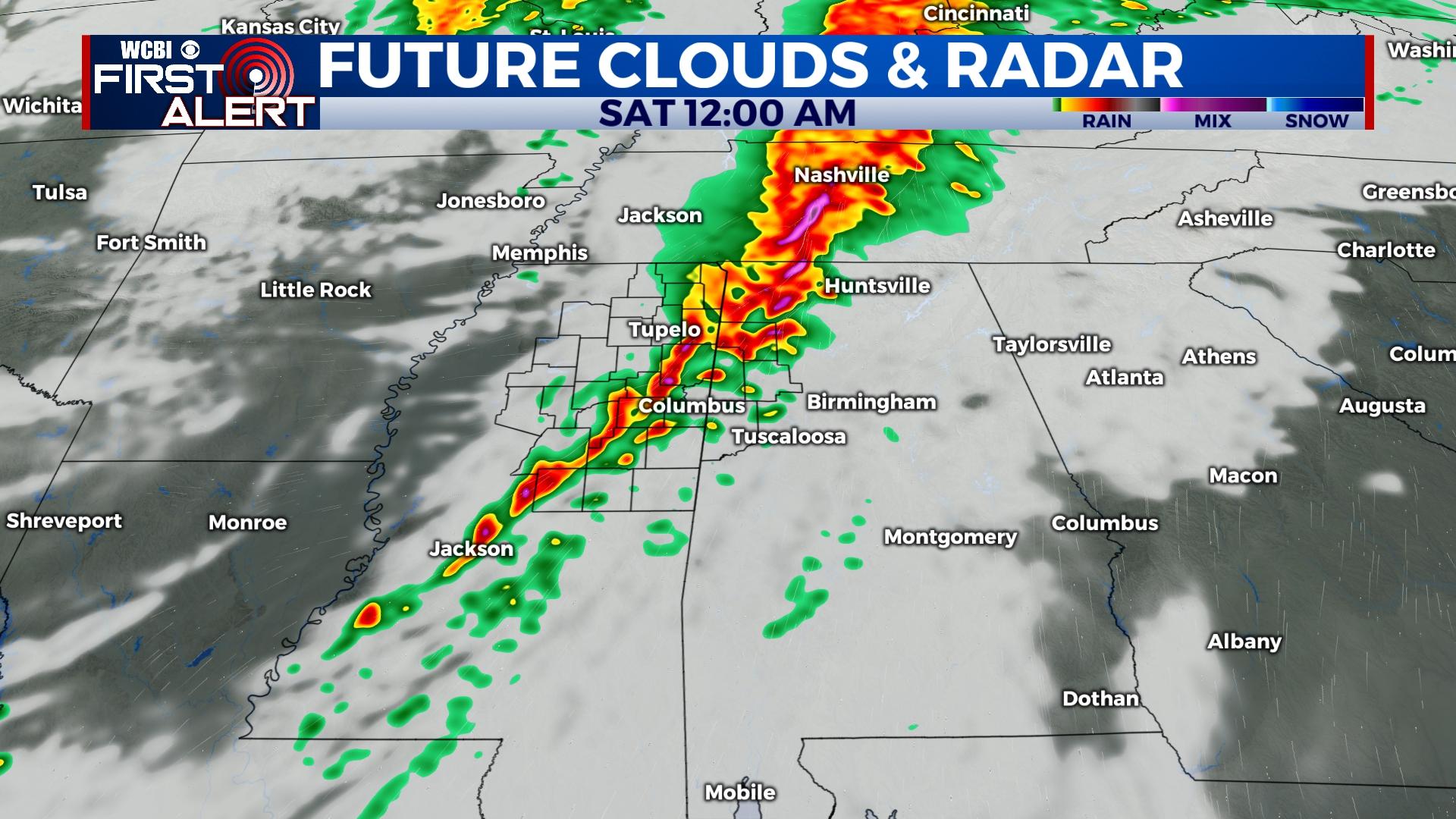
FRIDAY EVENING: Showers and storms will rapidly develop across the Arklamiss Delta region between 4-6p, accelerating toward western and northern MS between 6-8 PM. As this occurs, the environment will be becoming quite favorable for potentially significant severe weather, including tornadoes. These supercell storms will have elevated tornado potential, and accordingly severe weather potential in the WCBI coverage area will increase between 7 PM & midnight. Eventually, either a broken line of supercell storms or a solid line of storms with embedded supercells will move across the remainder of northeast MS. This line of storms will bring damaging wind and tornado potential as well. Storms will exit by 2 AM.
Please take some time to review your severe weather action plan. Make sure to have multiple ways to receive severe weather information.
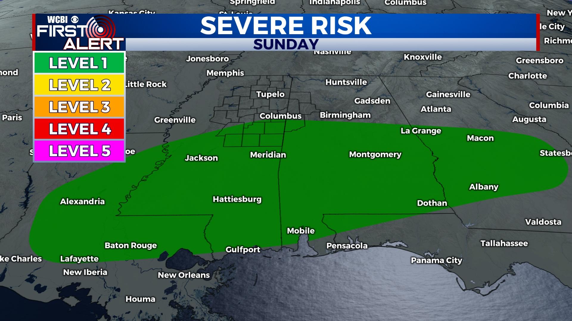
WEEKEND: The sky becomes mostly sunny Saturday as highs stay in the lower 80s – quite a nice day is in store! Sunday starts dry, but showers and storms move in again Sunday evening. These storms could produce some gusty wind or hail, but the severe weather threat remains low.
NEXT WEEK: A few showers stay possible Monday, but drier and slightly cooler air should makes its way into the area by Tuesday and Wednesday. The next system looks to bring increasing storm chances by next Friday, stay tuned!