Get ready for the rain and cold air to move in
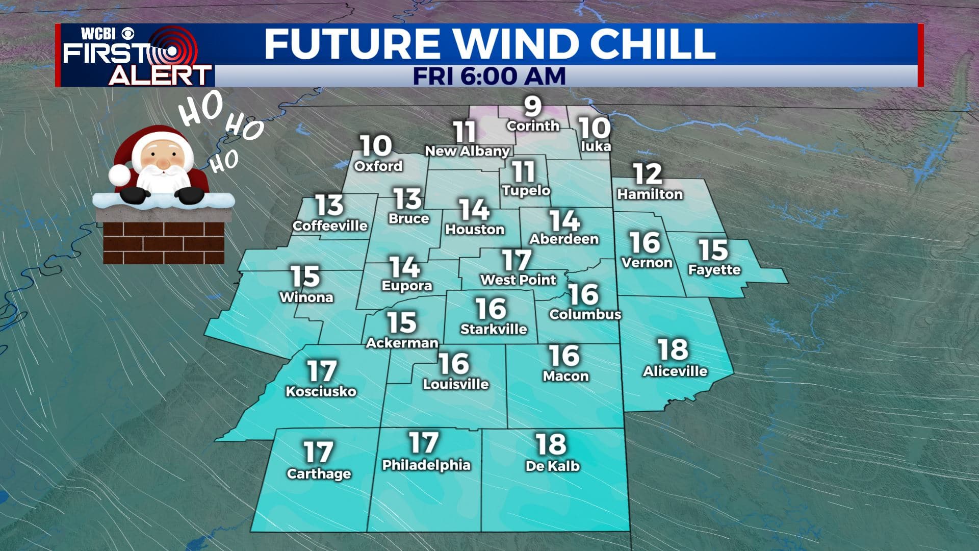
SUMMARY: Can’t say we didn’t warn you! Big changes are on the way with our weather over the next 24 hours. Our next cold front set to push through on tonight into our Christmas Eve Thursday morning and this one will pack a punch. It will give us a good chance of rain, some thunder and windy conditions. Then the colder air will filter in behind it for Christmas Eve and Christmas Day. Temperatures only into the 30s and 40s for highs while overnight lows will be in the 20s. Wind chill temperatures look to be the 20s and 10s into Christmas morning.
WEDNESDAY: We’re waking up to mostly clear skies and temperatures in the 30s to 40s this Wednesday morning. Becoming breezy throughout the day with SE winds picking up 10-20, gusting up to 25 mph. Temperatures mild for more day with highs in the lower to mid 60s. Clouds will increase before the rain starts to move in late afternoon into the evening hours.
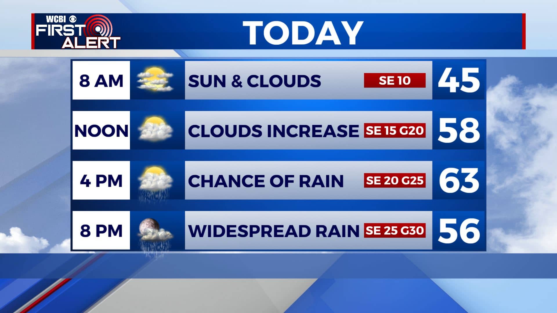
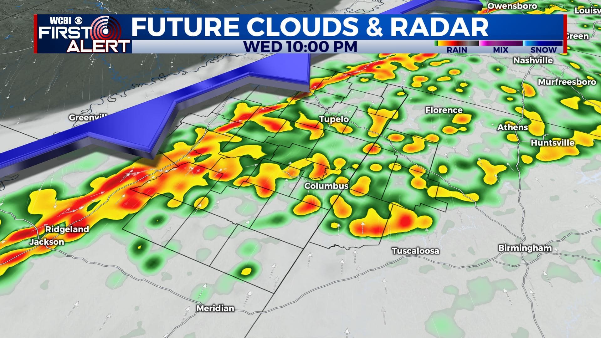
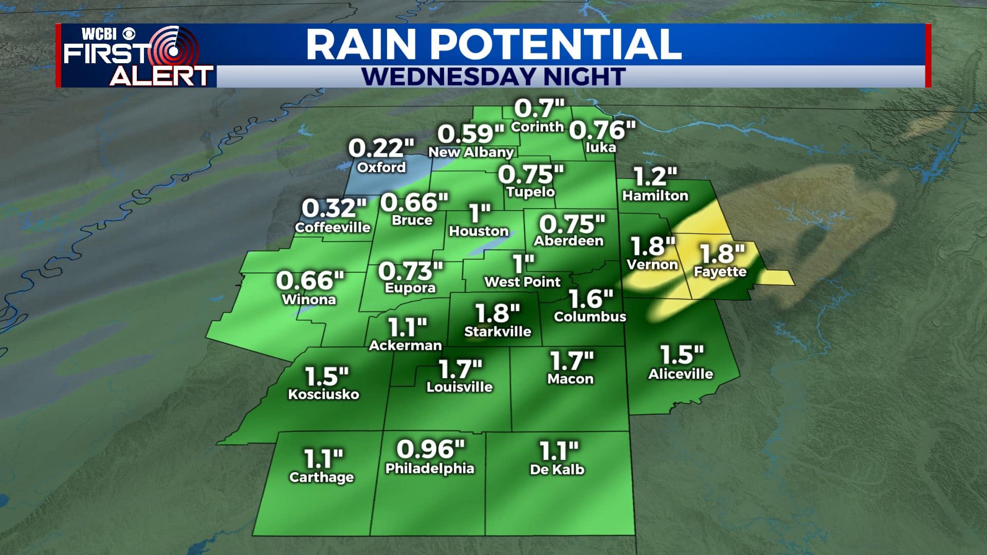
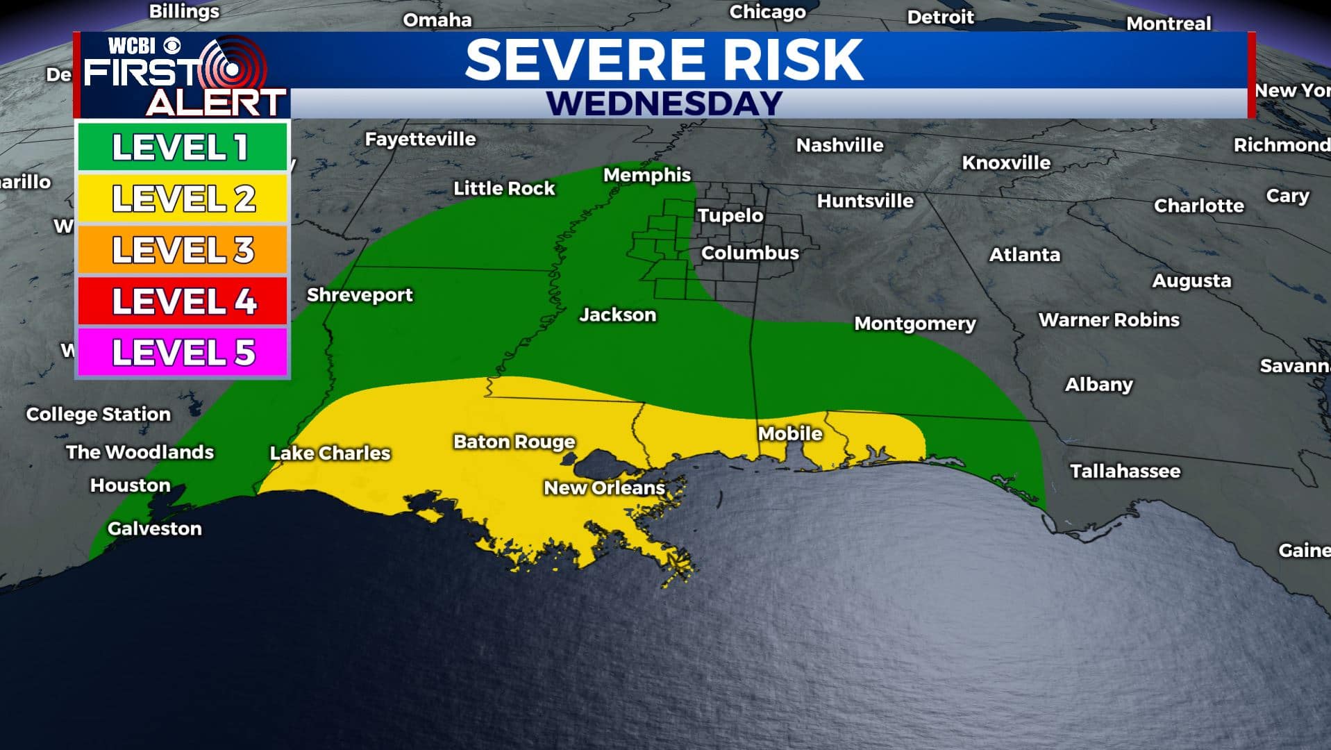
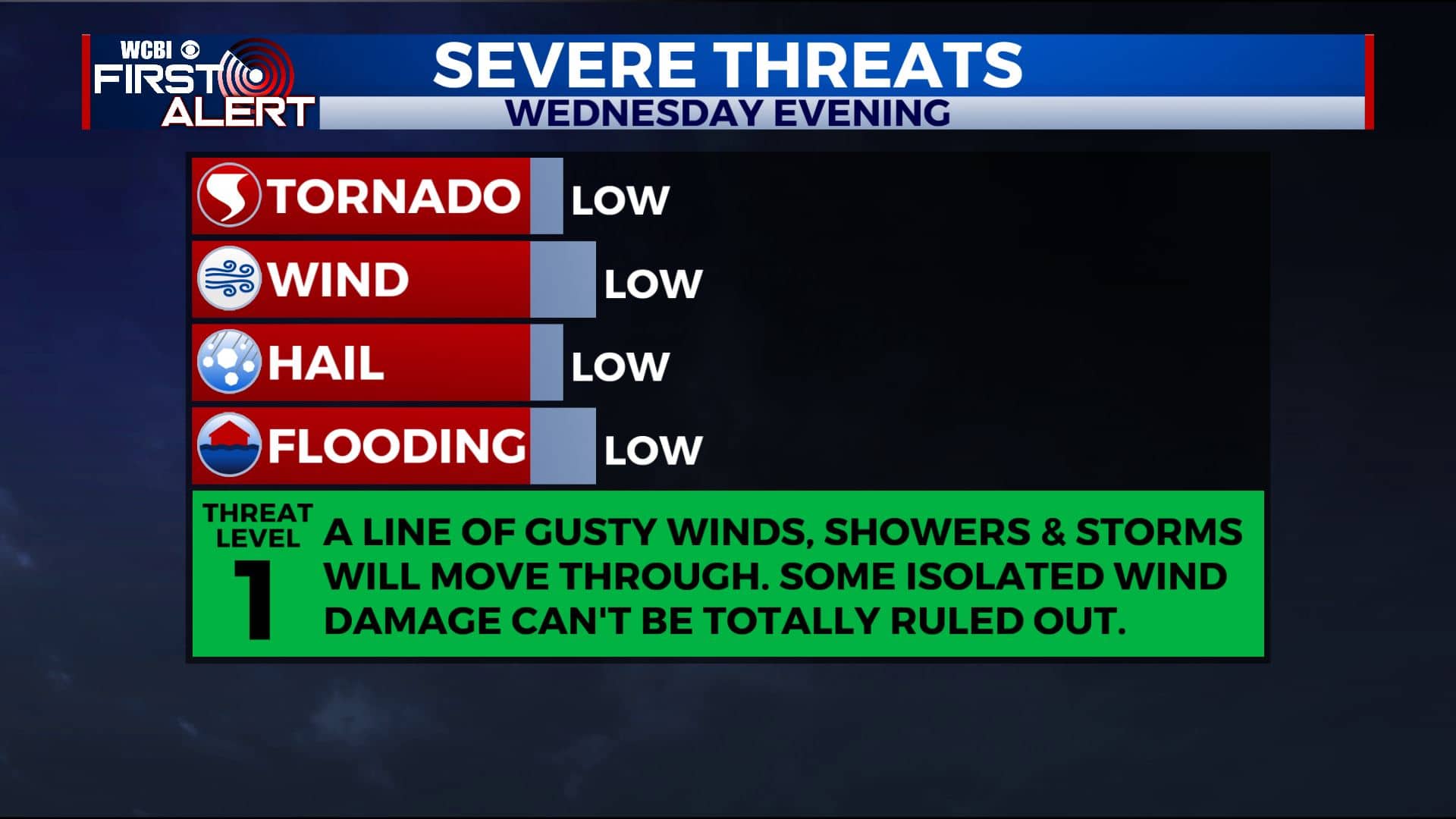
WEDNESDAY NIGHT: Our strong cold front will push across the region tonight. It will give us a good chance of rain & some thunder. Severe weather threat will stay to our south and west. Rainfall amounts 1-2″. Gusty winds can be expected all night from the SE to NW 15-20, gusting up to 30-35 mph. Overnight lows in the mid 30s by sunrise Thursday.
CHRISTMAS EVE: Cloudy skies in the morning will give way to more sunshine by the afternoon. It will be blustery and much colder behind our cold front as temperatures will be struggling to get up into the lower 40s. Winds NW 10-25 mph, gusts 30-35 possible. Wind chill values int the 30s and 20s.
THURSDAY NIGHT: Mostly clear skies and cold. Overnight lows in the low 20s with colder wind chill values in the 10s. Santa should have good visibility as he makes his way into our region this year.
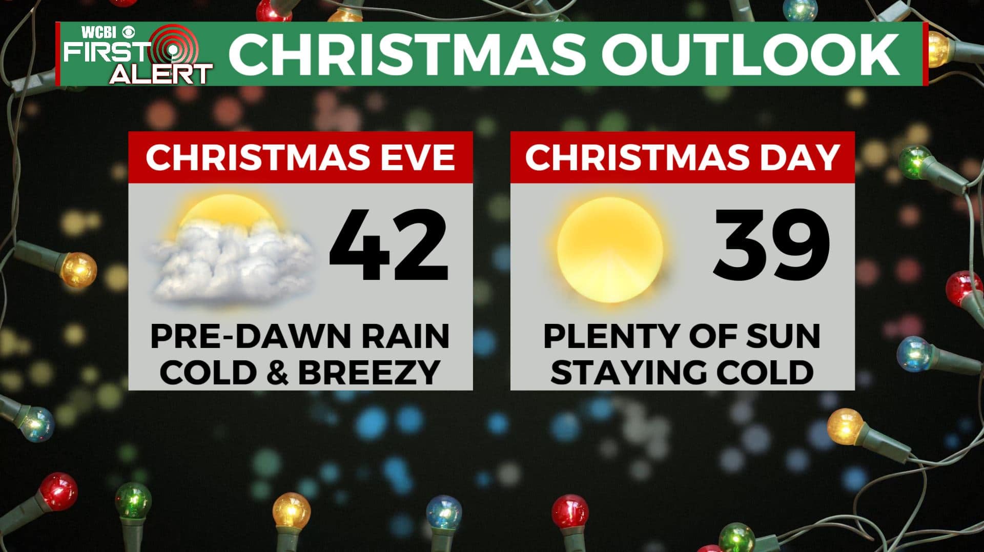
CHRISTMAS DAY: Merry Christmas! Lots of sunshine and cold. High temperatures in the upper 30s to 40 degrees.
FRIDAY NIGHT: Clear skies and cold. Overnight lows in the low 20s.
SATURDAY: Sunny skies continue. Temperatures begin to rebound back up to near 50 degrees.
SATURDAY NIGHT: Mostly clear. Lows near 30.
SUNDAY: Increasing clouds with another chance of afternoon and evening rain showers. Highs in the mid 50s.
MONDAY: A mix of sun & clouds after some morning showers. Cool with highs in the upper 40s to lower 50s.
Stay connected with @WCBIWEATHER on Facebook, Twitter, Instagram, and the WCBI News App


Leave a Reply