A few gusty Monday evening storms possible
SUMMARY: A few strong/severe storms are possible this evening prior to midnight. Gusty winds look to remain the primary threat overall but the tornado risk isn’t zero. Quiet and mild conditions build in briefly for Tuesday. Showers are possible again Tuesday night into Wednesday.
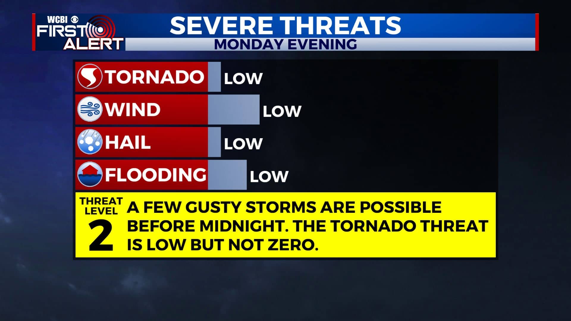
MONDAY NIGHT: A chance for showers and storms during the evening hours. Gusty winds and heavy downpours are the main threats. The hail and tornado risk remain low, but not zero. Expect clearing late with temperatures dropping into the mid to low 50s by sunrise. WSW winds 5-15 mph.
TUESDAY: Partly cloudy. Mild highs in the upper 60s to around 70. Winds WSW 5-10 mph.
TUESDAY NIGHT: Mostly cloudy with rain showers developing. Lows in the upper 40s.
WEDNESDAY: Mostly cloudy. A 50% chance of rain showers. Highs in the mid 50s. Turning breezy with NNW winds 10-20 mph.
WEDNESDAY NIGHT: Clearing skies. Much colder lows around 30.
THURSDAY: Turning sunny. Highs in the upper 40s to around 50. Lows in the upper 20s Thursday night.
FRIDAY: Mostly sunny. Highs in the mid 50s. Lows in the low 30s Friday night.
SATURDAY: Morning sun, afternoon clouds, and a chance for some evening rain showers. Highs near 60. Chance of rain 40%. Milder lows in the low 50s Saturday night.
SUNDAY: Mostly cloudy with a 40% chance of rain showers. Highs in the low 60s. Lows in the upper 30s Sunday night.
MONDAY: Partly cloudy. Highs in the mid 50s.
Follow @WCBIWEATHER on Facebook, Twitter, Instagram, and the WCBI News App


Leave a Reply