Gusty storms possible Wednesday, nice Thanksgiving
SUMMARY: A cold front will spark some gusty showers and storms around the region Wednesday. The main threat will be isolated damaging gusts but we can’t totally rule out an isolated tornado. Pleasant weather builds in briefly for Thanksgiving Day but more rain is possible again Friday. Additional rain and even some storms could return on Sunday.
TUESDAY NIGHT: Variably cloudy during the evening with skies becoming mostly cloudy during the night. A few showers are possible by sunrise. Breezy SSE winds increase to 10-20 mph. Evening temperatures will briefly fall into the low 50s before rising to around 60 by sunrise.
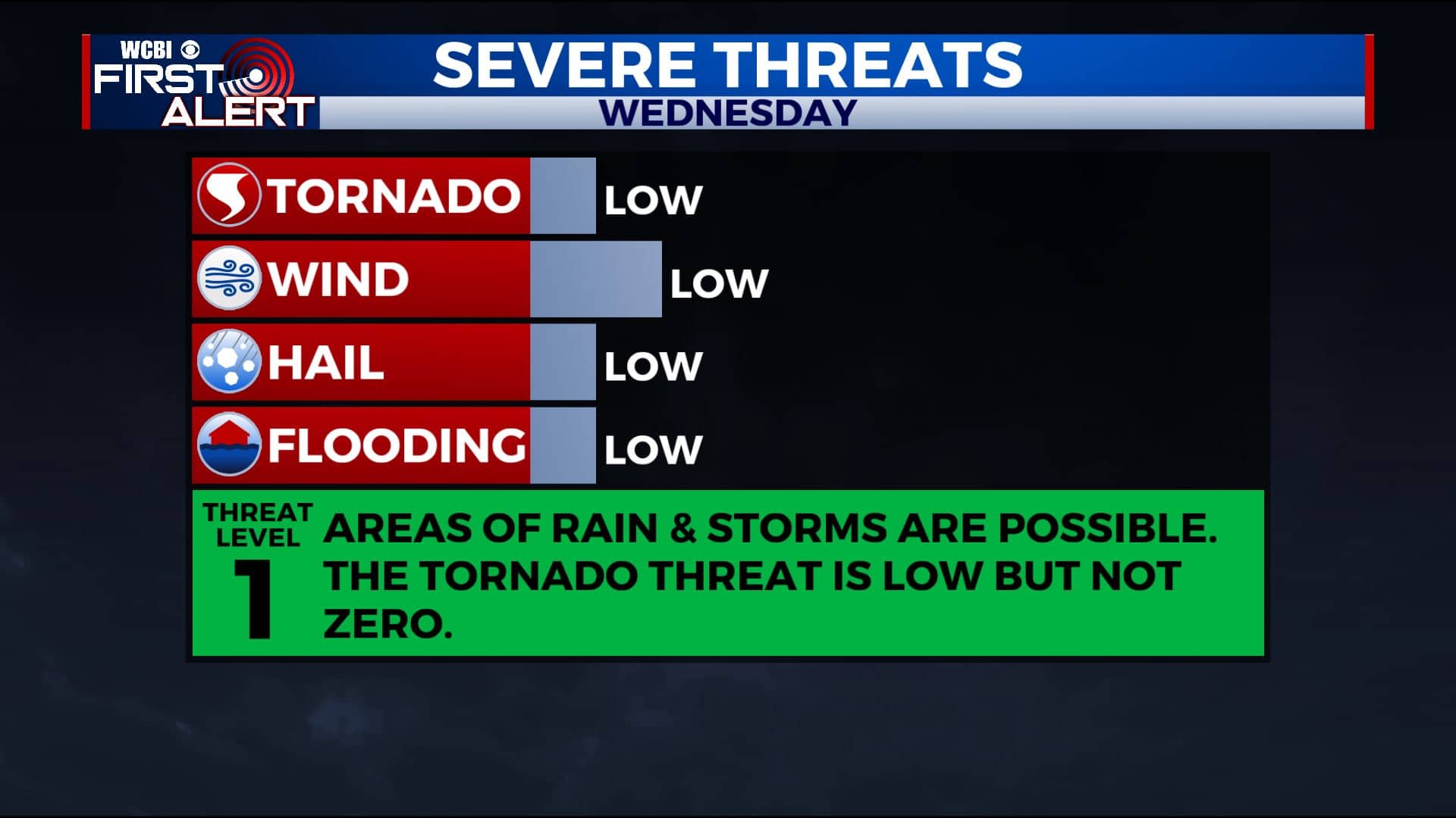
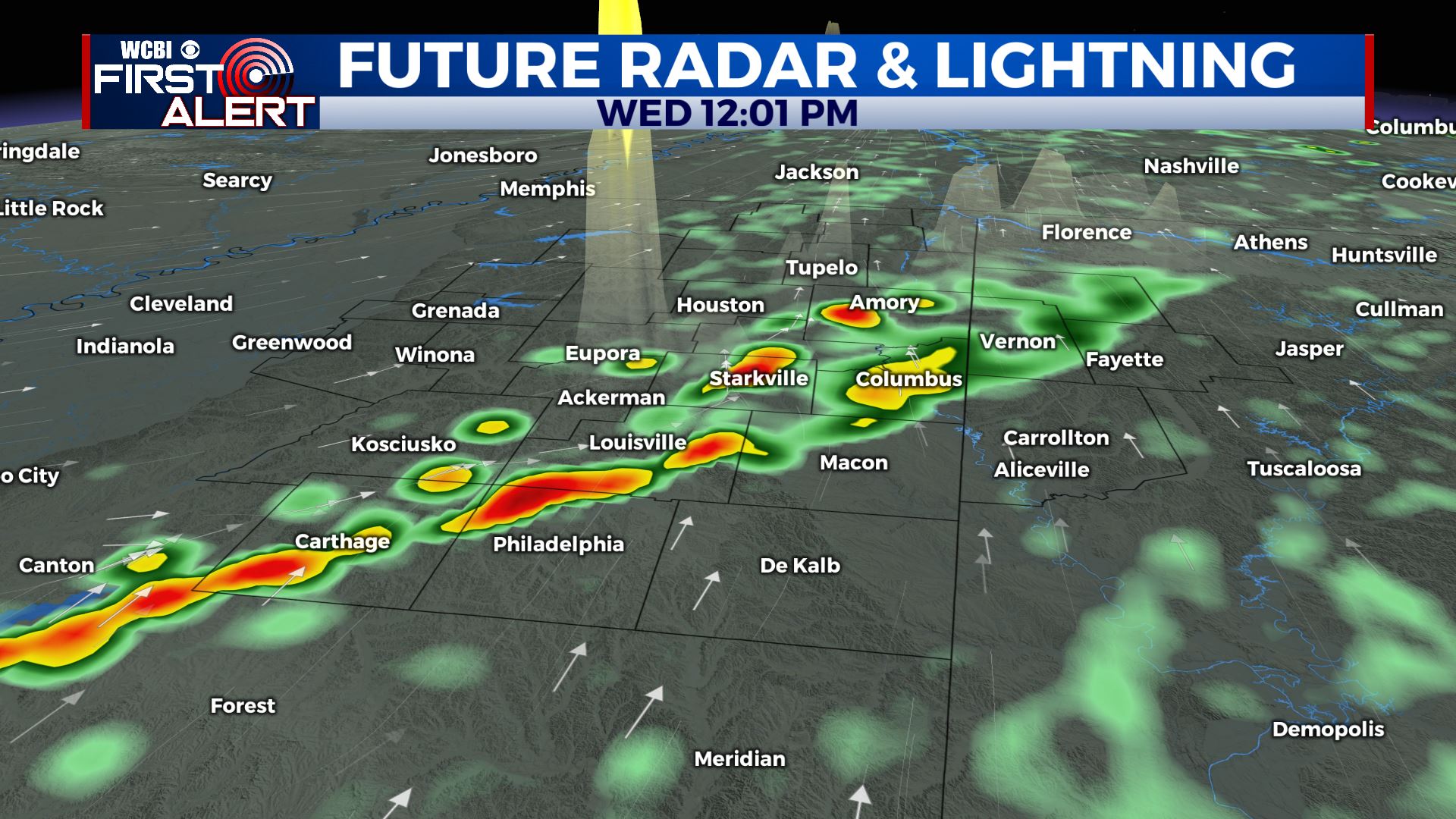
WEDNESDAY: Areas of rain and storms are possible. Isolated damaging wind gusts are the main concern but we can’t totally rule out an isolated tornado. The overall setup doesn’t look like it will produce a lot of severe weather here but we’ll be watching it all day. Look for milder highs in the 70s with breezy SSW winds 10-25 mph with gusts possibly over 30 mph.
WEDNESDAY NIGHT: Turning partly cloudy. Lows in the mid 40s.
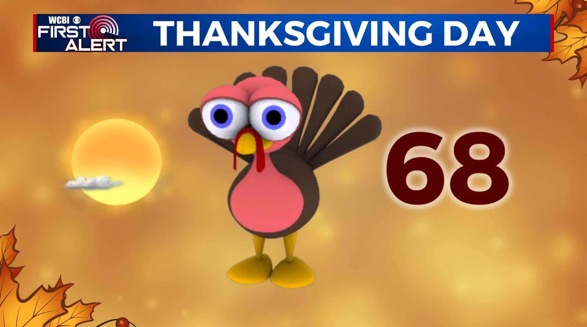
THANKSGIVING DAY: Mostly sunny. Highs in the mid to upper 60s.
THURSDAY NIGHT: Partly cloudy. Lows in the mid 40s.
FRIDAY: Turning mostly cloudy with afternoon and evening rain developing. Highs in the upper 60s.
SATURDAY: Mostly cloudy with a 20% chance of a shower or two Higher odds of rain farther to our south. Highs in the low 60s. Weather looks fair for the Egg Bowl in Oxford.
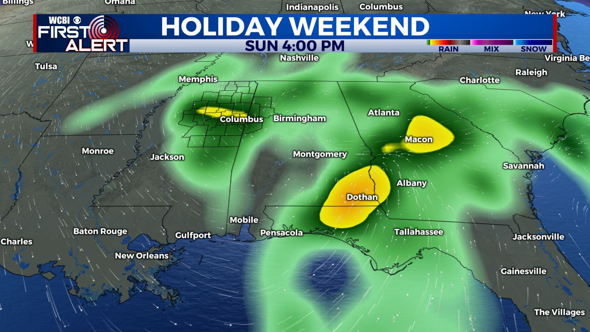
SUNDAY: Additional rain and storms develop. There could be some strong activity somewhere across the Twins States so stay tuned for updates. Highs should range from the upper 50s to low 60s.
EARLY NEXT WEEK: Much cooler highs in the 40s. Lows in the 30s and 20s.
Follow @WCBIWEATHER on Facebook, Twitter, Instagram, and the WCBI News App


Leave a Reply