Heat danger builds through end of week
COLUMBUS, Mississippi (WCBI) – Temperatures and heat indices will be trending up through Friday, resulting in increased heat danger.
WEDNESDAY: Earlier storm chances have decreased across the area, which is good news! We’re expecting a partly cloudy sky with highs in the 90s by afternoon. Similar to yesterday, there will be a weak boundary separating increased moisture with slightly less humid air across the area, resulting in varying heat indices of 95-106°.
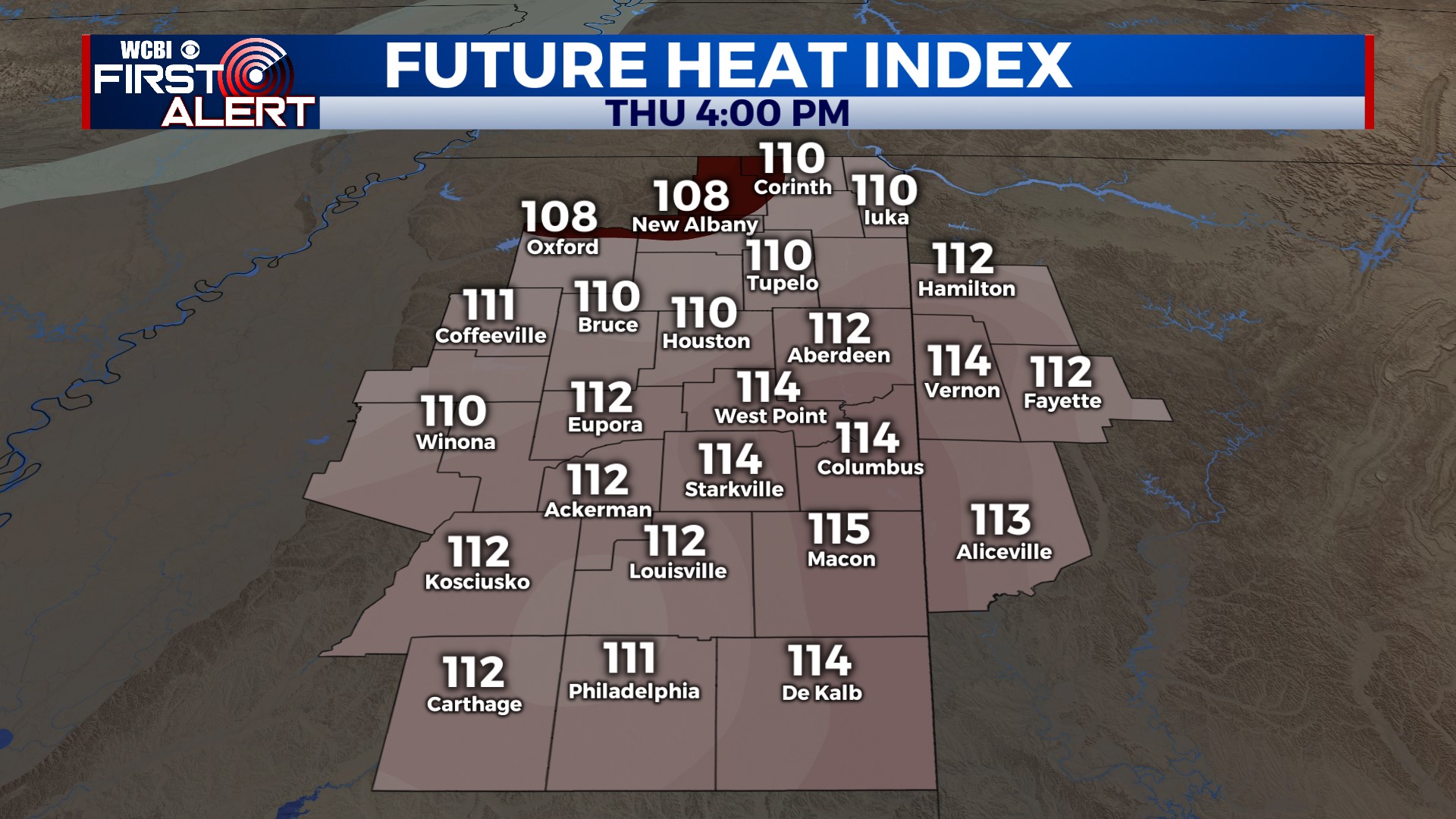
THU/FRI: Temperatures will continue trending up, reaching the upper 90s Thursday and near 100° Friday. Heat indices both days will soar to 110° or above with an excessive heat warning in effect. There is a small chance of cooling downpours late each afternoon, but the heat danger remains the focus of the forecast.
WEEKEND: Heat levels back off slightly for Saturday & Sunday, thanks largely in part to increased afternoon rain chances. These look like your typical summertime downpours – briefly heavy with lightning the main concern. Highs will be in the mid 90s.
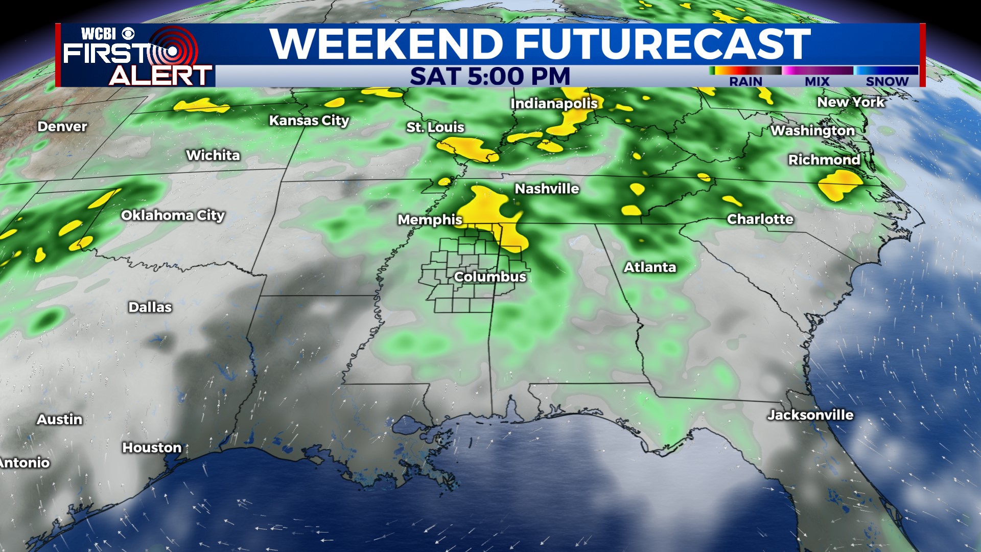
NEXT WEEK: Scattered downpours and a few storms remain the story to start the week. Each afternoon will see a 30-40% coverage of PM storms with highs near 90°.


