Heat danger continues ahead of weekend rain chance
COLUMBUS, Mississippi (WCBI) – Heat advisories and warnings continue Thursday. Saturday still brings the best chance of rain in recent weeks.
THURSDAY: Hazy sun mixed with clouds for today as highs return to the 90s to near 100 degrees. Heat indices could peak as high as 113° for some. Downpours will be fewer and more far between than previous days.
FRIDAY: Temperatures should reach the upper 90s to near 100 degrees across the entire region, cementing more heat danger/stress concerns in the forecast. Rain should be quite limited to almost non-existent.
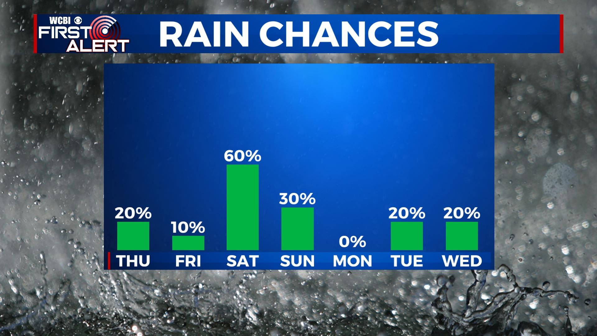
WEEKEND: More heat danger highlights the first half of Saturday’s forecast before hopeful rain relief arrives. Showers and storms should form by mid to late afternoon and move into northeast MS after 5p. Rain chances should continue into the evening hours as well. A few storms could grow strong with gusty wind as well. Sunday should be comparatively less active and less hot – highs drop back to near 90 degrees with a variably cloudy sky.
NEXT WEEK: Forecast models have diverged and thrown a wrench in the going forecast. For now, we’re going to advertise mostly dry and hot weather. However, if model trends continue to suggest a wetter pattern, the forecast will be adjusted accordingly. Stay tuned for updates, as beneficial rain is certainly needed!


