Heavy rain and gusty winds to start the week
COLUMBUS, Mississippi (WCBI) – An active stretch of weather looks to continue for the next week to week and a half. Rain and gusty winds start us off Monday night into Tuesday.
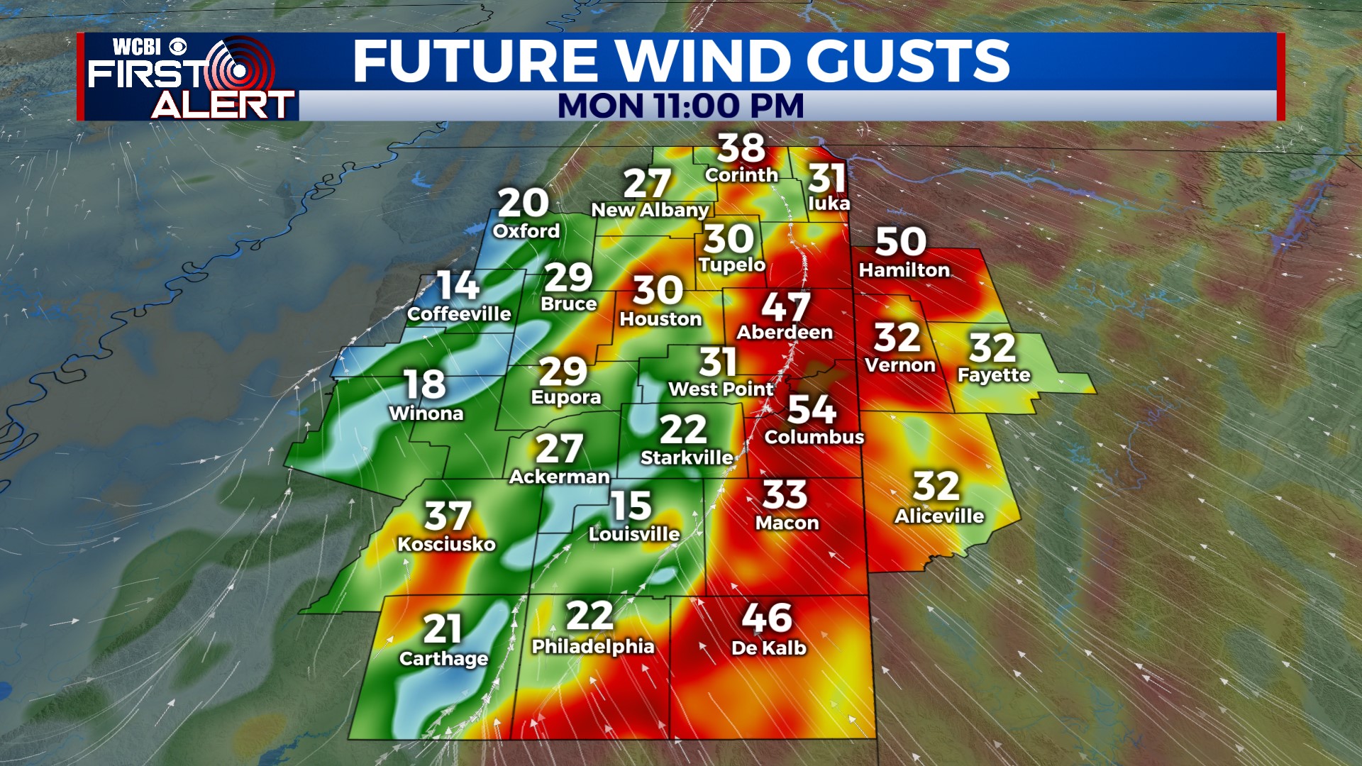
MONDAY: The day starts quiet, but gusty winds (over 30 mph) pick up quickly by afternoon out of the southeast. Rain will then overspread the region from southwest to northeast after 3 PM.
MONDAY NIGHT: Heavy rain and gusty winds likely, with wind gusts over 40 mph possible. There will be some rumbles as well, but there is no “classic” risk of severe weather in the WCBI coverage area; however, a few wind gusts over 50 mph are possible in a few spots. With a prolonged window of gusty “gradient” winds, some tree & power line damage is possible. Rain amounts are likely to range between 1-3″ for most, which is certainly welcomed for ongoing drought concerns.
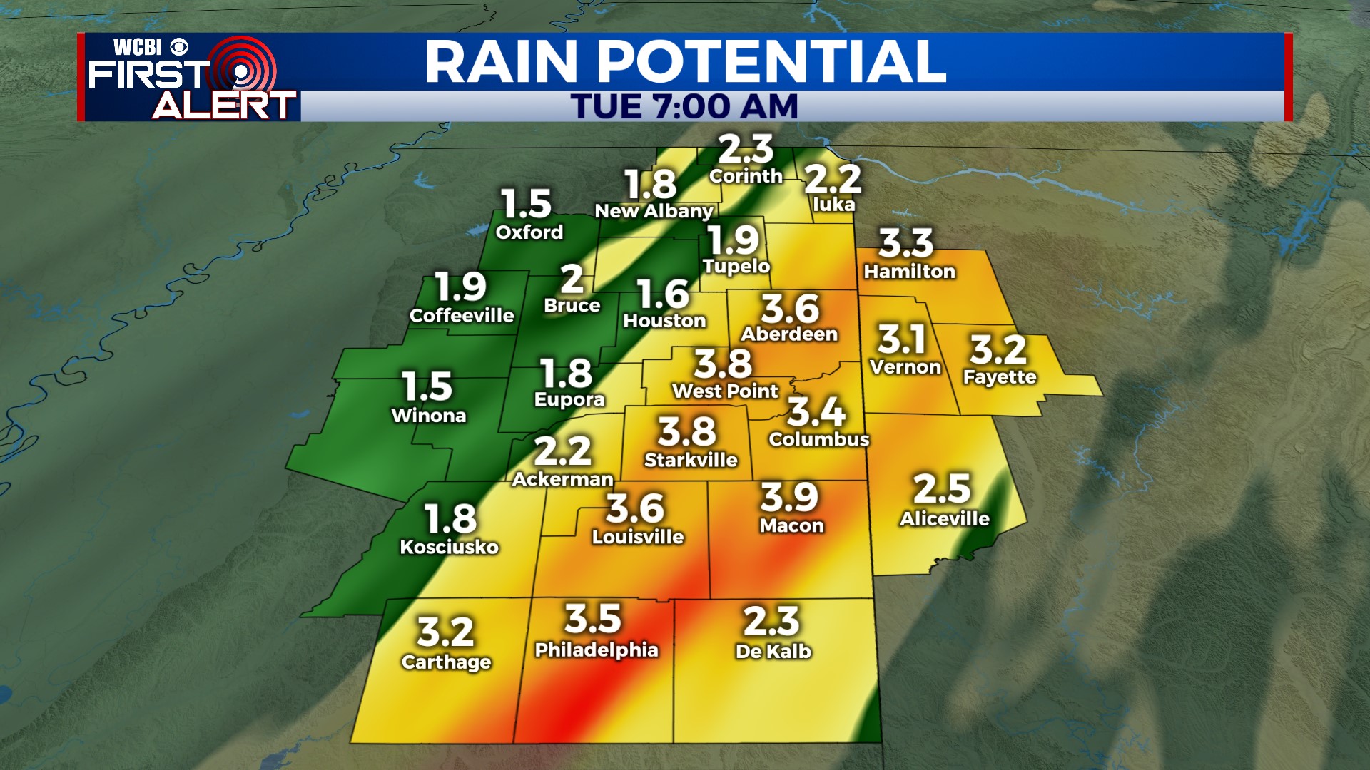
TUESDAY: Rain is likely in the early morning hours, but we should get a chance to dry out by midday. Wrap-around moisture (in the form of low clouds) quickly moves in, limiting “high” temperatures in the afternoon to the 40s with breezy southwest winds up to 30 mph. A few showers are also expected, potentially with mixing snowflakes in the northeastern corner of the state. No accumulation is expected.
WED/THU: Our quietest stretch of weather. Wednesday looks chilly in the low 50s, but Thursday looks quite nice with highs in the low 60s and sunshine.
FRIDAY/WEEKEND: The next system rolls in Friday, bringing another round of widespread rain, gusty winds, and potential thunderstorms. Though models have been persistent in keeping the unstable air south of the region, the latest runs have trended slightly north with the unstable air. We’ll watch trends closely and update accordingly. Chilly weather settles in behind Friday’s system for the weekend, as we wait on the next system next Monday.


