Heavy rain, severe storms likely on Tuesday
COLUMBUS, Mississippi (WCBI) – The first full week of spring will be marked by increasing severe potential Tuesday.
MONDAY: Quiet weather continues through the day with lots of sun and high clouds in store. Highs will top out in the mid to possibly upper 70s with increasing southeasterly breezes.
MONDAY NIGHT: Clouds increase this evening and overnight with lows in the upper 50s.
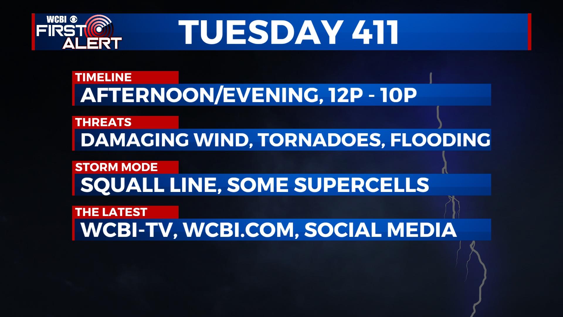
TUESDAY: A potentially high impact weather day remains possible. While the day will start dry, showers and storms become likely toward midday and could last for the remainder of the afternoon hours. Increasingly warm, unstable air along with significant wind shear will promote a severe weather threat for the entire region; however, areas near and south of Hwy 82 stand to see a potentially higher risk. Hail, damaging winds, and tornadoes are all on the table with developing storms. In addition to the severe weather threat, very heavy rain and potential flash flooding also remains a risk; 1-3″ of rain or more could fall, and most of the area is in a flood watch. You’ll want to remain weather aware from Noon until 8p, and make sure you have multiple ways to receive watch and warning information.

REST OF WEEK: Increasingly cooler weather is in store, especially in the evenings and overnights. Several mornings with temperatures in the 30s are possible later in the week. Thursday could bring a small chance for showers late as an upper low and pocket of very cold air aloft move overhead. The weekend looks to clear up with below average temperatures continuing.