High pressure brings high heat next week
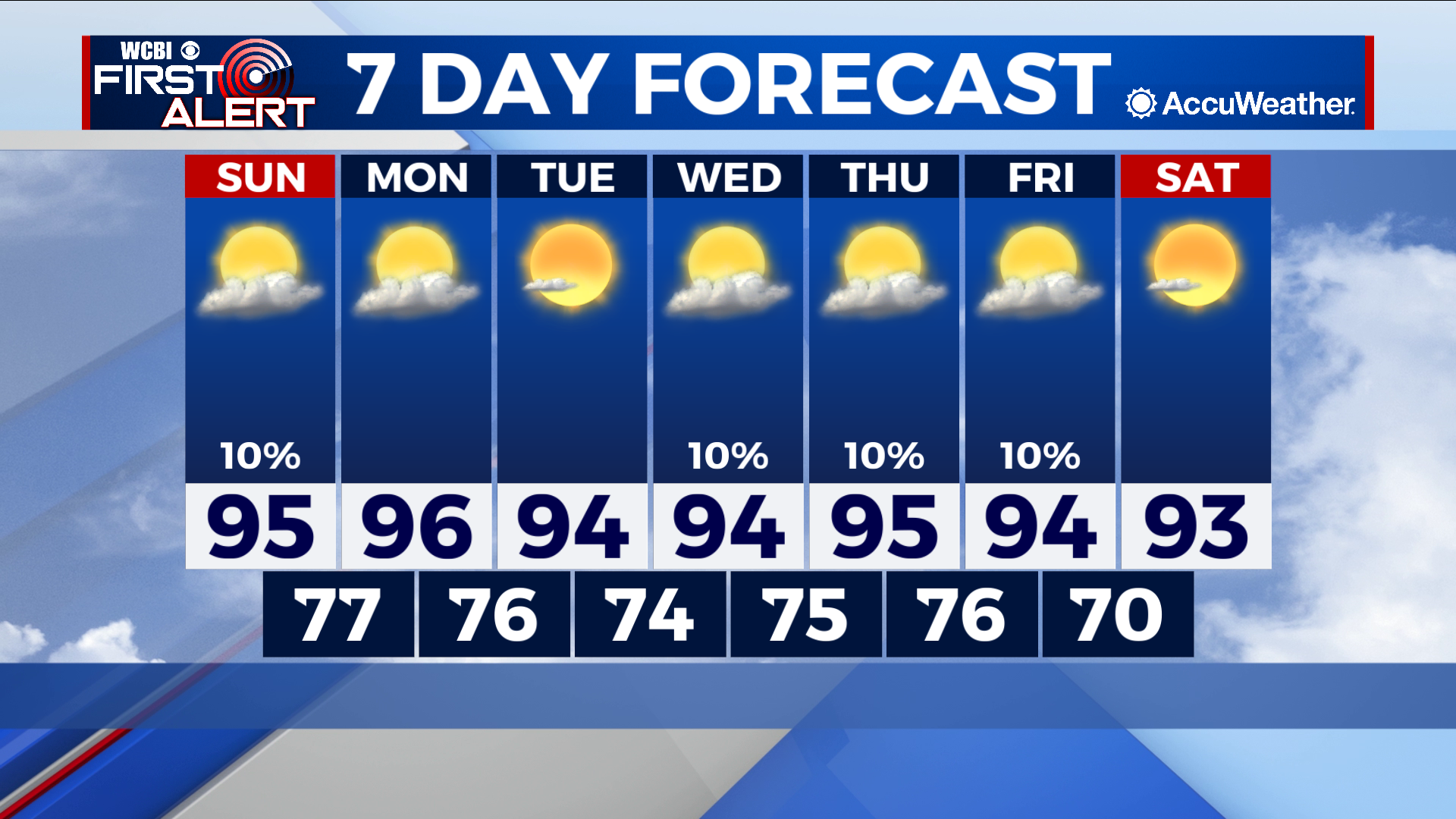
COLUMBUS – SUMMARY: High pressure settling in over the southeast this weekend brings highs into the 90s by Sunday, and keeps us clear, hot, and dry throughout next week. Lows similarly experience some warming and jump into the 70s for the next week.
SUNDAY: We get back into the 90s for the first time in a little while off the back off a major high pressure system that will arrive in the area early Sunday. Clearing skies and lack of major rain chance Sunday will aid in the quick heat-up. Lows similarly will feel the high pressure boost and will make the switch into the mid to upper 70s overnight.
NEXT WEEK: Plenty of warmth and plenty of sunshine remains in the tank next week as our high pressure system moves into our neighborhood for the next several days. Highs will mostly remain in the mid 90s next week under a relatively consistent regime of sunshine and scattered clouds. The odd shower or thunderstorm cannot be ruled out next week but no major chances for rain take part in next week’s forecast. In terms of overnight temperatures, lows will hover around the mid to upper 70s for most of next week.