Hot again Tuesday, much cooler Wednesday as rain moves in
COLUMBUS, Mississippi (WCBI) – Temperatures stay near normal for mid August Tuesday with limited rain. Rain chances markedly increase by Wednesday.
TUESDAY: Expect a mix of sun and clouds today with highs in the lower 90s to possibly middle 90s. Slightly drier air will filter in, so dangerous heat indices are not as likely today compared to Monday. The best chance of developing storms will be southwest of a line from Louisville to Winona, mainly across central MS and outside the WCBI coverage area. Still, a few stray showers remain possible, but the main rain focus is Wednesday.
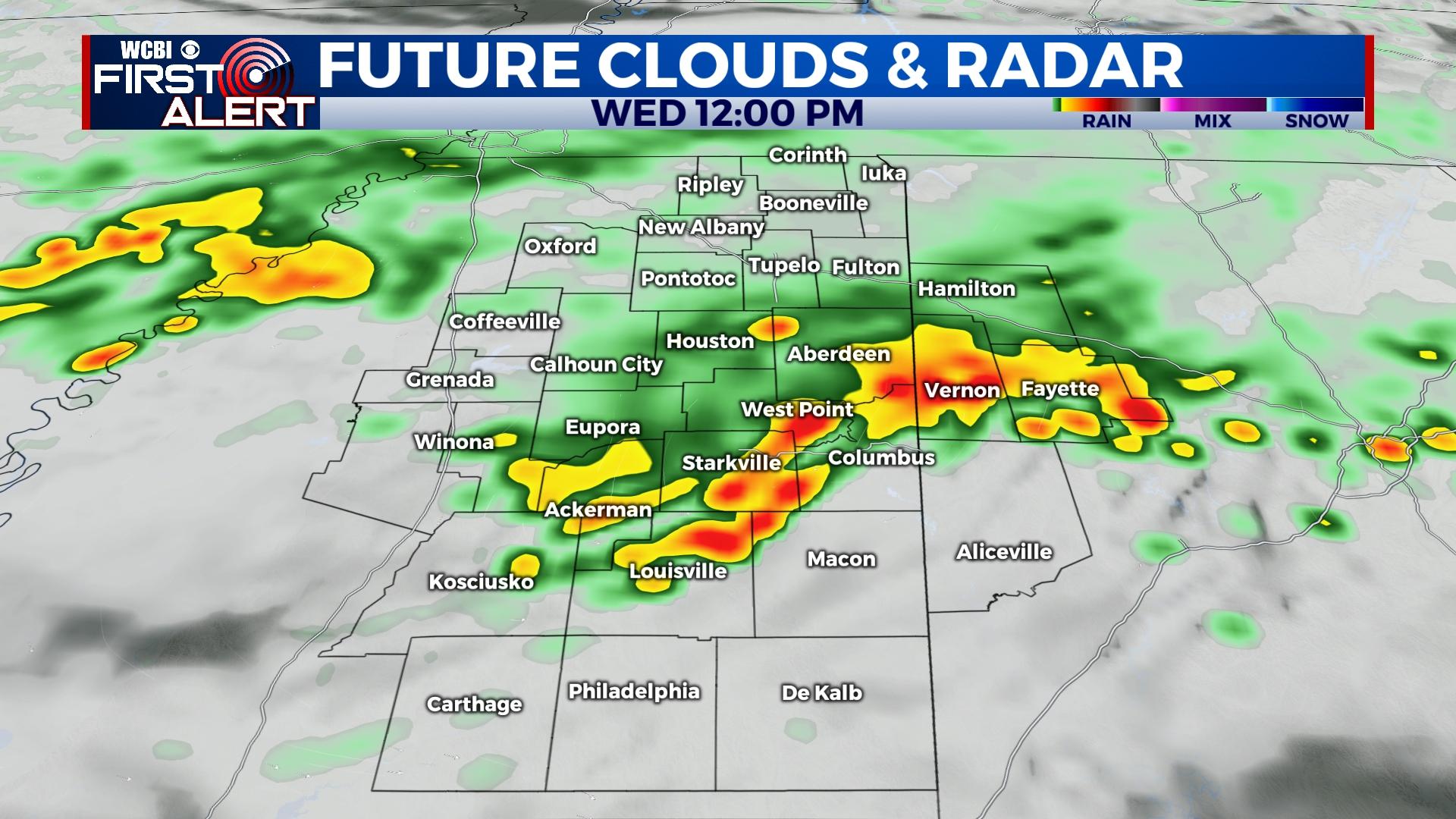
WEDNESDAY: Rain is likely to arrive during the pre-dawn hours and stick around much of the day. Steady showers with locally heavier rain rates will be the story, and highs are likely to hold in the 70s thanks to persistent rain! Most areas should be able to absorb the rain, but minor flooding is possible in areas seeing training downpours. Rain should dissipate late Wednesday afternoon.
THURSDAY: The responsible front should be enough south of the region to keep major rain chances also to the south, but persistent clouds and isolated showers will help keep temperatures in the 80s.
FRIDAY/WEEKEND: Isolated to scattered storms will be back in the forecast thanks to earlier stalled front wiggling north as a weak warm front. This forecast resembles classic mid to late August with slightly below average temperatures.


