Hot conditions continue as potential relief comes in sight
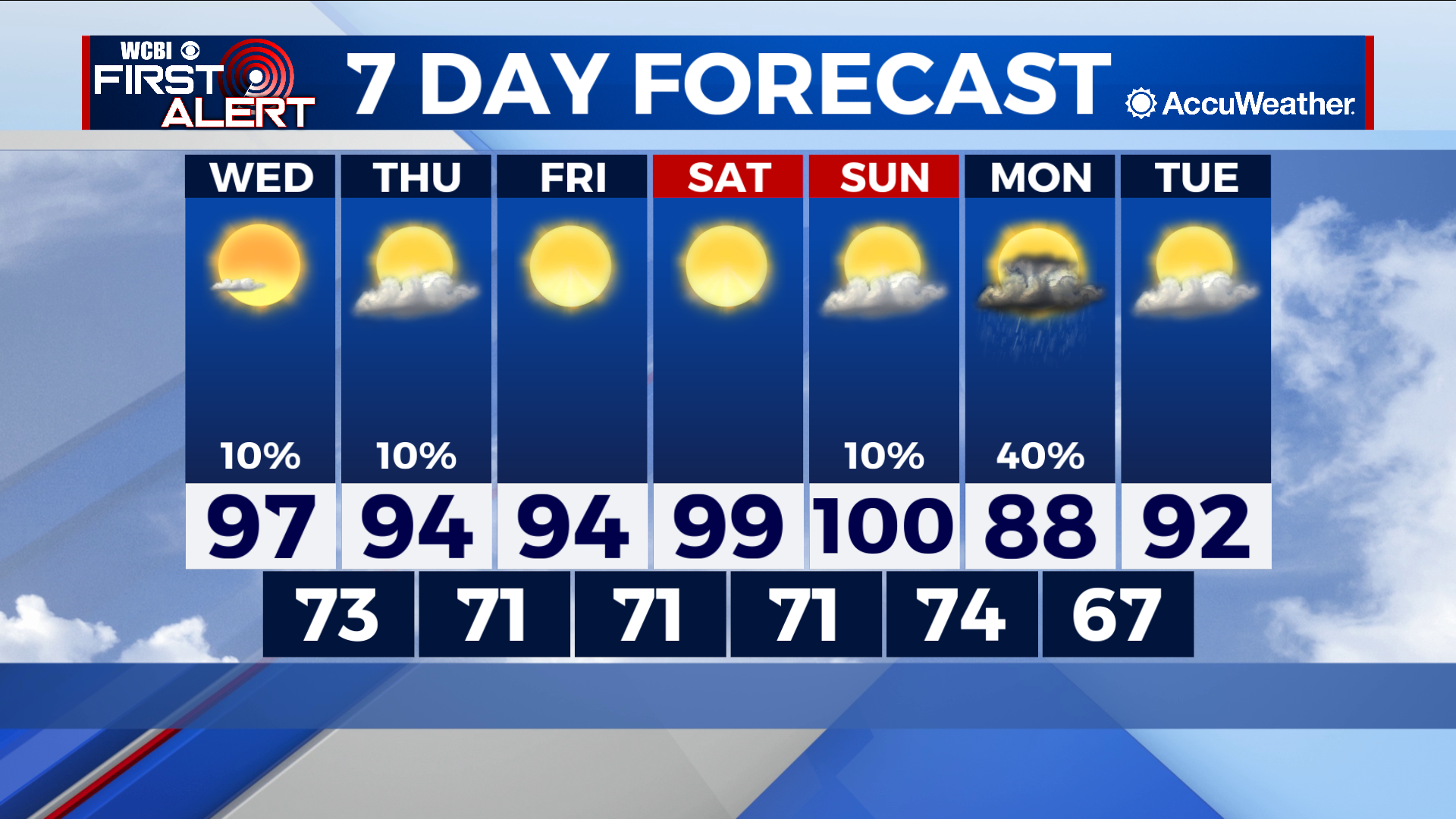
COLUMBUS – SUMMARY: Highs continue to remain in the mid to upper 90s, slowly warming into the 100s by Sunday. Chances for scattered showers and thunderstorms Monday provide the best chance for significant cooling as highs drop into the mid to upper 80s. Lows remain in the low 70s throughout.
WEDNESDAY: Highs sit in the upper 90s once again with mostly clear skies accompanying. The odd shower or thunderstorm cannot be ruled out but overall the day remains dry. Lows bottom out in the lower 70s.
THURSDAY: Afternoon temperatures dip slightly but remain in the mid 90s. Partly cloudy skies and the odd shower provide some relief. Lows sit in the lower 70s overnight.
REST OF THE WEEK: Slight warming continues throughout the rest of the week, culminating in highs in the 100s Sunday. The chance for scattered showers and thunderstorms Monday accompanies some slight cooling that will envelop the region, dropping highs down into the 80s. Lows also take a dip into the upper 60s overnight Monday.