Hot Thursday, Sct’d Storms Friday
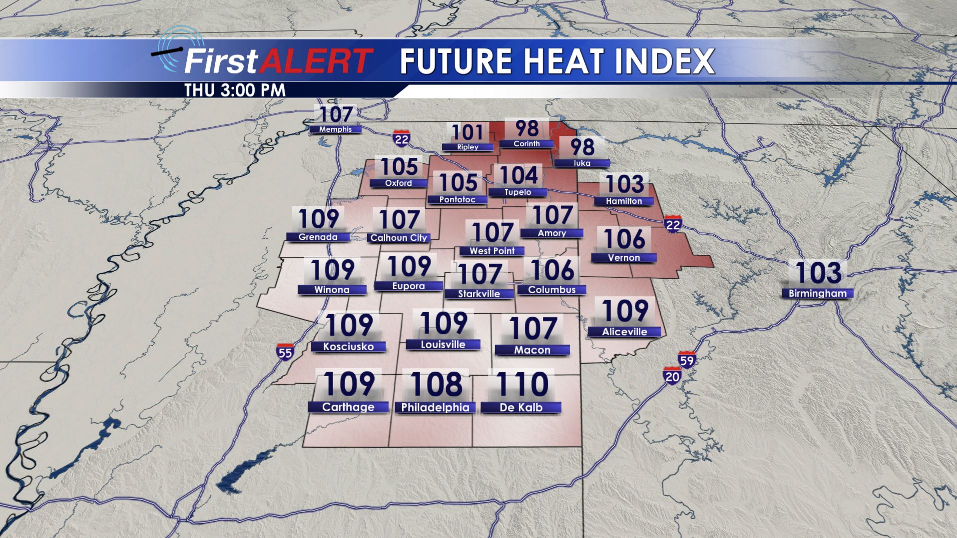
Future Heat Index Thursday
WEDNESDAY EVENING/NIGHT: While a stray shower or storm remains possible, the main concern will be the continued warm and muggy conditions. Temperatures will cool into the low 80s by 11 p.m. with overnight lows in the mid 70s. A bright full moon is going to shine all night long.
THURSDAY: Expect hot and humid weather to be widespread all around the region. Daytime highs in the mid 90s are likely with heat indices pushing 105+. Be sure to limit your exposure to the heat if you can. A few pop-up showers and storms may develop but the chance of rain is 30%.
FRIDAY: The chance of rain bumps up to 40-50%. Highs in the low to mid 90s with higher heat indices can be expected before any shower or storm develops.
WEEKEND: Pop-up showers and storms are possible both Saturday and Sunday. The chance of rain is 40%. Daytime highs should be in the low to mid 90s.
Follow @WCBIWEATHER on Facebook, Twitter, Instagram, and Snapchat


Leave a Reply