Humidity & Rain Chances Coming Back
Rain Chances
SUMMARY: Father’s Day weekend is shaping up to be a return to summer after recent fall-like conditions. Dry weather should hold for our area on Saturday but scattered showers and storms are possible on Sunday. Humidity levels will be going up drastically starting Saturday morning.
FRIDAY NIGHT: Mainly clear to partly cloudy. Temperatures will not be as cool but comfortable 60s can be expected one more night.
SATURDAY: Southerly winds between 10 and 15 mph allow for deep tropical moisture to return to north MS and west AL as the day wears on. It’ll feel a lot more humid during the afternoon as compared to the first part of the day. We’ll have a mix of sun and clouds but and isolated rain/storm activity should remain focused across central and southern MS. Daytime highs should get back into the low 90s with heat indices around 93°.
SATURDAY NIGHT: Partly cloudy, warm, and humid. Lows drop to the low 70s.
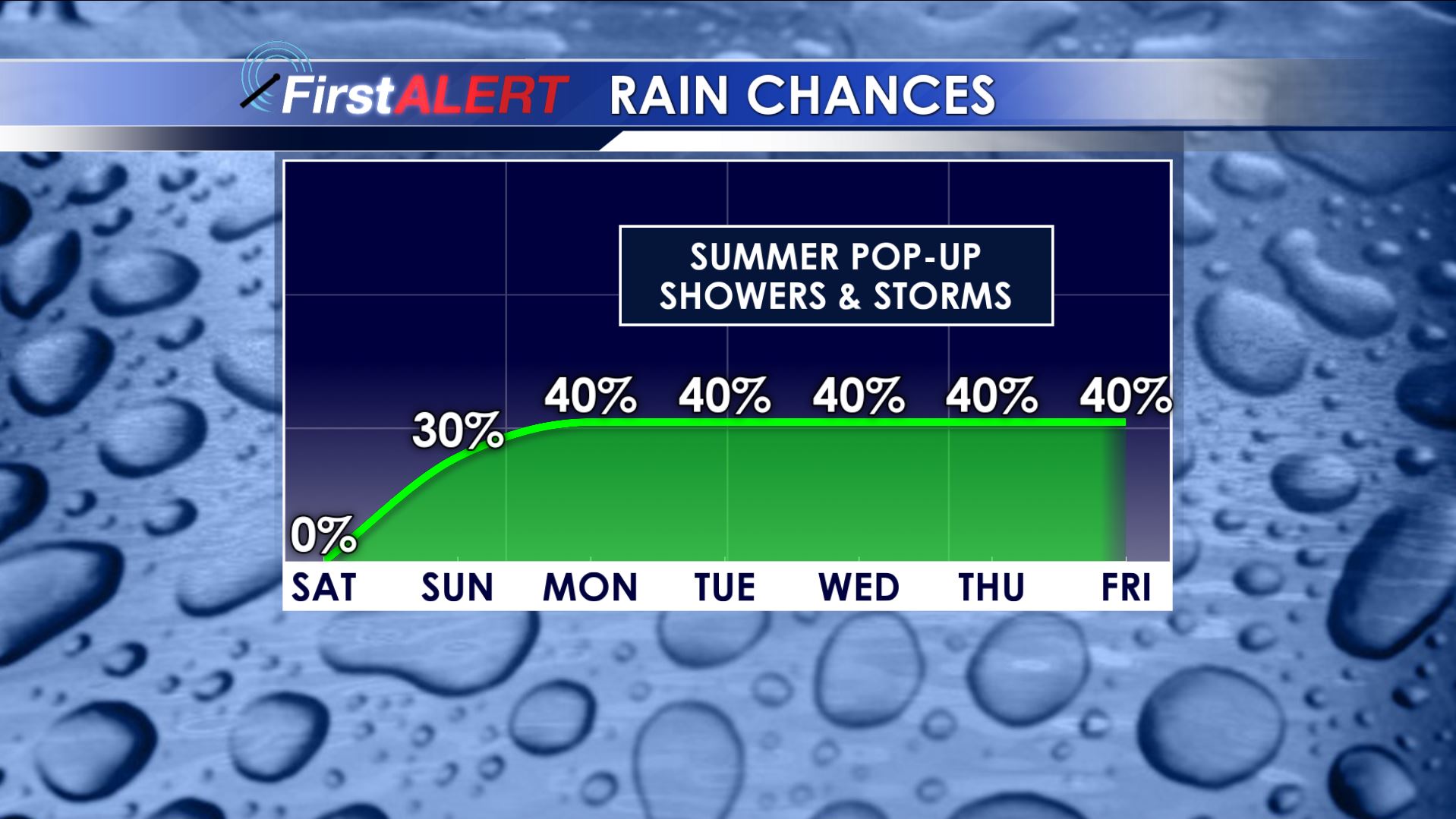
SUNDAY: It’ll be a warm and humid day with highs around 90° plus or minus. Heat index values should push back up towards 96°. Pop-up showers and storms are possible during the afternoon and evening but we’re going to cap the chance of rain at 30% for now. Any drop of rain is welcome due to recent dry conditions.
NEXT WEEK: A typical summer weather pattern is setting up for our region. The combination of a stalled front, upper disturbances, and tropical moisture should give rise to scattered showers and storms each day. At times there may be a few strong to severe storms around the region with gusty winds, hail, heavy rain, and lightning but that’s not too unusual this time of year. Plan on highs in the mid to upper 80s, lows in the low 70s, and plenty of humidity.
Stay connected with @WCBIWEATHER on Facebook, Twitter, and Instagram


Leave a Reply