Laura getting stronger and the breakdown of its effects for us
SUMMARY: All eyes are on now Category 1 Hurricane Laura and its eventual landfall somewhere on the northern Gulf Coast by Thursday as a major hurricane. Laura’s track and intensity will determine how we’ll be affected as it comes inland. We may experience some heavy rain and stormy weather Thursday into Friday. Stay tuned to WCBI.
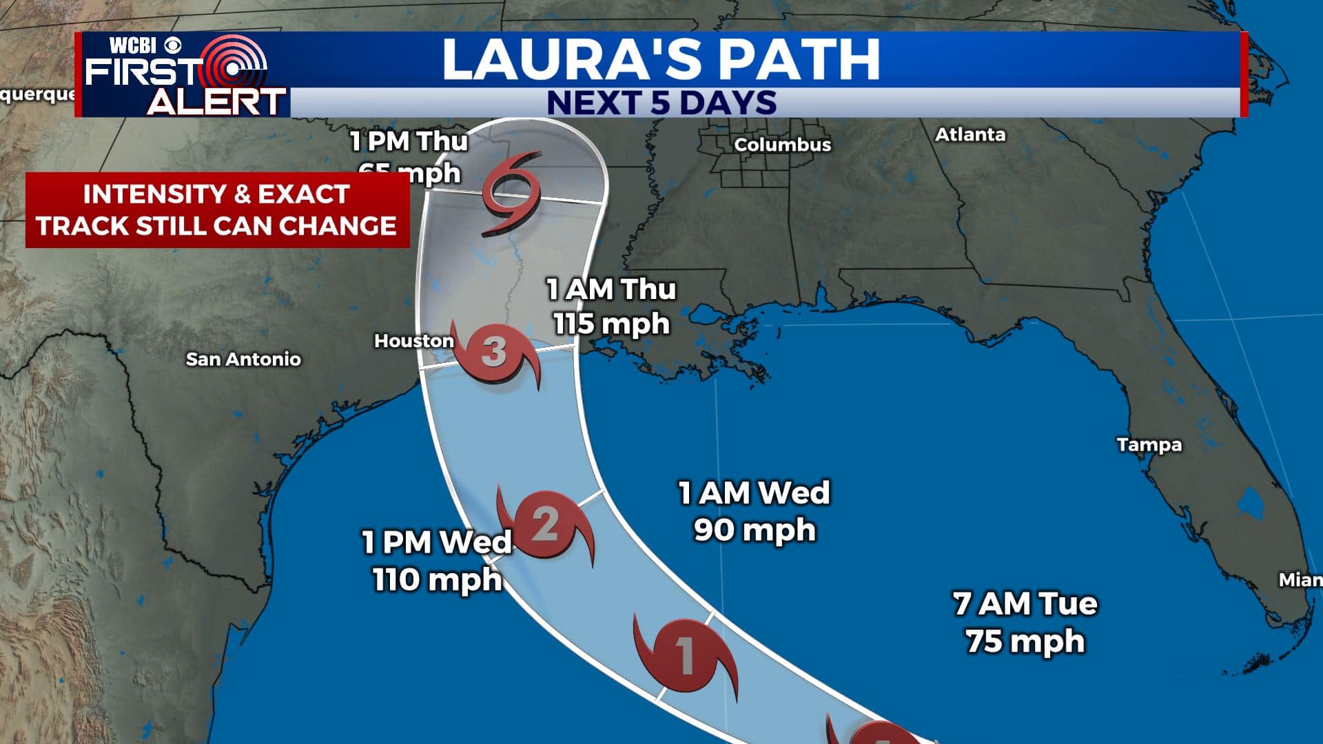
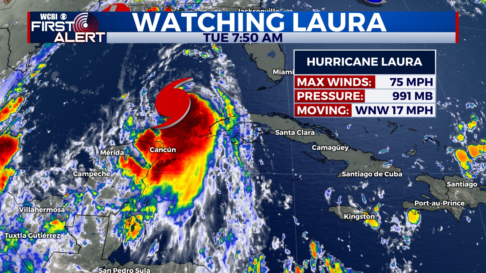
TROPICAL UPDATE: Marco becomes a remnant low just south of Louisiana as is no longer a concern. BREAKING: Laura is now a Category 1 Hurricane with winds at 75 mph. It’s forecast to continue strengthening and become a Major Category 3 Hurricane over the northwestern Gulf of Mexico before landfall somewhere along LA/TX coastline early Thursday morning.
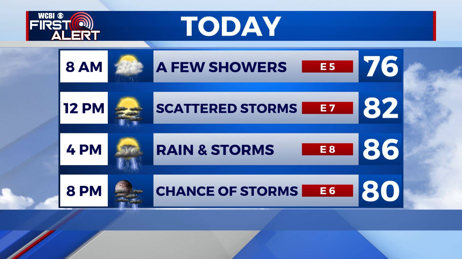
TUESDAY: We’ll be dealing with a lot of tropical moisture thanks to what’s left of Marco for our Tuesday. Expect likely chances of rain and storms with cloudy skies by late morning into the afternoon. Highs in the mid 80s. Winds E 5-10 mph.
TUESDAY NIGHT: Mostly cloudy with some lingering showers. Overnight lows in the lower to mid 70s.
WEDNESDAY: It will be hot and humid thanks to the tropical moisture continuing to come up from the Gulf. A mix of sun & clouds with scattered chance of showers or storms. Highs near 90 with SE winds 5-10 mph.
THURSDAY: Laura could make landfall in SW Louisiana or far eastern Texas. As of right now we’ll have scattered showers and storms but should increase heading into the overnight hours as Laura continues to move inland. Highs in the upper 80s.
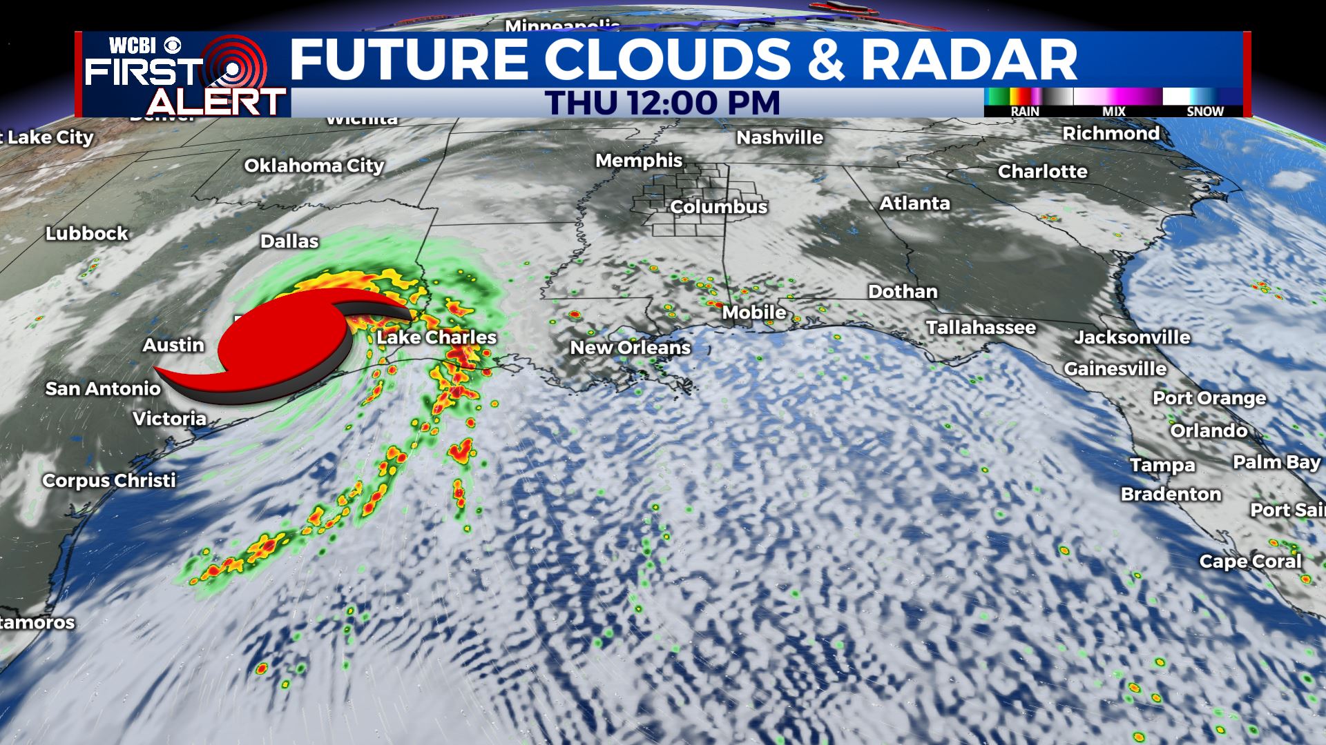
FRIDAY: Cloudy with showers and storms likely. Locally heavy rain is possible as the remnants of Laura swirl west of our area. A few strong to severe storms with an isolated tornado threat remain a possibility IF the remnant low of Laura is close enough. We’ll keep you updated. Highs in the mid to upper 80s.
SATURDAY-SUNDAY: Rain chances will decrease a bit going into the weekend as the remnants of Laura moves away from us, but there will still be some storms around. Highs will stay in the upper 80s to near 90 with overnight lows in the low to mid 70s.
Stay connected with @WCBIWEATHER on Facebook, Twitter, Instagram, and the WCBI News App


Leave a Reply