Looking and feeling good
COLUMBUS, Mississippi (WCBI) – Finishing off the week and heading into the weekend, conditions are really going to be beautiful. However, plans change when a storm chance returns mid-week.
FRIDAY NIGHT: A few leftover clouds tonight, but a mostly clear sky will be sticking with us. Temperatures are back to being cool, falling into the lower 40s.
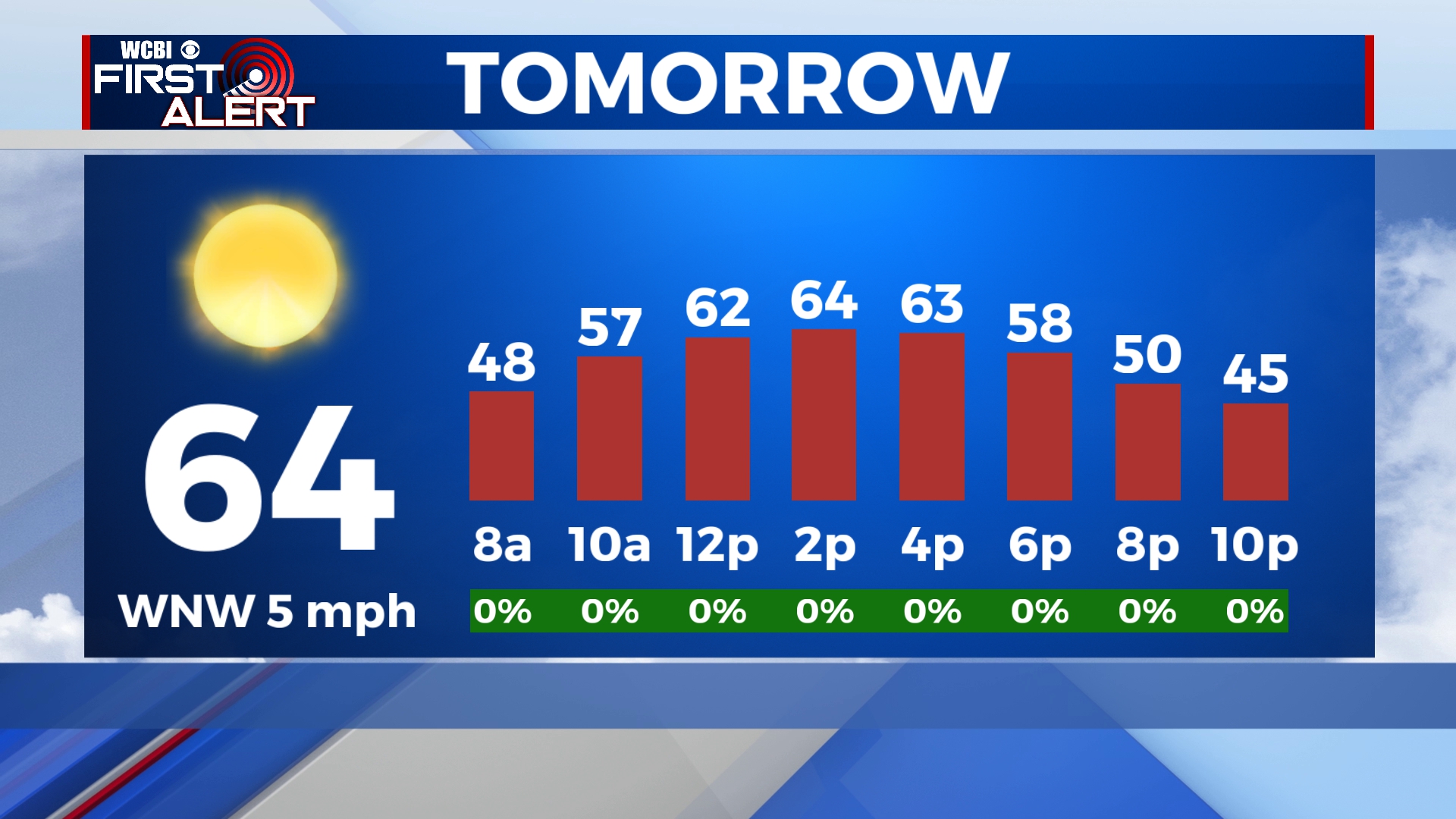
SATURDAY: A secondary cold front will keep temperatures slightly cooler tomorrow, but still very pleasant. High temperatures will be reaching into the middle 60s. Mostly clear and dry conditions, great to get outdoors. A cold night though, as overnight lows drop into the lower 30s.
SUNDAY: Bundle up with light layers Sunday morning for church. By the time service is over, high temperatures will be tracking into the upper 60/lower 70s. Another beautiful weekend day to enjoy before the work week starts back up.

NEXT WEEK: The gradual climb in temperatures will be continuing. Extra moisture will be adding in too. Clouds will increase Monday and Tuesday, light rain possible. Need to start thinking about you mid-week plans, especially Wednesday, where a strong cold front is set to move through northern Mississippi. This front does have potential to bring strong to severe storms to parts of the Deep South…stay tuned!