Lots of rain chances, cooler start to next week
SUMMARY: A bit of a temperature see-saw in store for us over the next week. We’ll see multiple disturbances moving through the area as well bringing several rain chances. After a mild weekend, we cool down quite a bit after a cold front moves through on Monday. The cool air won’t last long though, as moisture will quickly return to the region beginning Wednesday, with temperatures climbing for the rest of the week. Pretty much every day of the next 7 has a chance for rain, but November was very dry so we could use it!
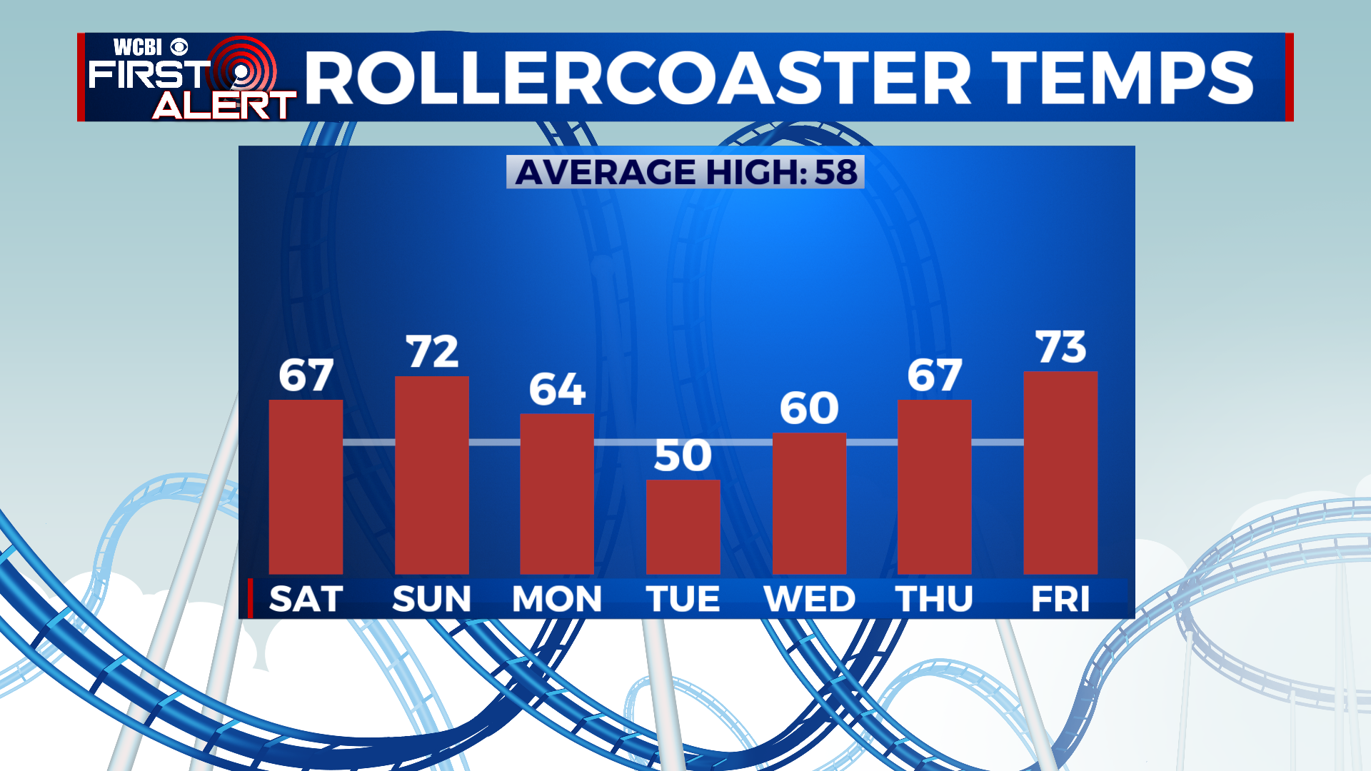
SATURDAY: A weak area of low pressure will move through the region today, bringing showers and areas of drizzle. While it won’t be a washout, it will be damp out there. Highs top out in the upper 60s to near 70.
SATURDAY NIGHT: A few showers will linger into Saturday night, but they should taper off by morning. Otherwise, it’ll be cloudy with a low in the mid to upper 50s.
SUNDAY: Another push of warm air ahead of a cold front will bring our highs back into the low to mid 70s for Sunday afternoon. While most of us will stay dry and mostly cloudy, a few showers can’t be ruled out.
SUNDAY NIGHT: A line of showers and storms will be approaching the area Sunday night, reaching our area after midnight. A few showers are possible out ahead of the main line of storms. Temps will stay very mild in the low to mid 60s overnight.
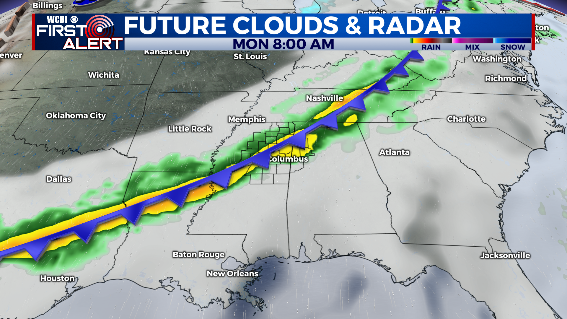
MONDAY TO FRIDAY: The line of showers and storms will be moving through the area Monday morning, with heavy rain and gusty winds possible. It could be a rough commute! This clears out by Monday afternoon with temps falling into the upper 40s. Lows on Monday night will be in the low to mid 30s, a freeze is possible in rural locations. Tuesday, temps will struggle to get out of the 40s. A few showers could enter the picture Tuesday afternoon. Temps Tuesday night will not drop much, and may in fact rise overnight. Another round of heavy rain will move through Tuesday night, although areas south and east of Columbus have the best chance to see heavy rain. The rain will taper off on Wednesday morning, with a few afternoon showers possible. Highs around 60. Thursday and Friday will feature scattered showers and temperatures rising into the upper 60s Thurs to low 70s Friday.
CONNECT WITH @WCBIWEATHER ON TWITTER, FACEBOOK, AND INSTAGRAM