Lower Temperatures Next Week, New Depression in the Gulf
COLUMBUS, Mississippi (WCBI) – Finally! We can see the light at the end of the tunnel. A series of cold fronts will bring lower temperatures and a chance for meaningful rain next week.
TONIGHT: A few clouds passing overhead, still feeling warm and muggy. Low near 74°. A sprinkle or brief shower is possible in our northern communities overnight, but most of the area will stay dry.
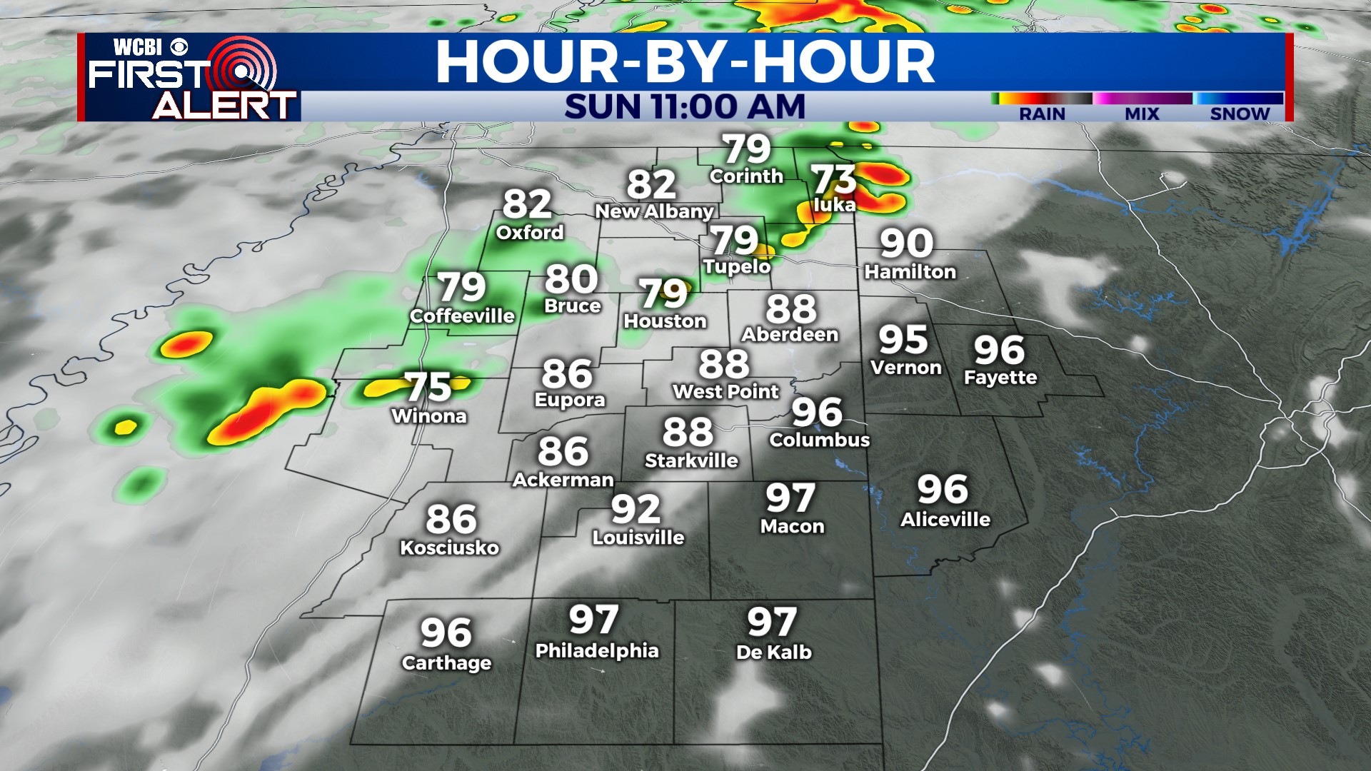
SUNDAY: Highs will range from the mid-90s to upper 90s, depending on whether or not you get rain. Extra clouds and a few showers and storms throughout the day will help knock the heat down for some of us. Check the radar before you leave for church in the morning, or if you have outdoor plans in the afternoon. Chance of rain: 30%.
NEXT WEEK: Monday and Tuesday are mostly cloudy, with scattered showers and storms at times during the day. Unfortunately, not everyone will get rain. Temperatures climb to near 90 on Monday, then we’re stuck in the upper 80s Tues, Wed, and Thurs! A cold front will drop south through the area Wednesday morning, making for a windy day with a few showers and storms. Behind the front on Thursday and Friday: low humidity! 90s are back over the weekend.
TROPICAL DEPRESSION TEN: TD 10 is parked just off the coast of Mexico and Cuba with 30 mph winds. It is expected to become Tropical Storm Idalia (ee-DAL-ya) on Sunday. By Monday afternoon, it will begin to move northward into the eastern Gulf of Mexico. Idalia is expected to become a category 1 hurricane before making landfall along the Florida coast sometime Tuesday night or Wednesday. Thankfully, it will stay east of us. Rough surf, wind, and rip currents are likely along the Mississippi and Alabama coasts on Tuesday and Wednesday as this storm passes by. No impacts for us here in northern MS or west AL.


