Messy situation with severe storm potential Thursday into Friday
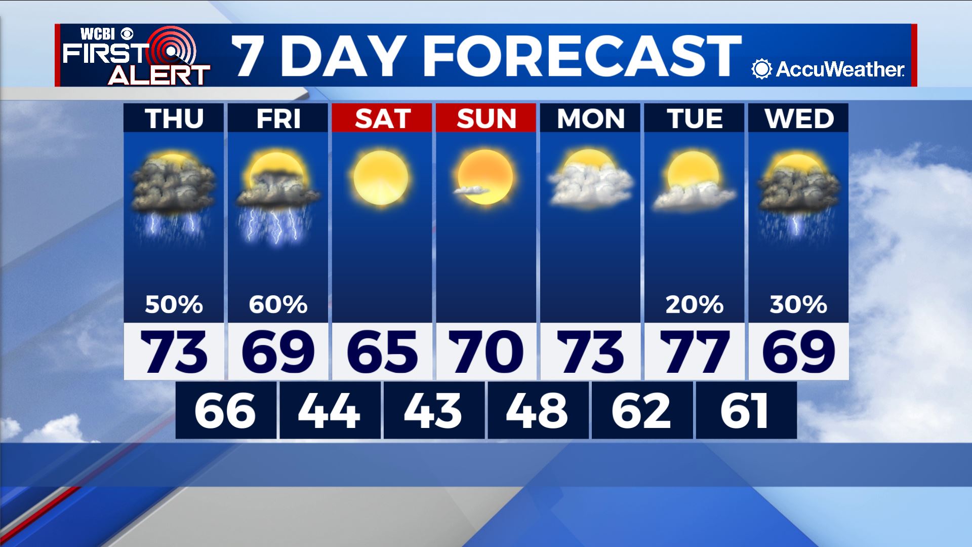
COLUMBUS – SUMMARY: The chance for severe storms Thursday and Friday will make way for much clearer weather heading into the weekend. Highs generally remain in the upper 60s to low 70s throughout much of the next 7 days.

THURSDAY: The forecast is tricky to say the least. The Storm Prediction Center recently released an updated outlook extending the enhanced risk eastward into parts of the Golden Triangle and Northeastern Mississippi. The primary threat to this point should largely be damaging winds, although an elevated tornado risk and the possibility for isolated large hail exists as well. We will keep you updated throughout Thursday as we continue to monitor the situation.

FRIDAY: The messiness of our multi-day severe threat extends into early Friday, when a cold front pushes a squall line through the region during the morning hours. Thankfully, this squall line will clear out the area and put an end to our severe bonanza. Damaging winds will likely be the primary threat once again with the squall line, although a tornado or two cannot be ruled out, as well as limited potential for some hail. Skies will clear out rapidly afterwards, as highs climb into the upper 60s and lows drop into the mid 40s.
REST OF THE WEEK: Highs will rebound into the upper 70s by next Tuesday before rain chances return next Wednesday. Lows will also rebound from the low 40s overnight Saturday into the low 60s by overnight Monday.