Monday night storm threat
COLUMBUS, Mississippi (WCBI) – A line of showers and storms will be coming through Mississippi, overnight tonight and into Tuesday morning. Once this system clears, nicer conditions are going to be on the way.
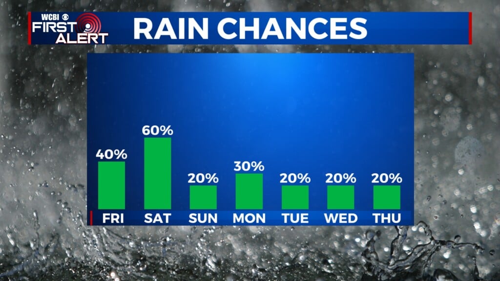
MONDAY NIGHT: A line of showers & embedded thunderstorms is expected to move across the state, bringing a risk of severe weather for some. Wind energy is quite impressive, but storm energy/instability is fairly weak. However, wind dynamics can sometimes “override” thermodynamics, so we’ll need to watch anywhere along the advancing line for damaging wind gusts (50+ mph) or a tornado threat. Storms should be approaching the I-55 corridor between 7-9p, the rest of central & NE MS between 9p-1a, and into west Alabama after 1a.
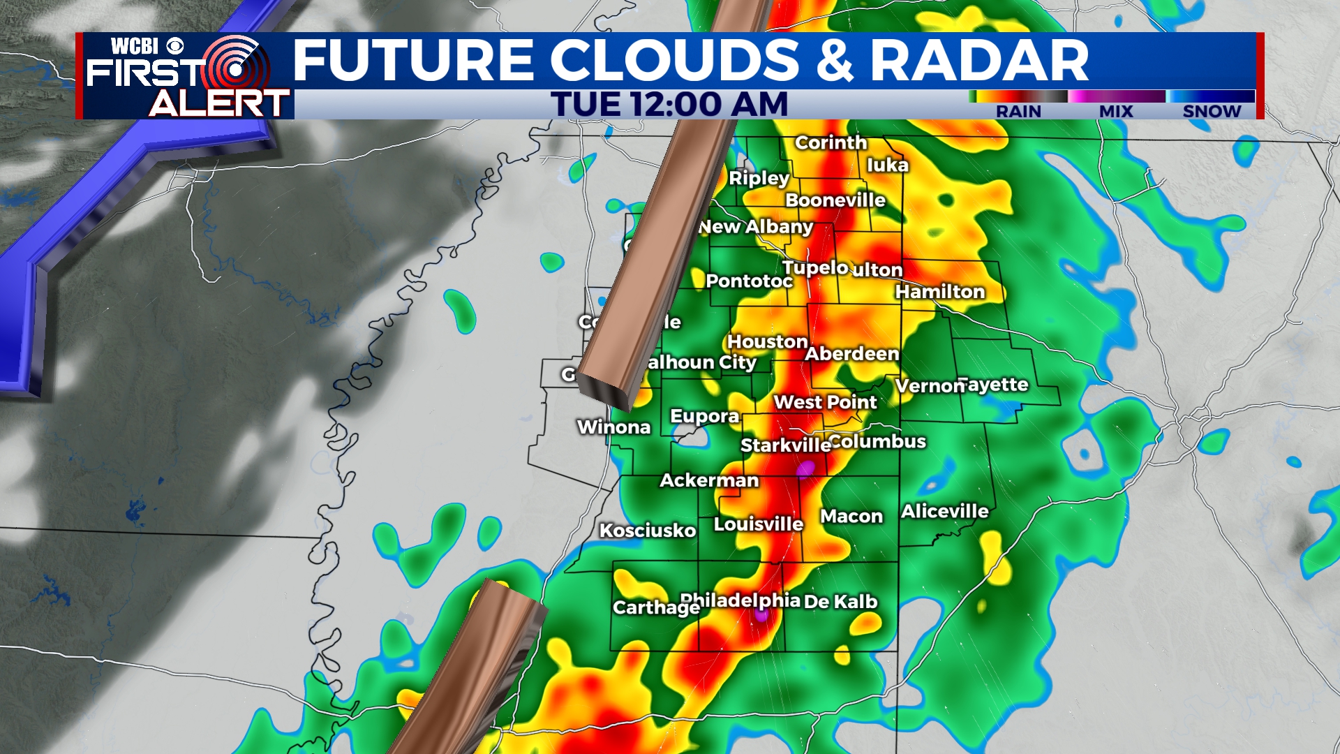
TUESDAY: While the severe risk will end before dawn, redeveloping showers are possible in the early morning hours. We expect some clearing after lunch behind the front, so temperatures should be able to reach the low 70s.
REST OF WEEK: Cooler mornings are on the way! Lows Thursday and Friday morning could both dip into the upper 30s, but afternoons will range from the 60s to low 70s. Warmer weather is on tap for the weekend.