More rain chances for Sunday; Cooler temperatures next week
SUMMARY: Expect clouds to increase on Sunday with highs in the upper 50s before another round of rain moves in Sunday evening. Cooler temperatures returns for the new workweek with highs in the upper 40s to lower 50s. There’s another chance for some isolated showers on Wednesday.
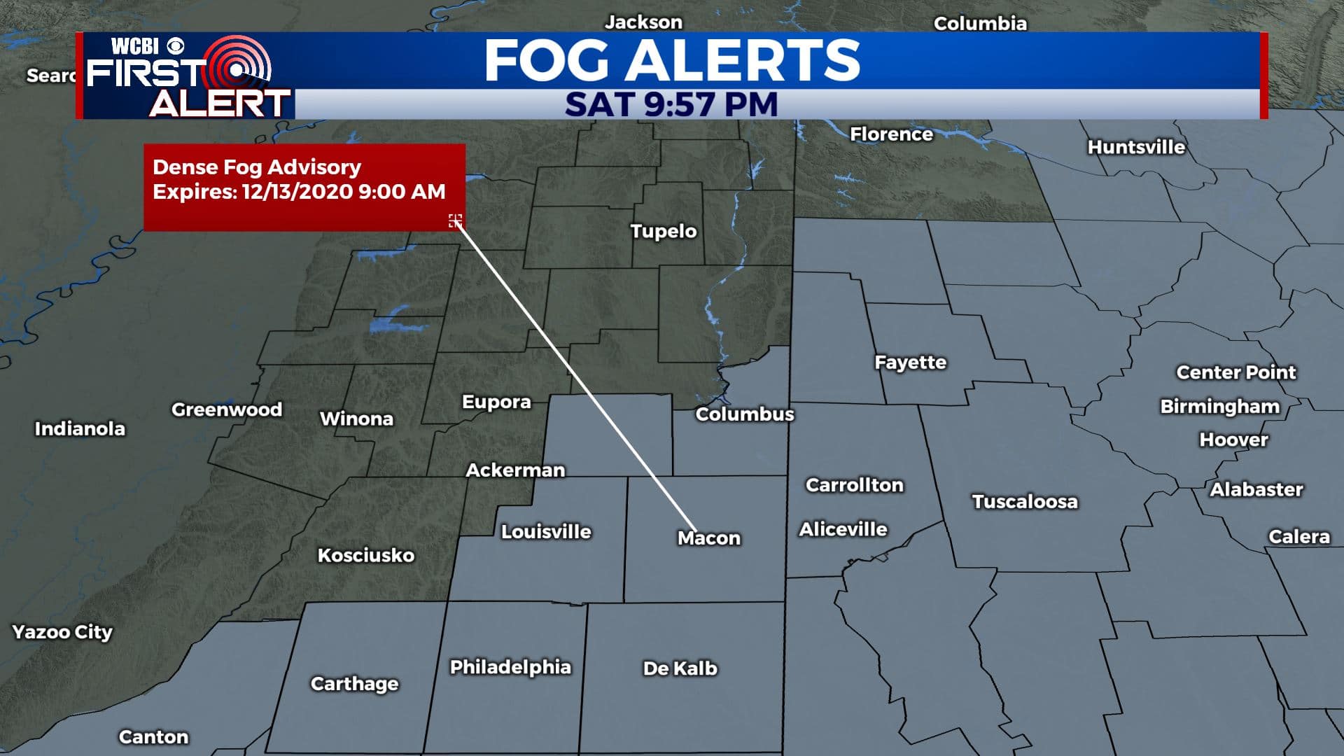
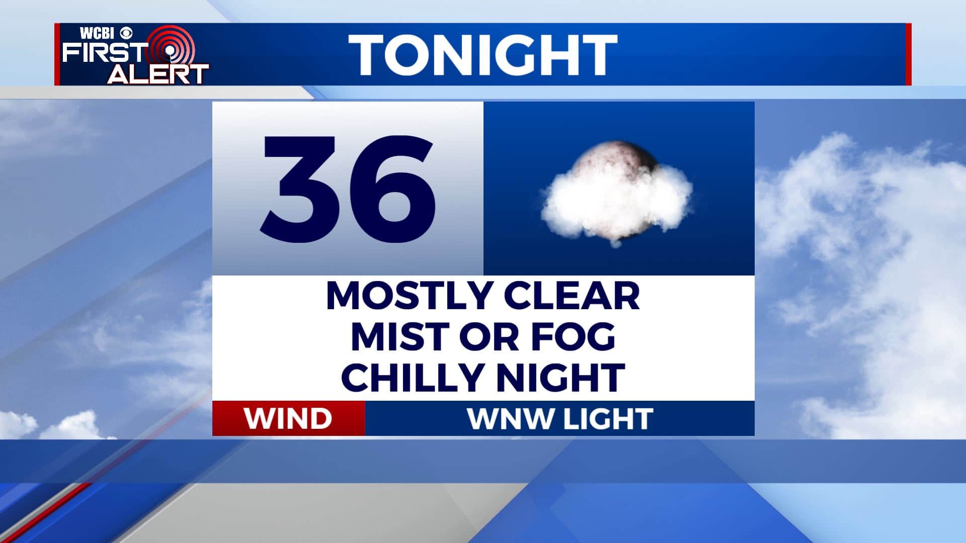
SATURDAY NIGHT: Some mist & fog has been developing this evening. A Dense Fog Advisory is now in effect through 9am Sunday for areas along & south of Highway 82 in Mississippi and our west Alabama counties. Expect visibility levels to fall to ¼ mile or less. Allow extra travel time, slow down, and use your low beam headlights. Mostly clear skies overnight with chilly temperatures as lows fall into the mid 30s. Light WNW winds.
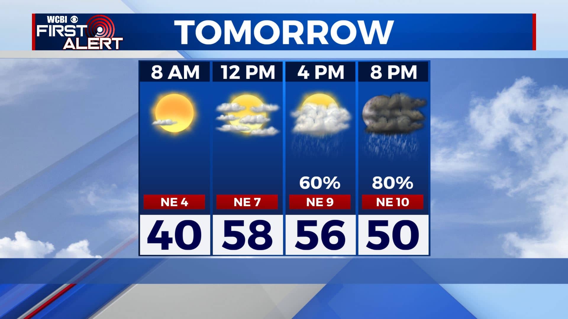
SUNDAY: After some morning mist or fog, most of Sunday will be dry but clouds will be increasing throughout the day ahead of our next storm system. Highs in the mid to upper 50s. A bit breezy with NE winds 5-15 mph.
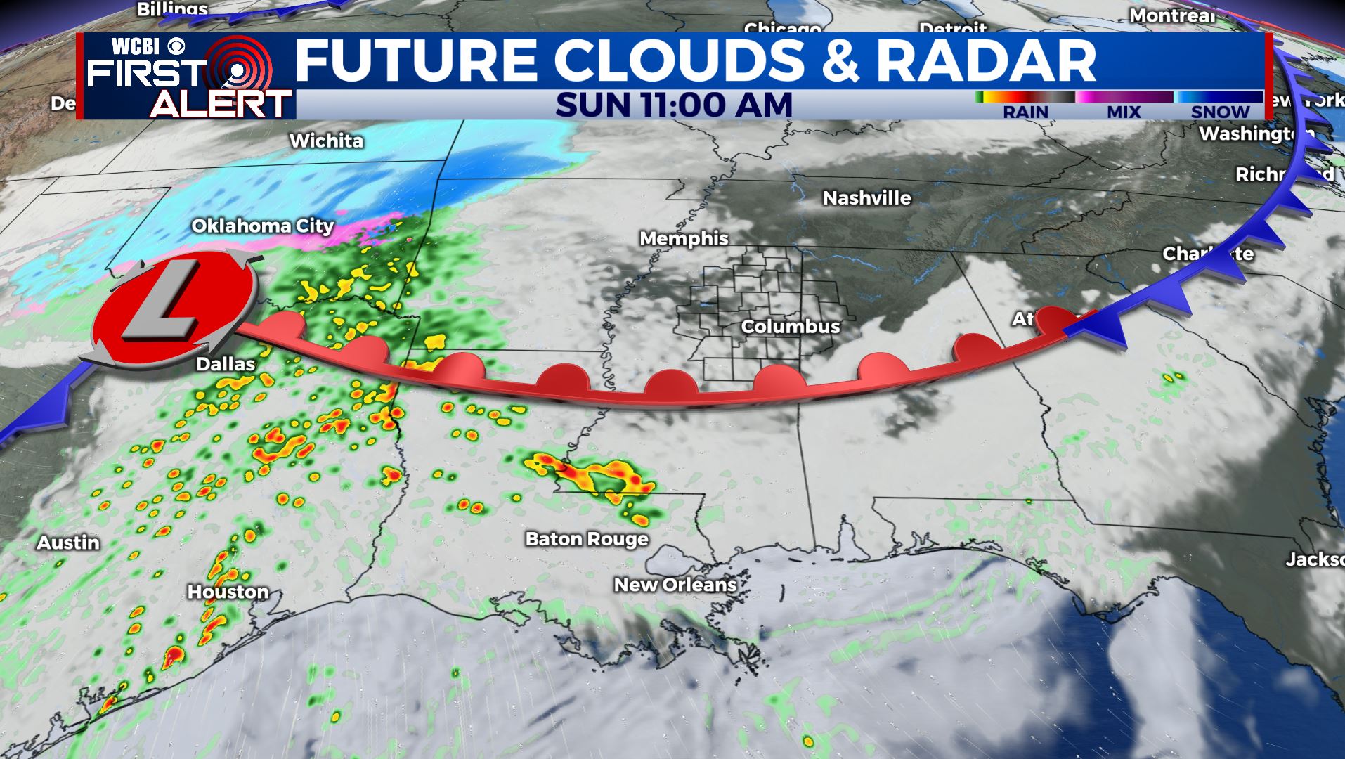
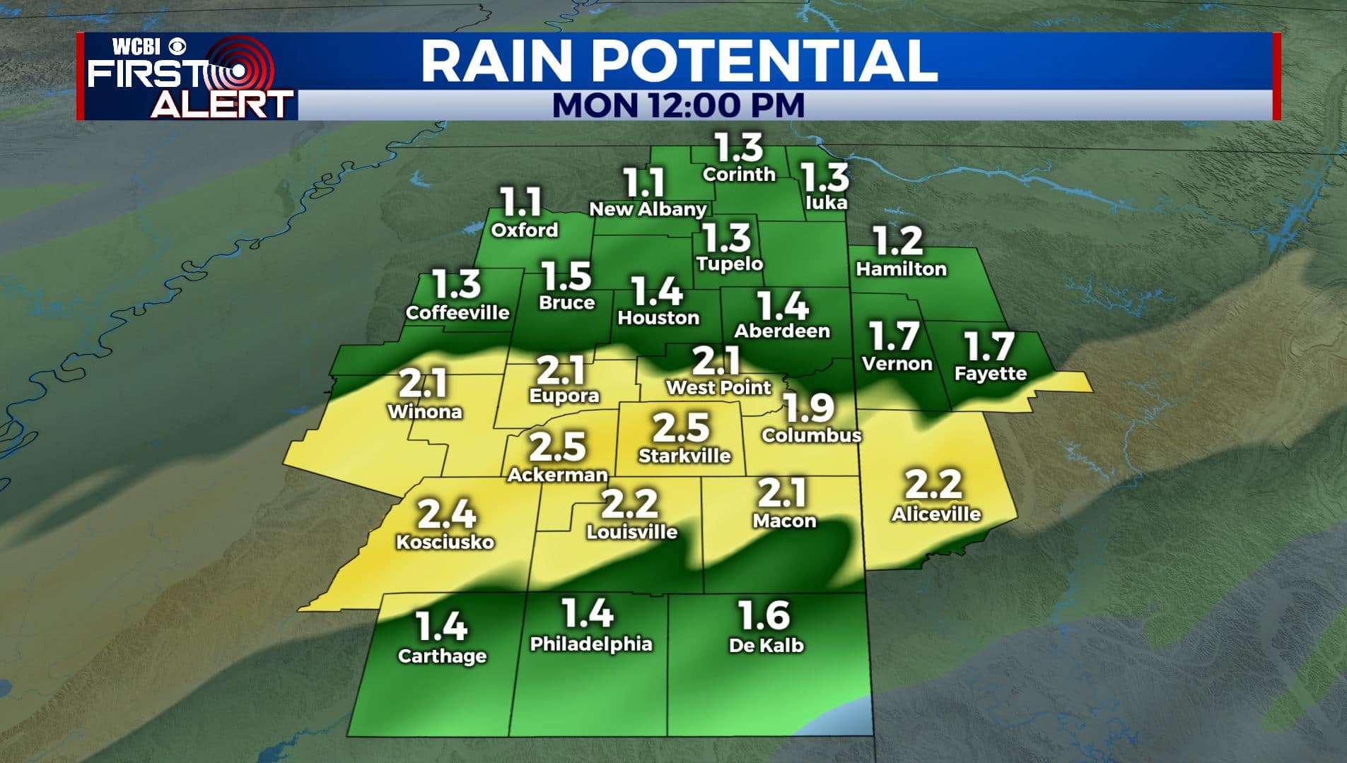
SUNDAY NIGHT: Another round of rain is expected to move in after sunset and continue into the overnight hours. Rain could be heavy at times. Again, no severe weather is expected. Rainfall amounts could be anywhere between 1-2 inches.
MONDAY: Monday will be drier as clouds move out of the region. It will be much cooler behind our cold front with highs only in the upper 40s. N winds 5-10 mph. Mostly clear and cold overnight with lows in the upper 20s.
TUESDAY-WEDNESDAY: We have a mix of sun & clouds on Tuesday. Some isolated showers are possible on Wednesday. Highs in the upper 40s to lower 50s. Overnight lows in the upper 20s and 30s.
THURSDAY-FRIDAY: The end of the workweek looks to be drier with more sunshine returning to the forecast. Staying cool. There may be a chance of rain in the forecast possible for next weekend. Something we’ll continue to watch!
Stay connected with @WCBIWEATHER on Facebook, Twitter, Instagram, and the WCBI News App


Leave a Reply