More rain Thursday
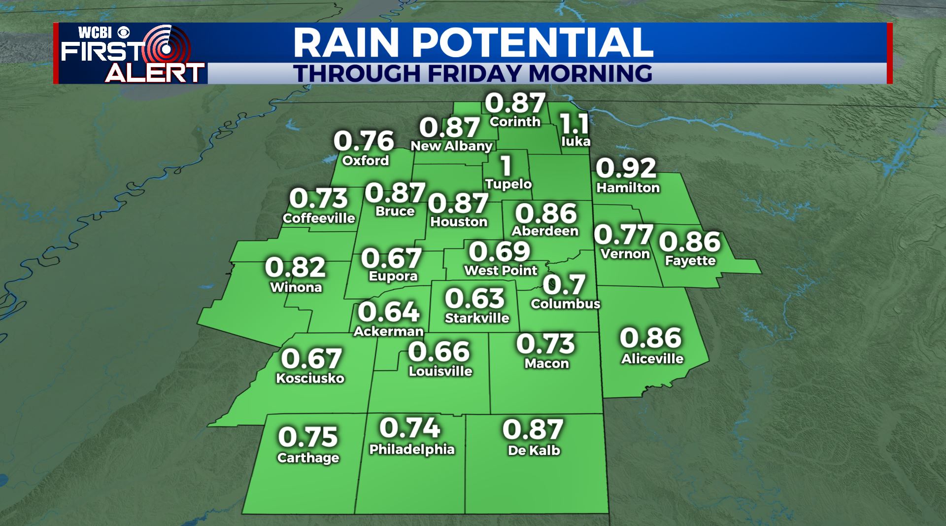
SUMMARY: Clouds will increase Wednesday out ahead of our next weather maker arriving Thursday and Thursday night. Another 1/2″ to 1 1/4″ of moisture may fall but it certainly won’t be as heavy as the last few systems that have rolled on through the region. Rain chances quickly decrease Friday and that will set up a pretty nice and seasonable weekend. Dry weather continues early next week.
TUESDAY NIGHT: Clear during the evening with an increase in cloud cover late. Lows in the low 20s. Winds become light and variable.
WEDNESDAY: Increasing clouds but dry. Highs top out in the mid to upper 40s. Winds SE 5-10 mph.
WEDNESDAY NIGHT: Mostly cloudy. Lows in the mid 30s.
THURSDAY: Clouds with areas of rain developing. Highs in the upper 40s.
THURSDAY NIGHT: Areas of showers. Lows in the 40s.
FRIDAY: A few morning showers are possible but most of the day is looking drier and drier as new data arrive. Look for highs in the 50s with westerly winds developing.
FRIDAY NIGHT: Variably cloudy. Lows in the mid 30s.
SATURDAY & SUNDAY: Partly cloudy. Highs in the mid 50s. Lows in the mid 30s.
MONDAY & TUESDAY: A mix of sun and clouds. Highs warming into the low 60s by Tuesday with overnight lows moderating back into the upper 30s and 40s.
Stay connected with @WCBIWEATHER on Facebook, Twitter, Instagram and the WCBI News App


Leave a Reply