More Storms Likely for This Weekend
COLUMBUS, Mississippi (WCBI) – The rain is here to stay for just a little while longer as we start off our weekend. A few isolated showers this morning, but most of the rainfall will hold off until later this afternoon. There is a severe weather risk for the storms that are moving in later today, so stay weather aware!
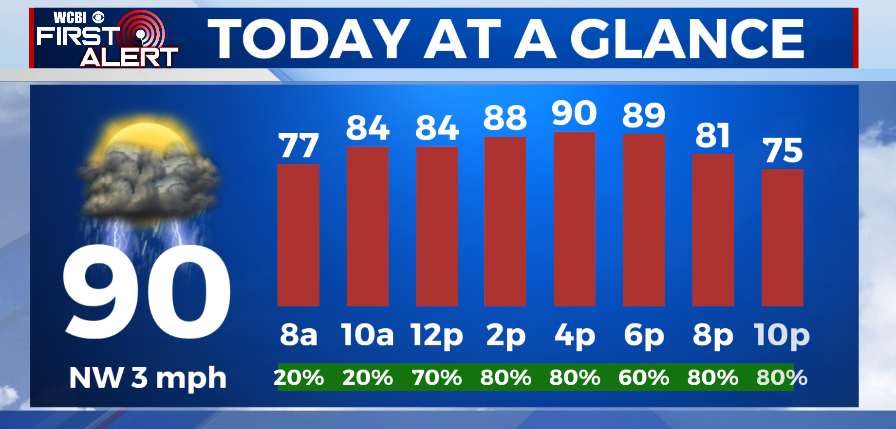
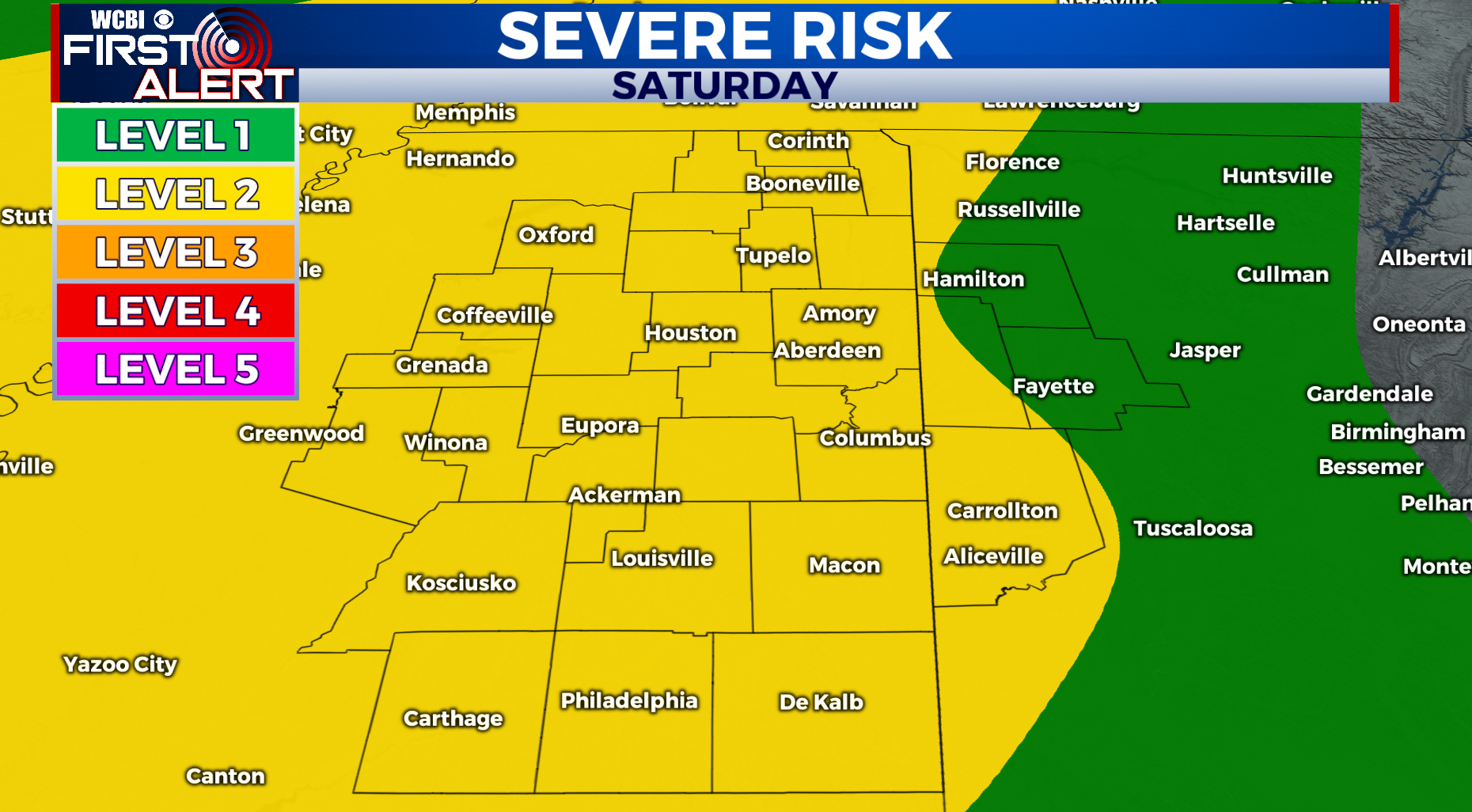
TODAY – Starting off with a gloomy Saturday morning and a few isolated showers, but most of us will stay dry this morning with just overcast skies. After lunchtime, a few showers will pop up just ahead of a line of storms for later this evening. It will feel very muggy outside with more humidity! Temperatures are warming up into the upper 80s for today and reaching a high of 89 later this afternoon. There is a chance for some heavy rainfall, gusty winds, and a possibility to see some hail associated with these storms. The SPC has issued all of the viewing area under a level 2 out of 5 risk for severe weather this evening.
TONIGHT – Things will begin to calm down as we head into the overnight hours. Skies will be mostly cloudy and temperatures will quickly cool off into the lower 70s tonight. A few lingering showers will stick around after the storms, but we will be left with mostly cloudy skies to start off on your Sunday.
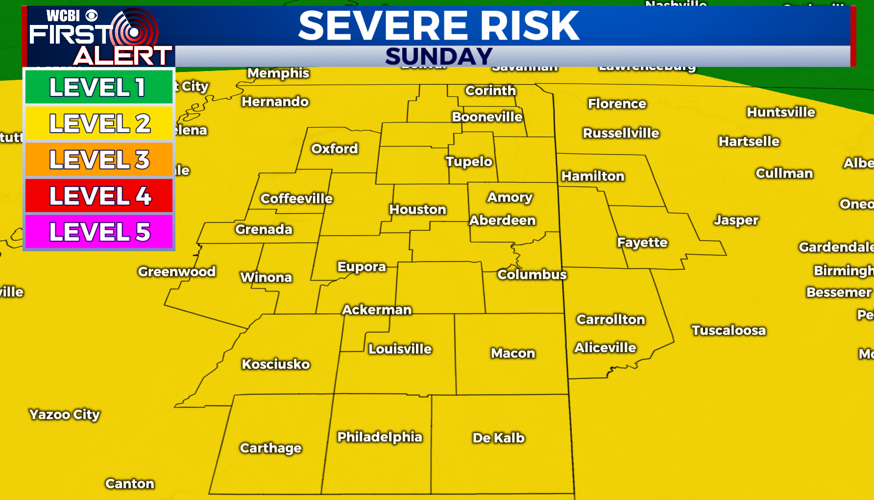
TOMORROW- Have your rain gear handy for your Sunday morning commute. Skies will be mostly cloudy with storms to develop in the early afternoon and temperatures will quickly warm up reaching a high of 88 tomorrow. Rain starts off early on Sunday morning just ahead of a line of strong to severe storms later tomorrow. There is another risk for severe weather for your Sunday afternoon (level 2), so stay cautious and be weather aware tomorrow.
NEXT WEEK – Don’t lose the rain gear just yet, rain chances stick around for a little while longer into the next work week!


