Mostly dry Monday, heavy rain and storms late Tuesday into Weds
COLUMBUS, Mississippi (WCBI) – Unsettled weather continues for most of this week and potentially into this weekend.
MONDAY: Clouds and areas of mist will continue through the morning, and clouds will linger into the afternoon as temperatures only reach the low 60s.
TUESDAY: Much of the day will be dry and cloudy with highs in the upper 60s. Southeasterly breezes will pick up late-day and last into the evening hours as well. Heavy rain & storms will be arriving after midnight, moving quite slowly across the state.
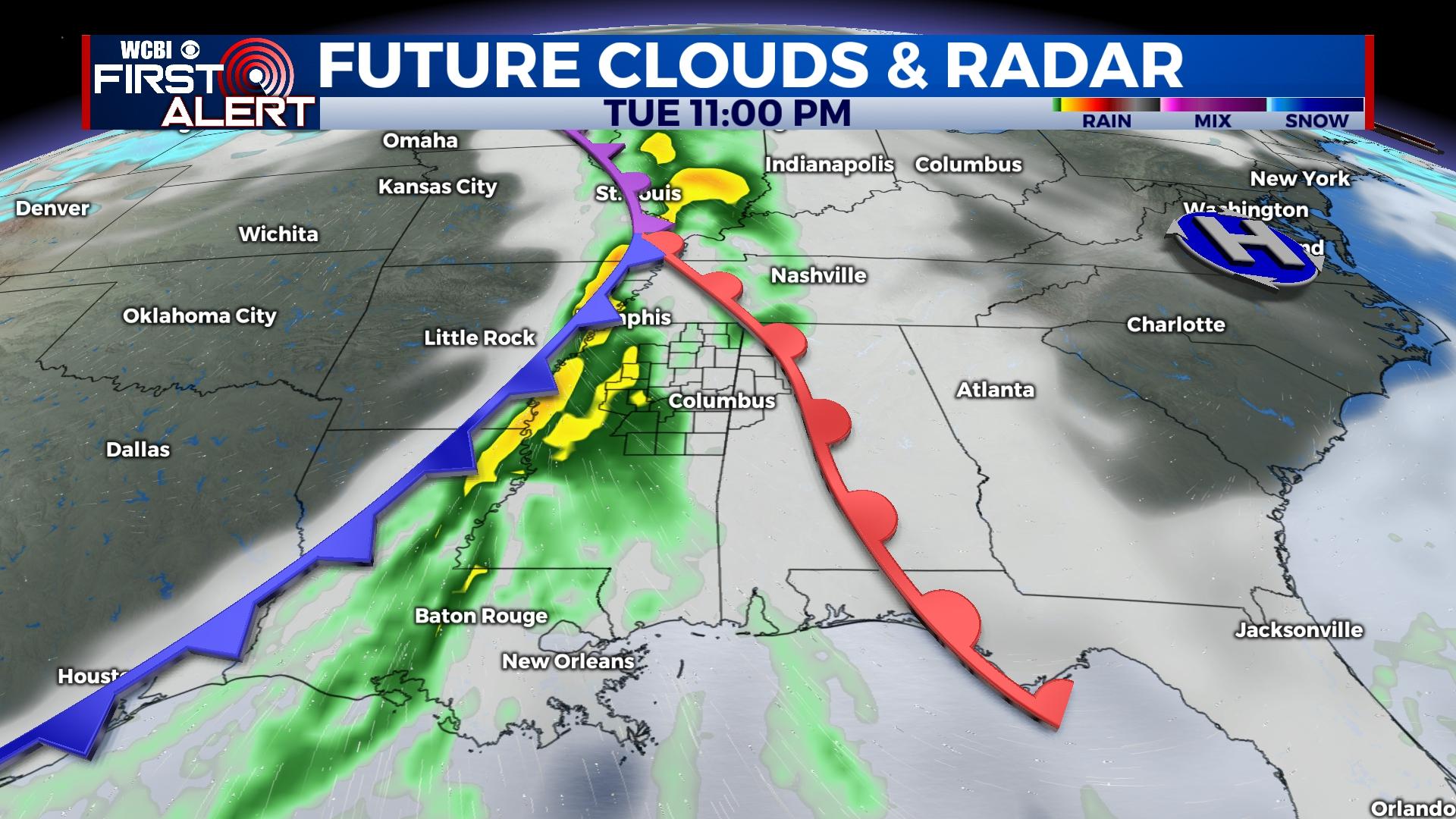
WEDNESDAY: Heavy rain and storms are likely much of the day, ending by mid to late afternoon. Some storms early Wednesday may reach severe limits, but the best parameter space for tornadoes looks to be just south/west of the WCBI coverage area. However, this could change…so please stay updated! At least 2″ of rainfall if not more is expected for most of the region.
END OF WEEK: The weather will gradually clear up Thursday and Friday, but temperatures will be falling. Highs Thursday may reach the upper 50s but will struggle to the low 50s by Friday.
WEEKEND: Unsettled weather returns, this time potentially in the form of winter weather. There have been a few model runs indicating some wintry precip. potential, but consistency and therefore confidence is lacking. Stay tuned for further updates! Regardless, it looks cold with highs in the 40s.


