Much cooler weather on the way
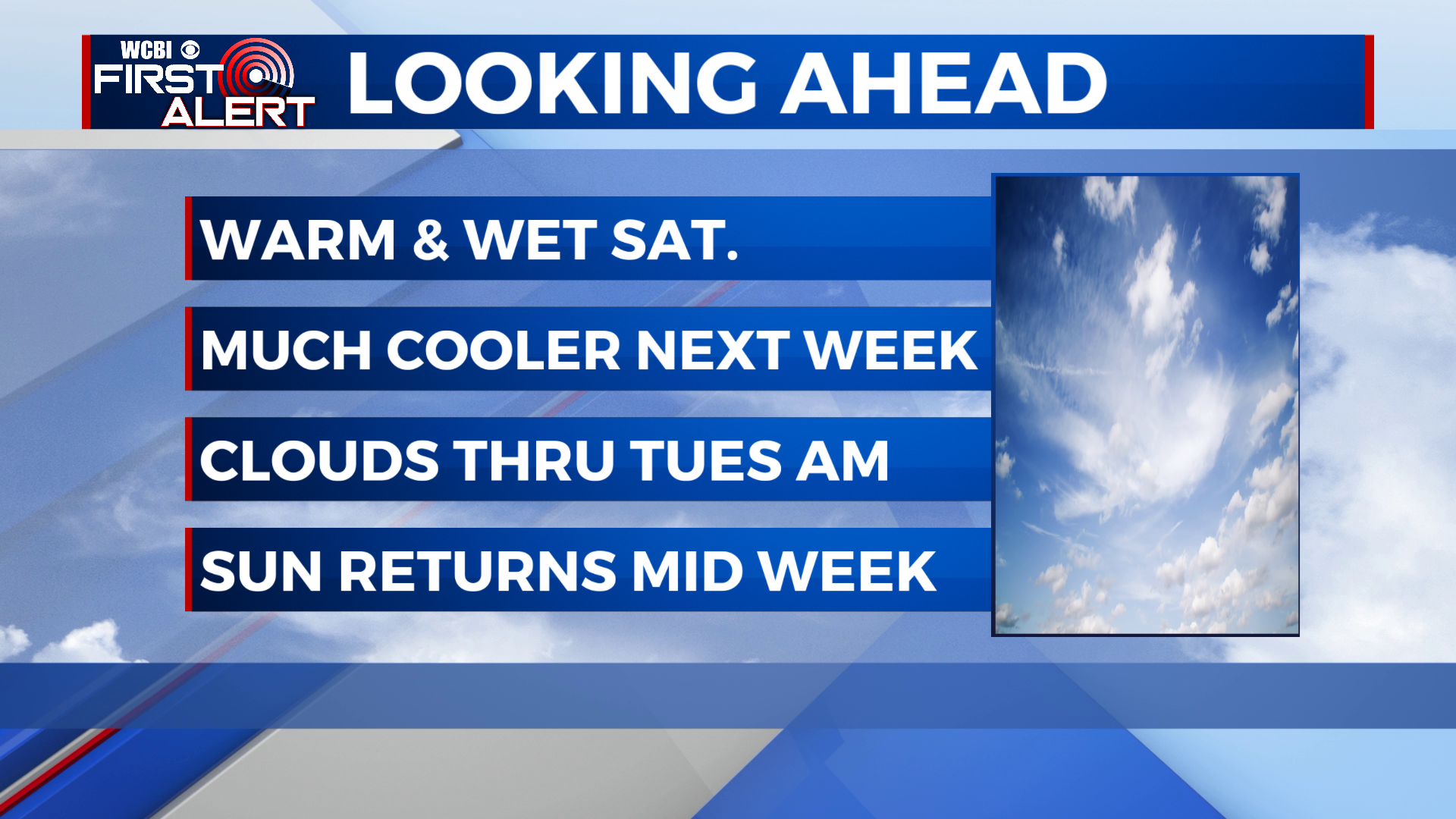
SUMMARY: One more very warm December day for Saturday, before a cold front moving through tonight drops our high temperatures more than 20 degrees in some cases. Rain will end tonight, leaving us with clearing skies for Sunday. Clouds return for Monday, as an area of low pressure moves to our south. We may see a few showers Monday night or Tuesday morning. We’ll finally clear out late Tuesday or Wednesday, with temperatures quickly warming back up as we head towards Christmas.
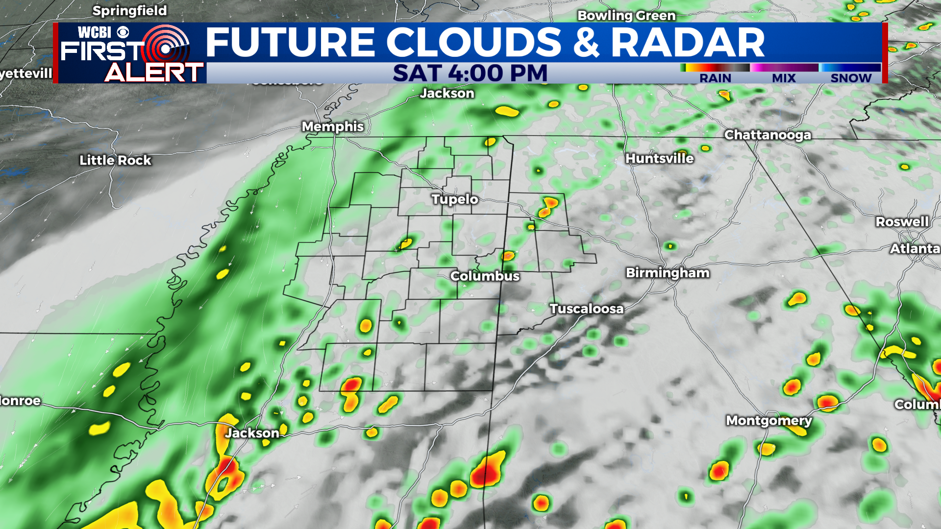
SATURDAY: As the cold front approaches the area, it will push through a broken line of showers and storms. Other than a stronger gust of wind or 2, no severe weather is expected. Rain amounts will be fairly light, around a quarter inch for most. Very warm once again with highs in the low 70s.
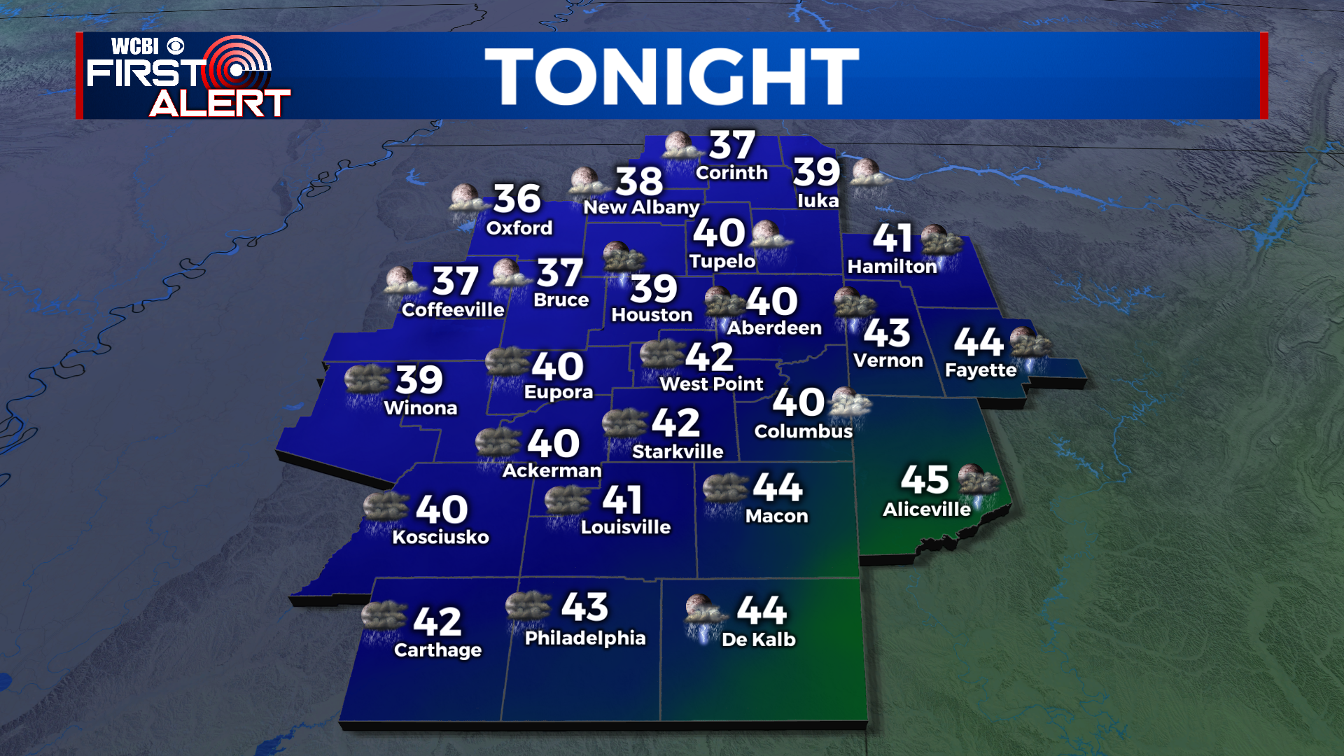
SATURDAY NIGHT: A drastic change is in store for tonight, with the front clearing out of the area. Showers will end for most of us by Midnight, with temps quickly falling and skies clearing. Lows will be in the mid-upper 30s north to low to mid 40s south.
SUNDAY: Expect clearing skies for Sunday, but it remains to be seen just how much we can actually clear the clouds out. Some places may stay fairly overcast. Highs will be 20+ degrees cooler than Saturday, in the upper 40s to low 50s.
SUNDAY NIGHT: If we clear out enough, we’ll get quite chilly on Sunday night, with lows dropping into the upper 20s to low 30s. If clouds linger, which may very well be the case, mid to upper 30s are expected.
MONDAY TO CHRISTMAS EVE: Clouds increase even more for Monday, with a cloudy day expected for most of us. With a north breeze, many of us likely stay in the 40s all day. An area of low pressure sliding along the gulf coast could throw some showers into the mix Monday night, with lows in the mid to upper 30s. An interesting side note, if the low was just a bit further north and we had cold air in place, it would be a perfect recipe for snow in the deep south. However, temps will be too mild this go around. Any showers taper off Tuesday morning, and we should begin to clear by the afternoon. Once again chilly, with highs in the upper 40s to low 50s. Wednesday looks to be the nicest day this week, with sunshine and highs in the mid to upper 50s. Some clouds come back in the picture for Thursday, with highs in the 60s. Christmas eve is looking a bit toasty with a high in the upper 60s to low 70s and mostly cloudy skies.
CONNECT WITH @WCBIWEATHER ON TWITTER, FACEBOOK, AND INSTAGRAM


