Muggy Saturday with storms, less humid Sunday
Severe Threat Saturday
SATURDAY: We’re still looking at a warm and humid day with highs in the lower to middle 90s. The heat index may surpass 100 in many spots. There is a chance of pop-up storms during the day but not everyone will see them.
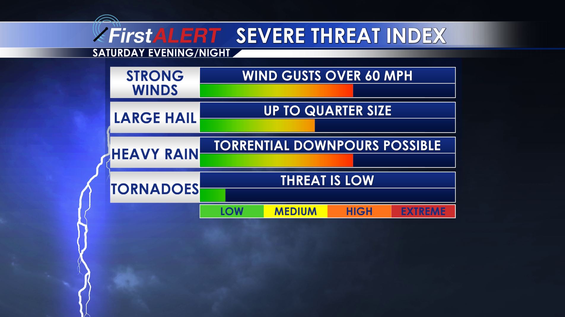
SATURDAY NIGHT: A batch of strong to severe storms remains possible with a cold front. The main concerns are damaging wind gusts, hail, and torrential rainfall. Most if not all of the activity should be done by sunrise Sunday or shortly thereafter. Lows in the upper 60s and 70s are likely.
SUNDAY: Seasonably warm highs in the mid 80s will continue but it won’t feel as bad as the last few days. A refreshing NW breeze should make things feel pretty good too as it ushers in lower humidity levels. Mostly sunny to partly cloudy skies look to be the general rule of thumb.
NEXT WEEK: New data suggest seasonably warm conditions and a fair amount of sunshine. A few pop-up showers and storms are possible by the middle of the week.
Follow @WCBIWEATHER on Facebook, Twitter, Snapchat, and Instagram


Leave a Reply