Multiple rounds of rain this week
COLUMBUS, Mississippi (WCBI)- After a cooler weekend and a mild Monday, the temperatures are going to be warming up throughout the week. There are going to be several rounds a rain the week and into the weekend.
MONDAY NIGHT: Overcast cloud coverage will continue into the night as rain showers move in and across Mississippi overnight and into Tuesday morning. Some areas may see heavier rain fall and possibly even a rumble of thunder. Temperatures tonight will be in the middle 50s.
TUESDAY: Some of the rain showers may keep falling into the morning hours of Tuesday. By the afternoon, this round of rain should clear out and will leave behind a cloudy sky. High temperature will warm into the lower 70s. Low temperatures will be in the upper 50s.
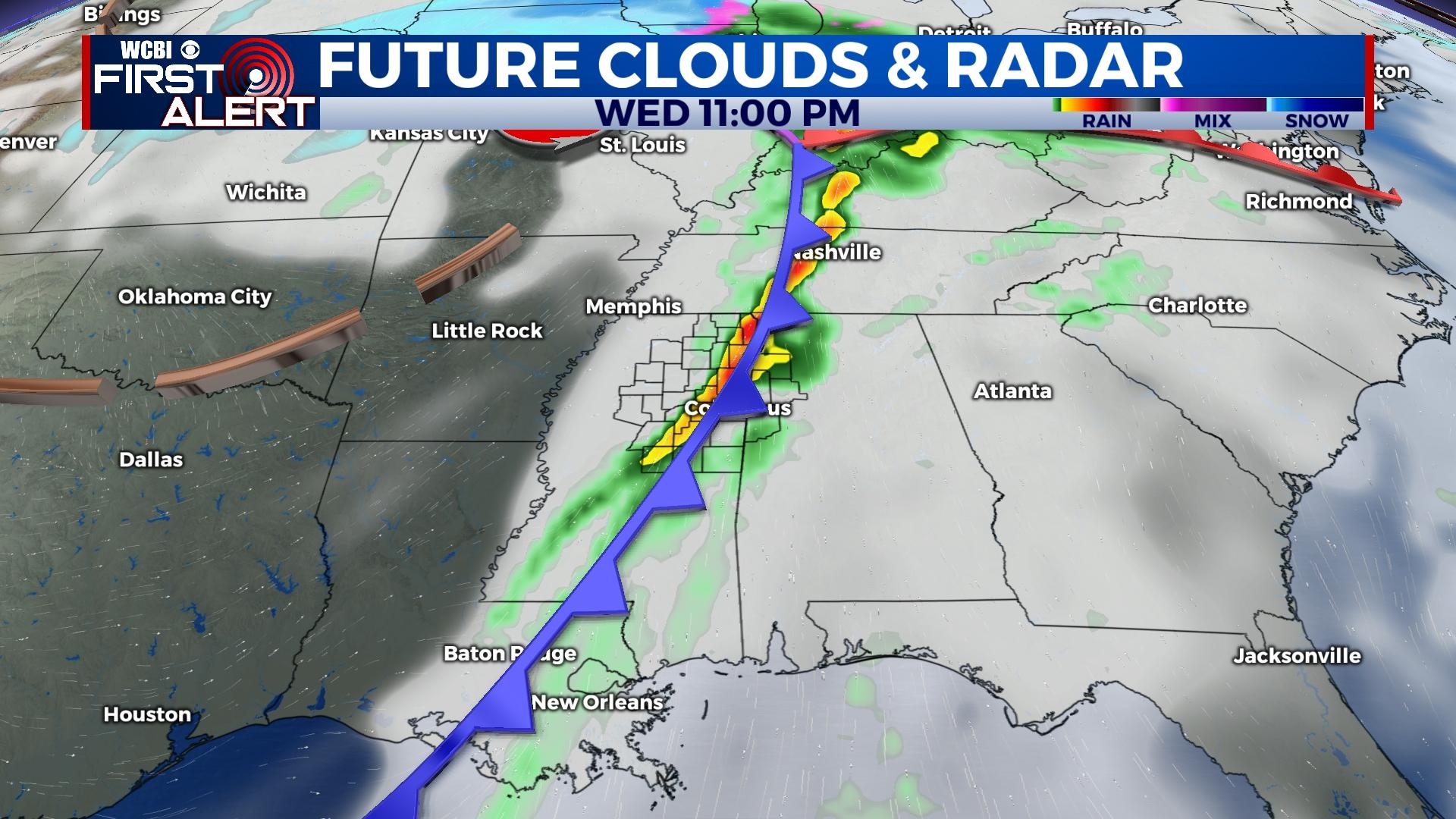
WEDNESDAY: The high temperatures will warm a little more into the low to middle 70s. With overcast cloud coverage, rain returns. Showers will begin throughout the morning will be isolated during the day. It will intensify into the late after and evening hours, potentially bringing in a severe risk. The Storm Prediction Center currently has SW and Central Mississippi in the Level 2 – Slight Risk for severe weather for Wednesday into Thursday morning. Overnight low temperatures will be in the middle 50s.


