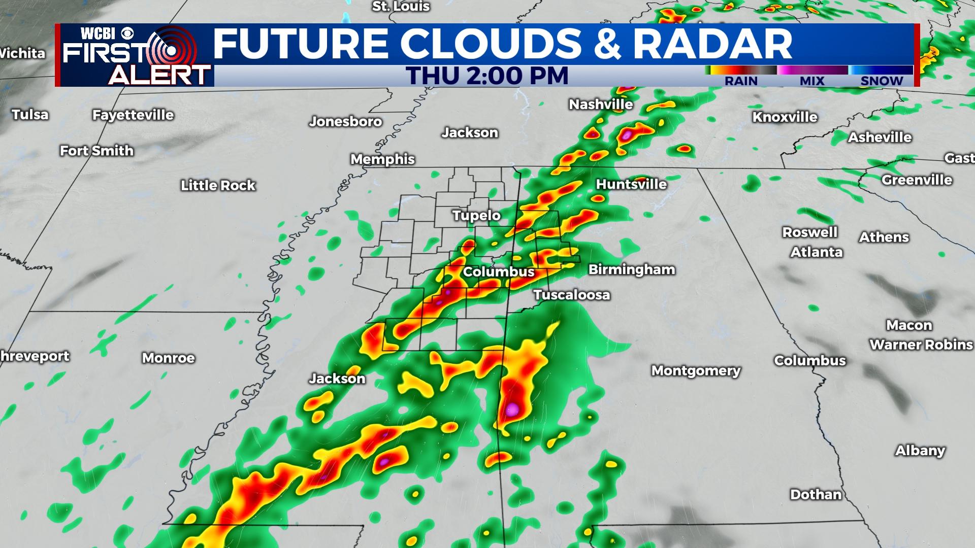
Multiple rounds of storms through Thursday afternoon
COLUMBUS, Mississippi (WCBI) – The weather turns active for Wednesday and Thursday across the Mid-South. Colder weather follows Friday.
WEDNESDAY: Expect a variably cloudy sky with highs reaching the lower 70s, possibly middle 70s if any sustained breaks occur. As a warm front retreats north, on & off showers are possible through the day.
WEDNESDAY NIGHT: As the warm front continues northward, a few stronger storms are possible from Tupelo northward into Tennessee. These would be mainly capable of gusty winds or hail. Then, stronger and more sustained storms could develop closer to midnight across the northern Arklamiss Delta and track northeast. These would be capable of all severe hazards, including a tornado risk. This risk would be mainly focused along and northwest of the Natchez Trace.
THURSDAY: Showers and storms will already be in progress across north and western MS at daybreak. Through the day, redevelopment or restrengthening of this activity is expected into northeastern/eastern MS into Alabama. The environment will be favorable for large hail, damaging winds, and a few tornadoes with these storms from 11a-4p. Steady rain is expected to last into the evening hours even as the severe threat shifts into central Alabama.
FRIDAY: Temperatures will start out in the 30s! Expect a gradually clearing sky with highs only reaching the upper 40s.
WEEKEND: Cold mornings will give way to increasingly pleasant afternoons. Highs will be in the 50s Saturday and 60s Sunday.


