Multiple strong storms in the next several hours
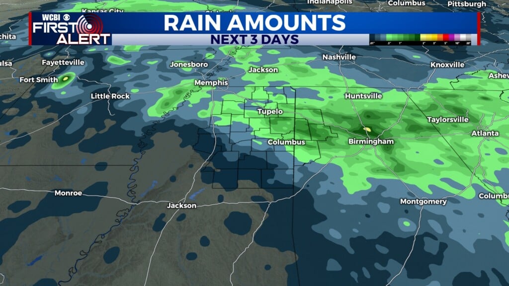
COLUMBUS, Mississippi (WCBI)- Heavy rain showers and storms will be moving throughout northern Mississippi over the next several hours. Rain and clouds will clear for the weekend though, as temperatures jump way up.
WEDNESDAY NIGHT: A few stronger storms are possible tonight from Tupelo northward into Tennessee. These would be mainly capable of gusty winds or hail. Stronger, more sustained storms are expected to form closer to midnight tracking northeast. These would be capable of all severe hazards, including a tornado risk. This risk would be mainly focused along and northwest of the Natchez Trace. Temperatures tonight are going to be mild in the middle 60s.
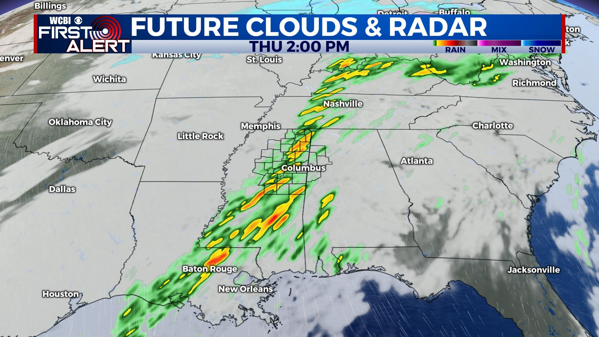
THURSDAY: Showers and storms will already be in progress across north and western MS at daybreak. Through the day, redevelopment or re-strengthening of this activity is expected into northeastern/eastern MS into Alabama. The environment will be favorable for large hail, damaging winds, and a few tornadoes with these storms from 11a-4p. High temperatures will be in the low to middle 70s. Steady rain is expected to last into the evening hours even as the severe threat shifts into central Alabama. Overnight temperatures will fall into the mild 30s, as cold air moves in behind the rain.
FRIDAY/WEEKEND: Friday will be the coldest day of the week, with temperatures only reaching into the upper 40s. Cloud coverage will be clearing out throughout the day, going from partly cloudy to mostly clear. Overnight temperatures will be in the middle 20s into Saturday morning. Frost is expected with these below freezing temperatures. Temperatures will be warming up through the 50s and 60s over the weekend. Sky conditions will stay mostly clear to partly cloudy, with a 0% chance for rain. Overnight temperatures will be in the 30s and 40s.