Newest system bringing warm, wet, then cold conditions
COLUMBUS, Mississippi (WCBI)- After a mild first couple of days this week, a new low pressure system is going to be bringing in warm, wet, and then cold conditions to northeastern Mississippi.
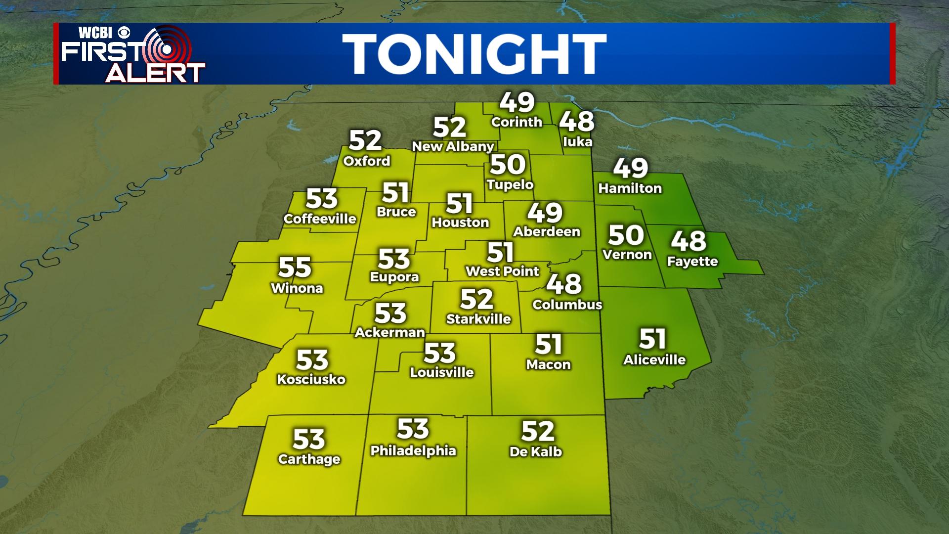
TUESDAY NIGHT: Cloud coverage is going to continue increasing throughout the evening and overnight hours. Wednesday morning will start off with mostly cloudy sky conditions and temperatures in the upper 40s to lower 50s.
WEDNESDAY: The heavy cloud coverage is not going to do much in terms of keeping the warmth out. Gulf moisture and temperatures will be working their way into Mississippi, along with a passing warm front. High temperatures are going to be heading towards the 70! A few of our cities may even see some record breaking temperatures. Along with the heavy cloud coverage, there may be a few scattered sprinkles of rain too. That coverage will be responsible for holding in the warmth overnight, with low temperatures only falling into the lower 60s.
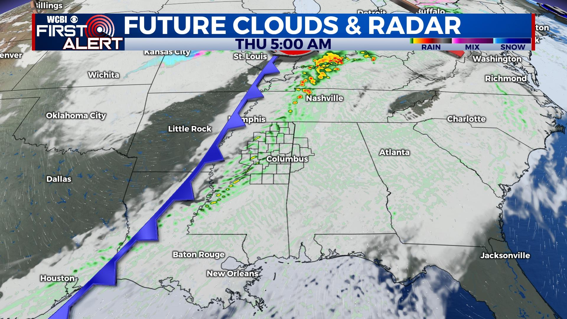
THURSDAY: A cold front will be working behind Wednesday’s warm front to bring in some cooler temperatures and rain showers. Overnight rain showers and storms will move across northern Mississippi ahead of the cold front. The temperatures will only rise into the upper 60s. The rain and front should move off to the East by Thursday afternoon, taking a lot of the heavy clouds along with it. This will allow the overnight low temperatures to drop close to freezing.
FRIDAY: The cold air is going to be sticking around. Temperatures on Friday reach only into the upper 40, despite it being a very sunny day. With the lack of cloud coverage, low temperatures will fall into the middle 20s.


