Polar double threat keeps milder temperatures at bay
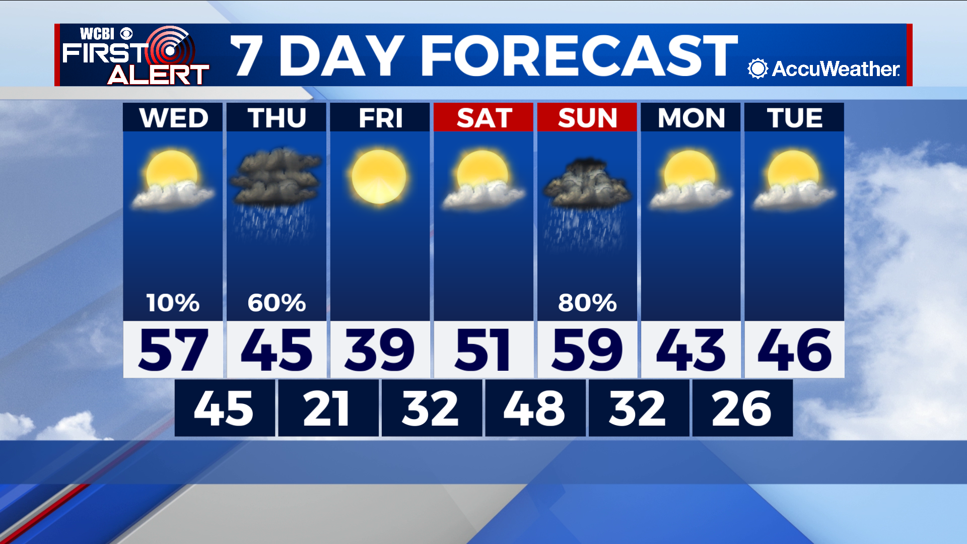
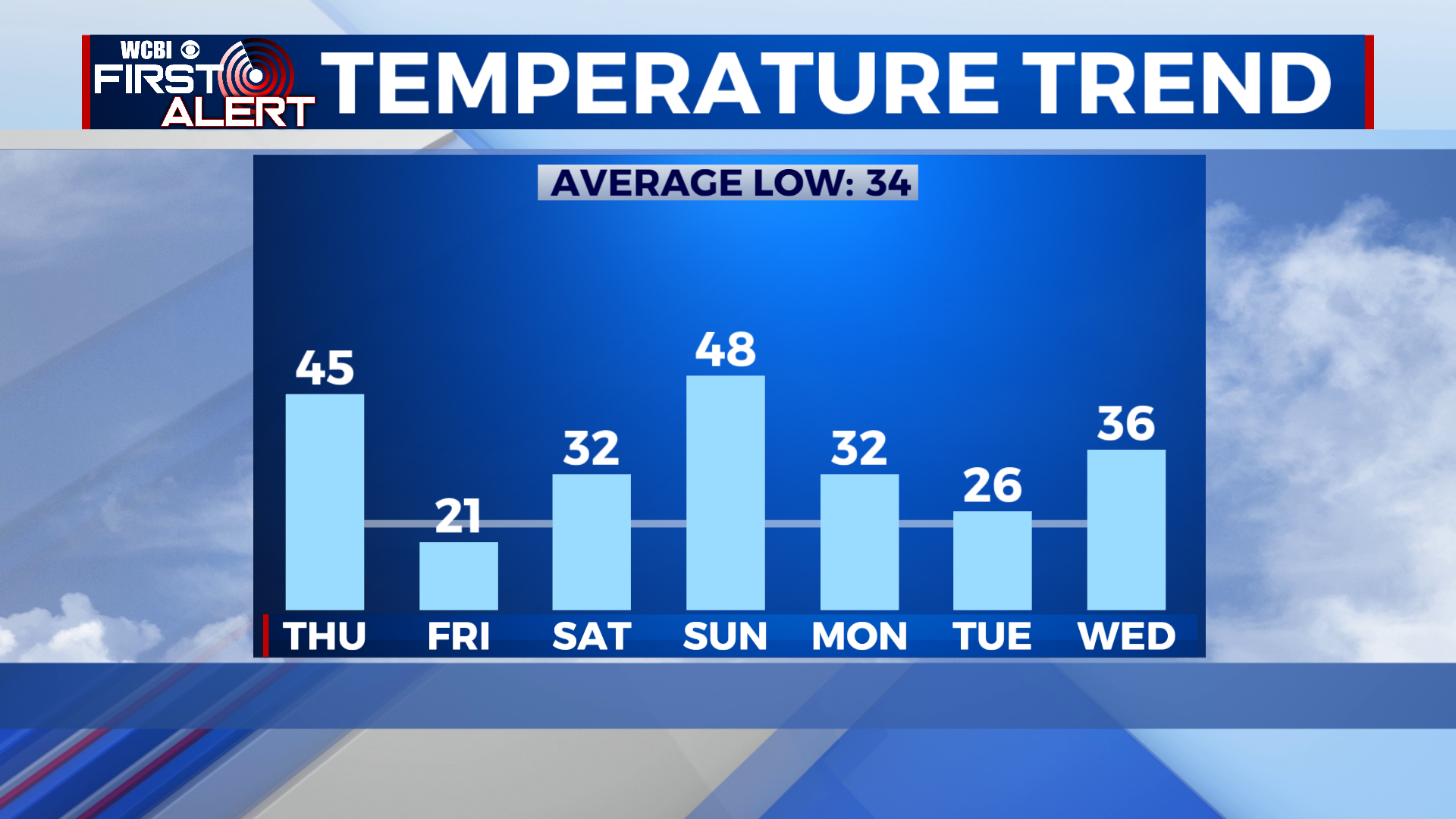
COLUMBUS – SUMMARY: Highs struggle to break 60 as polar air continues to hang around in Northeast Mississippi through next Tuesday. Two rounds of cold fronts on Thursday and Sunday aid in this wintry takeover, bringing lows down into the 20s along with significant rain chances. The week does remain otherwise dry, and periods of sunshine can be expected throughout the week.
WEDNESDAY: We continue to see our maximum daily temperature improve as afternoon highs reach into the high-50s. Partly cloudy skies accompany and the odd shower cannot be ruled out. Lows also improve somewhat, only dropping into the mid-40s overnight.
THURSDAY: Thursday’s cold front marks the first of two, although the rain chance in this case is much less severe. Rain coverage will be scattered in nature and we can look for things to wrap up by the early evening hour. The event will not be a washout so you can expect rain totals of no more than a quarter to half and inch across the region. The biggest impacts with Thursdays front come in the form of frigid temperatures, as lows are set to drop into the low-20s.
REST OF THE WEEK: Gradual warming does occur from Thursday onward and by Sunday temperatures will be poised to reach the 60s. Sunday’s cold front will put a wrench in this trend, dropping highs back down into the 40s and lows into the 20s. Significantly, Sunday’s front also brings back thunderstorms to the area, with some minor potential for severe weather should the right conditions come together.