Post-frontal clear out
COLUMBUS, Mississippi (WCBI)- It was an active weather morning and a calmer afternoon, as the first wave of this system passed into the Deep South. A second round will return this evening before a real clear out the last half of the week.
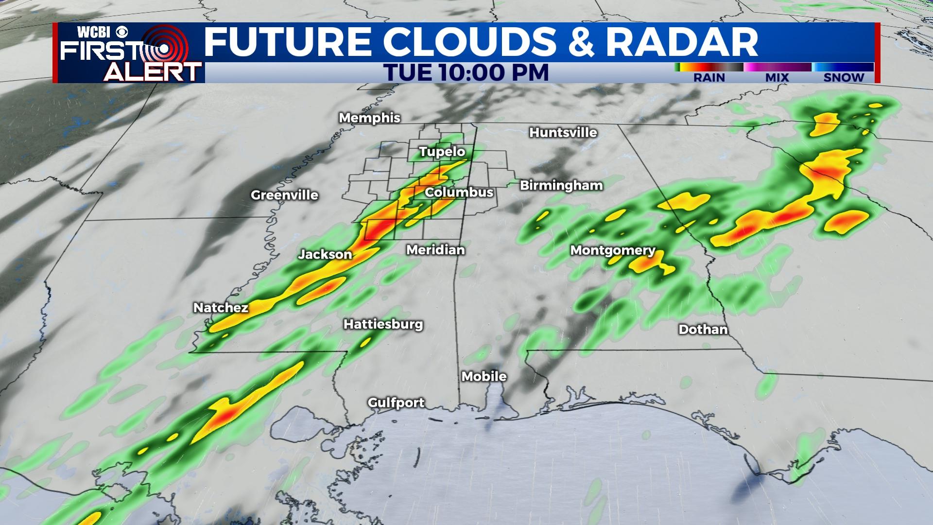
TUESDAY NIGHT: A few more showers and storms are expected to redevelop around 6PM and begin to head back towards the NE corner of Mississippi throughout the night. Heavy cloud coverage will also be sticking around overnight. The low temperature tonight falls into the middle 50s.
WEDNESDAY: Starting early in the morning, heavy cloud coverage will begin to clear off to the East, leaving us with mostly sunny sky conditions by Wednesday afternoon. High temperatures are going to be in the upper 60s. Low temperatures will fall into the lower 40s, with help from the clearer sky.
END OF THE WEEK: Sunny and mostly clear sky conditions finish out the first week of the new year. Cooler air follows behind the cold front system bringing the rain. High temperatures will make their way only into the upper 50s. Low temperatures will be in the middle to upper 30s.


