Quick warmup next week ends with weekend cold front
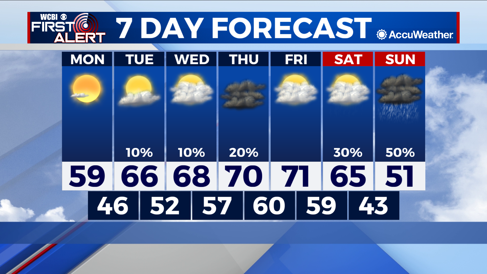
COLUMBUS – SUMMARY: We continue a trend rapid weekly warming followed by weekend cooling. The week starts in the high 50s and ends in the high 40s, reaching the 70s in-between. Clouds return this week with gusto and you may have to wait a while before we see some decent sunshine. Rain chances slowly creep back into the forecast throughout the week but show up mainly this weekend with a potential cold front Saturday.
MONDAY: Our Monday starts of chilly, with early-morning temperatures at or approaching freezing in the low 30s. It will warm up quite swiftly afterwards though, and we can expect to see temperatures reach the high 50s, possibly breaking 60 by the afternoon hour. Skies will be mostly sunny for perhaps the last time this week. No rain chance is expected.
TUESDAY: Our warmup continues as temperatures climb into the high 60s during the afternoon. Lows bottom out in the high 50s. Clouds start to move into the area and partly cloudy skies will be the order of the day.
WEDNESDAY: Our warming trend begins to slow down, but we trek ever closer to the 70s with highs in the high 60s Wednesday. Lows continue to warm up as well, reaching the high 50s overnight. Clouds really make their return today with mostly cloudy skies.
REST OF THE WEEK: High temperatures will reach the 70s by Thursday, and will stay there until a potential cold front brings temperatures back down again on Saturday. Rain chances throughout the rest of the week will be mixed. A slight chance for an isolated sprinkle exists on Thursday but our primary rain chances will be centered over the weekend. As mentioned earlier, clouds will be in play at least through Sunday. Once the front passes, watch for temperatures to decrease back down into the low 50s for the highs.