Quiet weekend before Ida arrives Monday
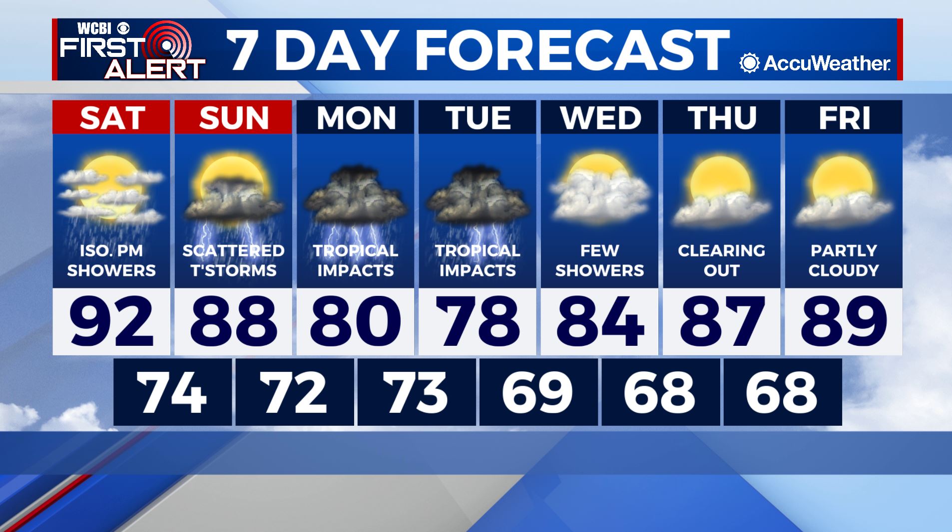
SATURDAY: Partly cloudy with high temperatures in the low-90s. Isolated afternoon thunderstorms will also be possible. Chance of rain: 20%.
SATURDAY NIGHT: Mostly cloudy with lows in the mid-70s.
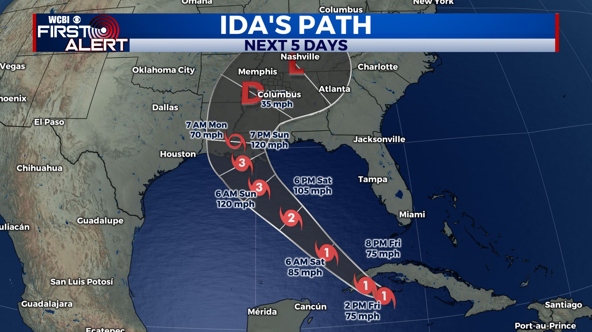
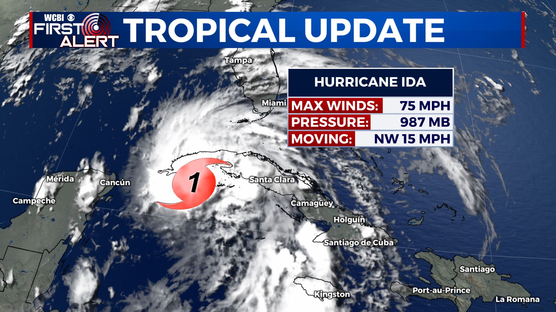
MONDAY – FRIDAY: Next week’s forecast will be entirely dependent on the eventual track and intensity of Hurricane Ida. As of 2pm, Ida is a weak Category 1 Hurricane with maximum sustained winds of 75 mph. Ida will cross Cuba and enter the southeastern Gulf of Mexico over the next 12 hours. Rapid intensification is possible as Ida crosses the Gulf to the northwest. Prior to landfall Sunday afternoon or evening, Ida is expected to be a major hurricane (likely a strong Category 3 or 4 storm). It will then slow and turn to the northeast, bringing greater impacts to the Mississippi Delta. Our region can expect tropical storm force conditions as early as early Monday morning lasting through Tuesday. The timing is still somewhat uncertain, but Ida’s forecast track is of relatively higher confidence. Heavy rain with flash flooding, tropical storm force winds, and isolated tornadoes will be possible across our entire viewing area as Ida moves across our region. Conditions will improve as we reach Tuesday evening and beyond. Wednesday through Friday’s forecast is quiet with temperatures rebounding to the upper-80s. Stay tuned for additional updates from the WCBI Team. We will be conducting Facebook Live updates and offer live coverage of Ida’s impact across our region.
Follow Meteorologist Lance Blocker on Facebook and Twitter or via reach out via e-mail at LBlocker@WCBI.com!
Stay connected with @WCBIWEATHER on Facebook, Twitter, Instagram and the WCBI News App


