Rain arrives Saturday, warmer next week
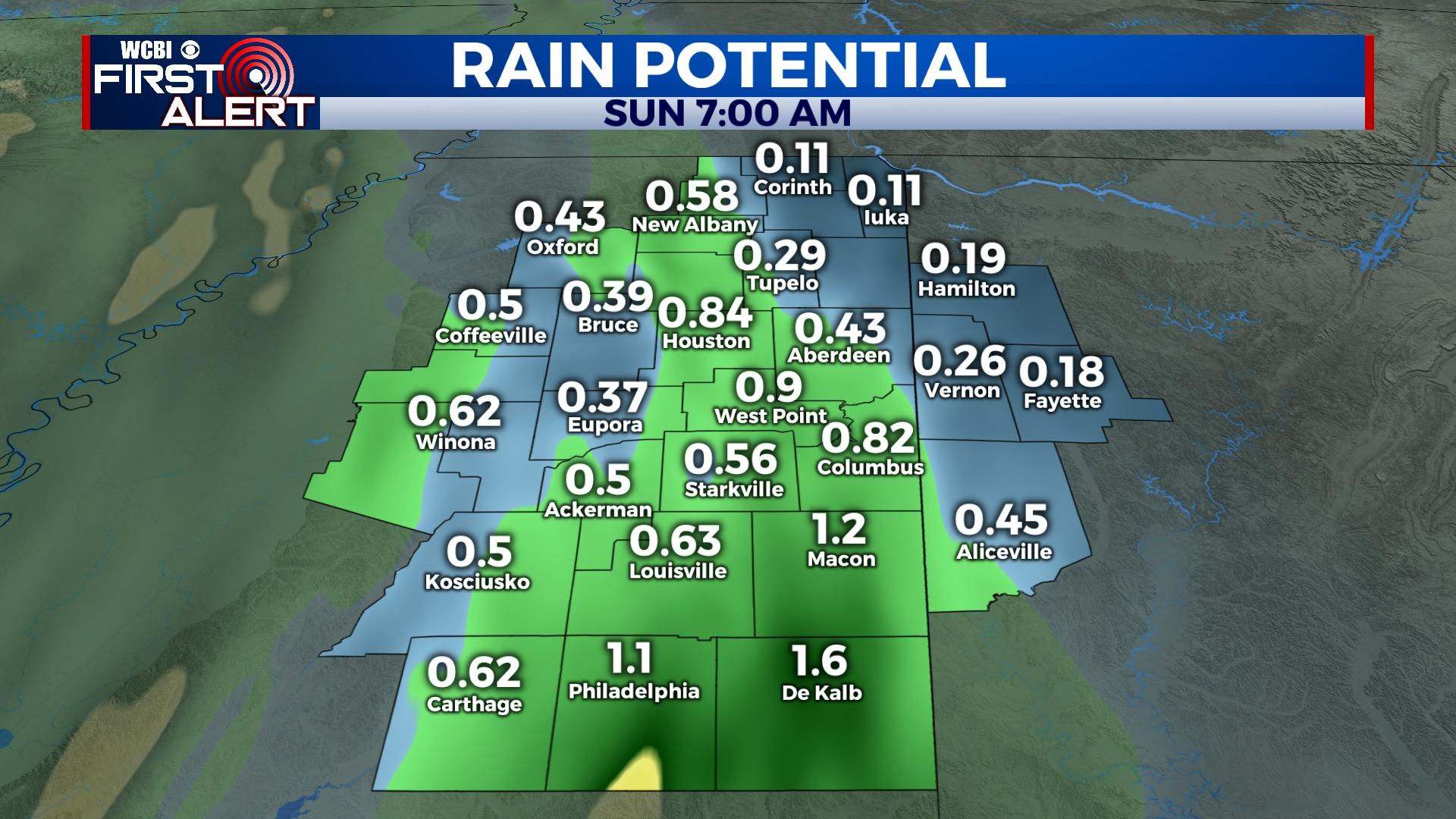
COLUMBUS, Mississippi (WCBI) – Rain develops into the Deep South Saturday, but rain coverage drops off substantially Sunday.
SATURDAY: A steady east wind and an overcast sky will keep temperatures mainly in the 60s much of the day ahead of developing rain. The heaviest rain looks to move into north-central/northeast MS after lunch, becoming steady & heavy at times into the evening. Some rumbles are possible along the way, but the best storm energy will remain south of the WCBI coverage area. Still, we’ll keep an eye on things and update if severe potential increases.
SUNDAY: Clouds will likely stick around much of the day, but rain coverage will be spotty at best. Highs will return to the lower 70s.
NEXT WEEK: Clouds increase again Tuesday ahead of the next quick-moving system. Scattered showers are possible Tuesday night into Wednesday, but the coverage and intensity will comparatively less than Saturday. A surge in temperatures is expected through the week’s end, reaching 80 degrees by Friday.


