Rain chance through the weekend
COLUMBUS, Mississippi (WCBI) – Unsettled weather through the next few days. Showers and storms start Thursday evening and are likely to continue through the end of the weekend.
THURSDAY NIGHT: A few showers and thunderstorms have already moved through Mississippi, including several Severe Thunderstorm Warnings. The chance for more rain continues through the evening and into Friday. A split between a Level 1 and Level 2 severe weather risk continues overnight into Friday too, so be aware of any warnings that may be issued. Temperatures are going to be very mild tonight, falling only into the middle 60s.
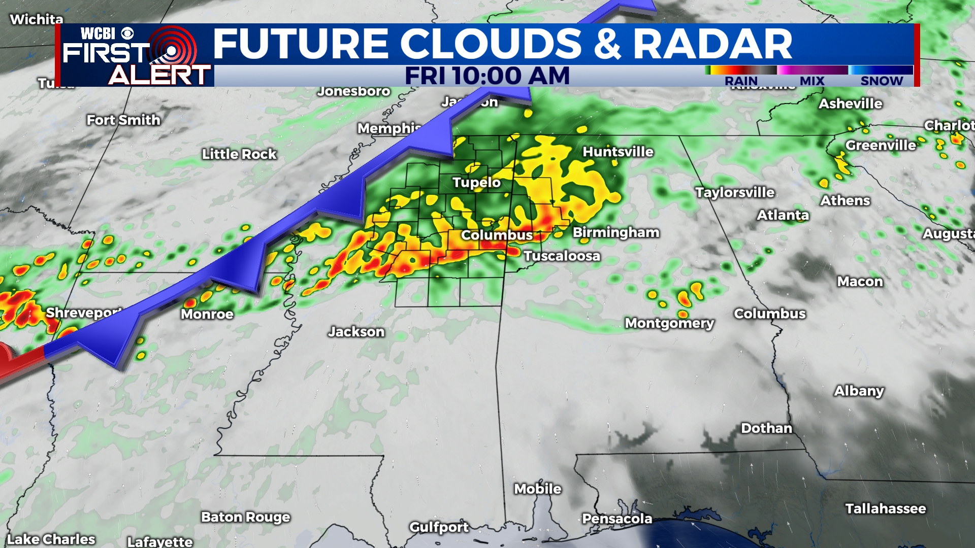
FRIDAY: More showers and storms will be moving through Mississippi from the NW. Timeline starts early along our northern border. The severe threat will continue towards the afternoon, with the continuation of the Level 1 – Marginal Risk across the southern 2/3 of the viewing area. High temperatures are expected to reach back into the lower 60s. Showers and thunderstorms are likely to continue through the afternoon into the evening. Gusty winds and hail are the main hazards. However, a tornado or two cannot be ruled out. Make sure to have your ways of receiving warnings ready. By Friday night, rain should be clearing off to the SE. Overnight lows will drop into the low to middle 50s.
WEEKEND: Saturday is expected to be dry with plenty of cloud coverage remaining. Another rain chance moves in Sunday morning, and hopefully should be out of the area by late Sunday afternoon or early evening. Saturdays highs and lows will be warmer than Sunday, going from around 70/56 Saturday to approximately 66/43 on Sunday.