Rain chances continue, briefly cooler Friday night
COLUMBUS, Mississippi (WCBI) – Occasional rain chances continue, and a cold front is set to bring chilly air to the region Friday night.
THURSDAY: Expect a cloudy sky with highs mostly in the 60s with 70s likely south of US 82. Occasional showers and storms will be likely through the day as well. There is a small chance one or two storms reaches severe limits with hail the primary concern.
THURSDAY NIGHT: The arrival of a stronger cold front will signal widespread rain and embedded storms after midnight. Additional rain totals of at least one half inch are expected.
FRIDAY: Rain is likely early in the day but should dry out by mid to late morning. Clouds will linger but should begin clearing late day, leaving highs in the upper 50s and low 60s.
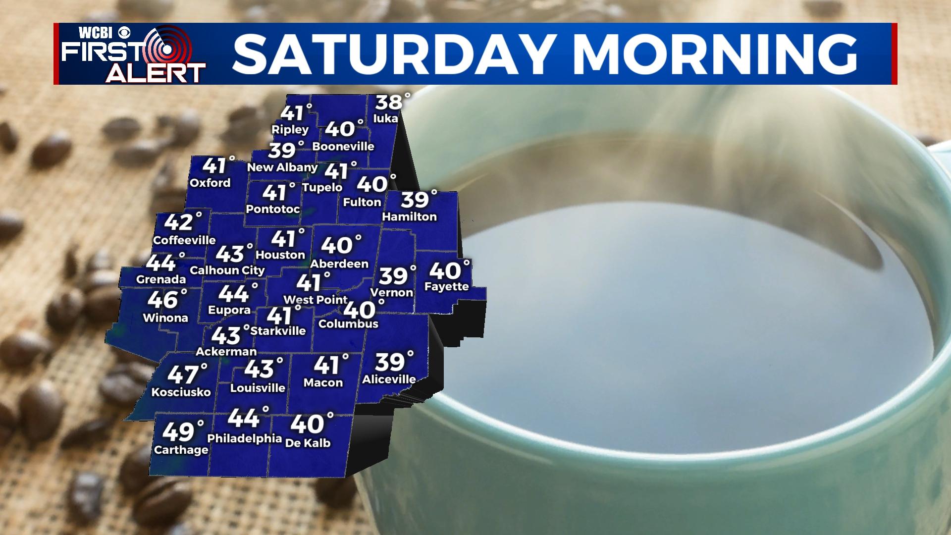
WEEKEND: Saturday morning starts off relatively chilly in the 30s to low 40s. Decent sunshine should warm the afternoon back to the 60s as clouds begin increasing yet again. Another strong front Sunday will bring more widespread rain and storms, and some of these could be severe with gusty winds or hail.
NEXT WEEK: A more extended stretch of chilly air is set to move into the Mid-South. Expect near freezing temperatures by Tuesday and Wednesday mornings.


