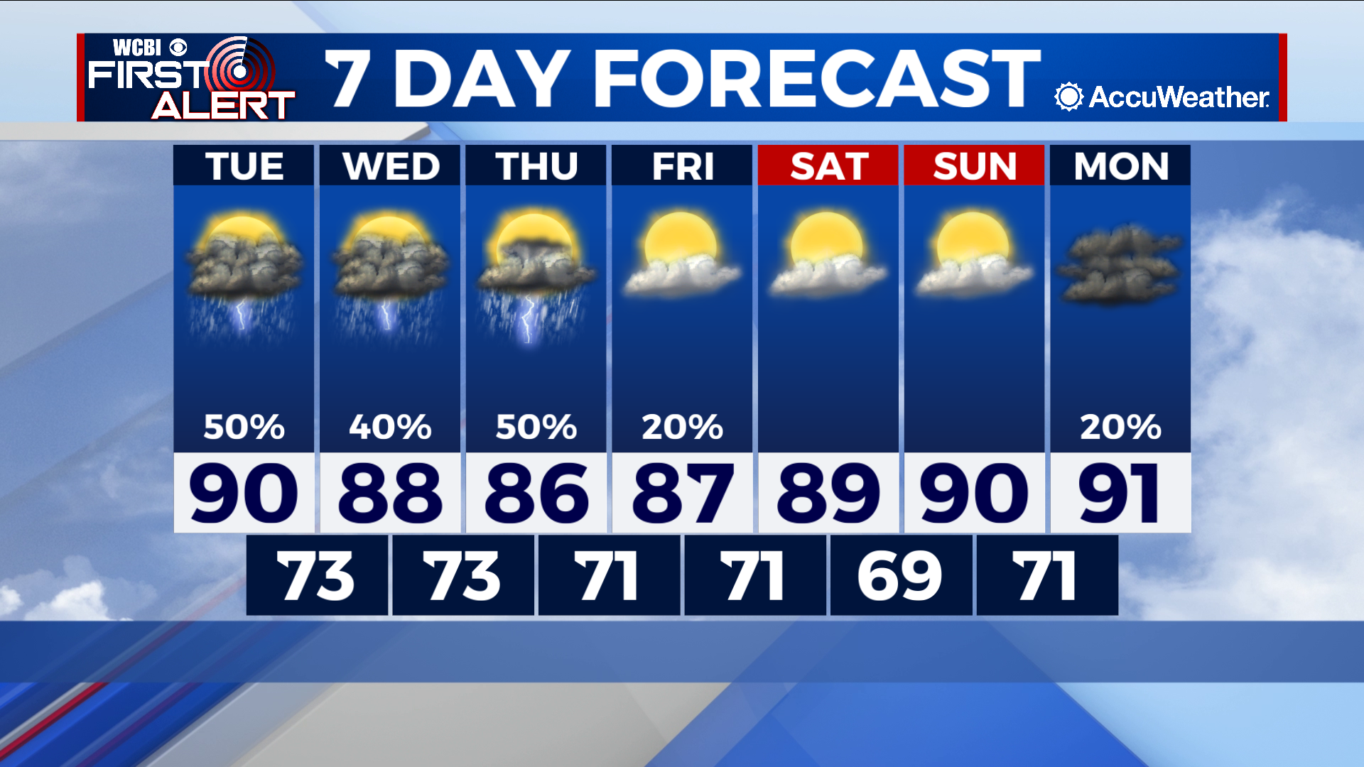
Rain chances persist as weak cold front looms
COLUMBUS – SUMMARY: Thunderstorm chances through the next few days offer some possibility to add on to already excellent rain totals for the year. Temperatures cool into the mid to upper 80s off the back of this rain. A weak cold front Thursday keeps highs in the upper 80s to low 90s throughout the rest of the week.
TUESDAY: We take a slight dip into the lower 90s and potentially upper 80s Tuesday, as scattered storms roll into the region. Mostly cloudy skies dominate. The chance for the odd pop-up exists throughout the day but storm chances maximize in the early evening and continue all the way to midnight. Lows bottom out in the lower 70s.
WEDNESDAY: Another slight drop puts most of us in the upper 80s Wednesday. Mostly cloudy skies prevail. Yet more chances for thunderstorms bring hope that additional rain relief can be achieved. Lows bottom out in the lower 70s once again.
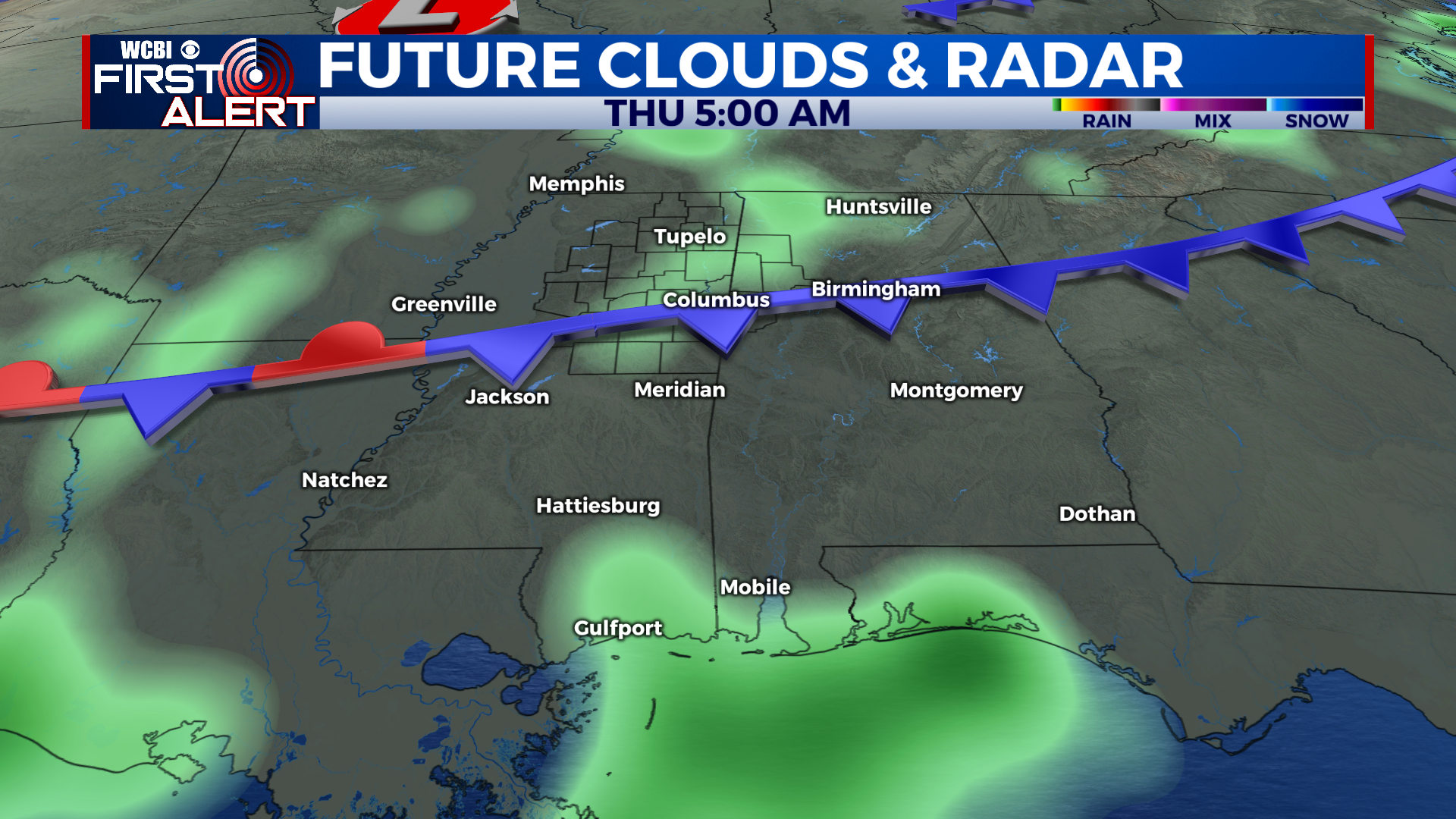
REST OF THE WEEK: A weak cold front takes aim at the region Thursday, aiding in keeping highs in the upper 80s and low 90s throughout the rest of the week. Rain and storms over the next few days will ultimately help the drop in afternoon temperature into the mid to upper 80s by Thursday. Skies dry up a bit starting Friday, and continuing into the next week. Lows reach into the upper 60s overnight Saturday, but remain in the low 70s for the most-part.