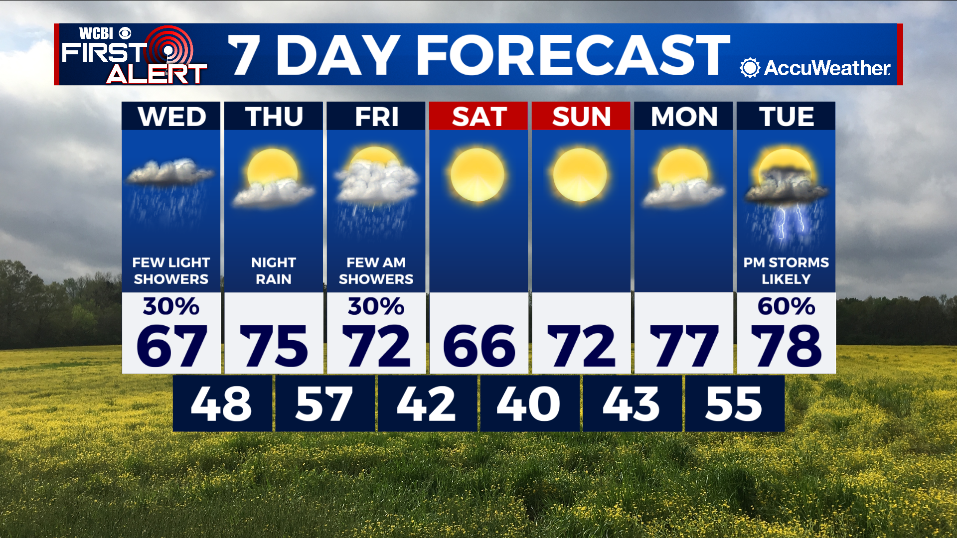
Rain continues tonight then warmer and sunny by Thursday
COLUMBUS, Mississippi (WCBI) – SUMMARY: An unsettled weather pattern will remain in place through Friday, then we’ll enjoy a beautiful weekend ahead.
TONIGHT: Showers likely. Lows in the mid-50s. Chance of rain: 60%. North wind 5-10 mph with gusts up to 20 mph.
WEDNESDAY: A few isolated showers early, then decreasing clouds through the afternoon. Highs in the upper-60s. North wind around 5 mph.
WEDNESDAY NIGHT: Partly cloudy with lows in the upper-40s. Calm wind.
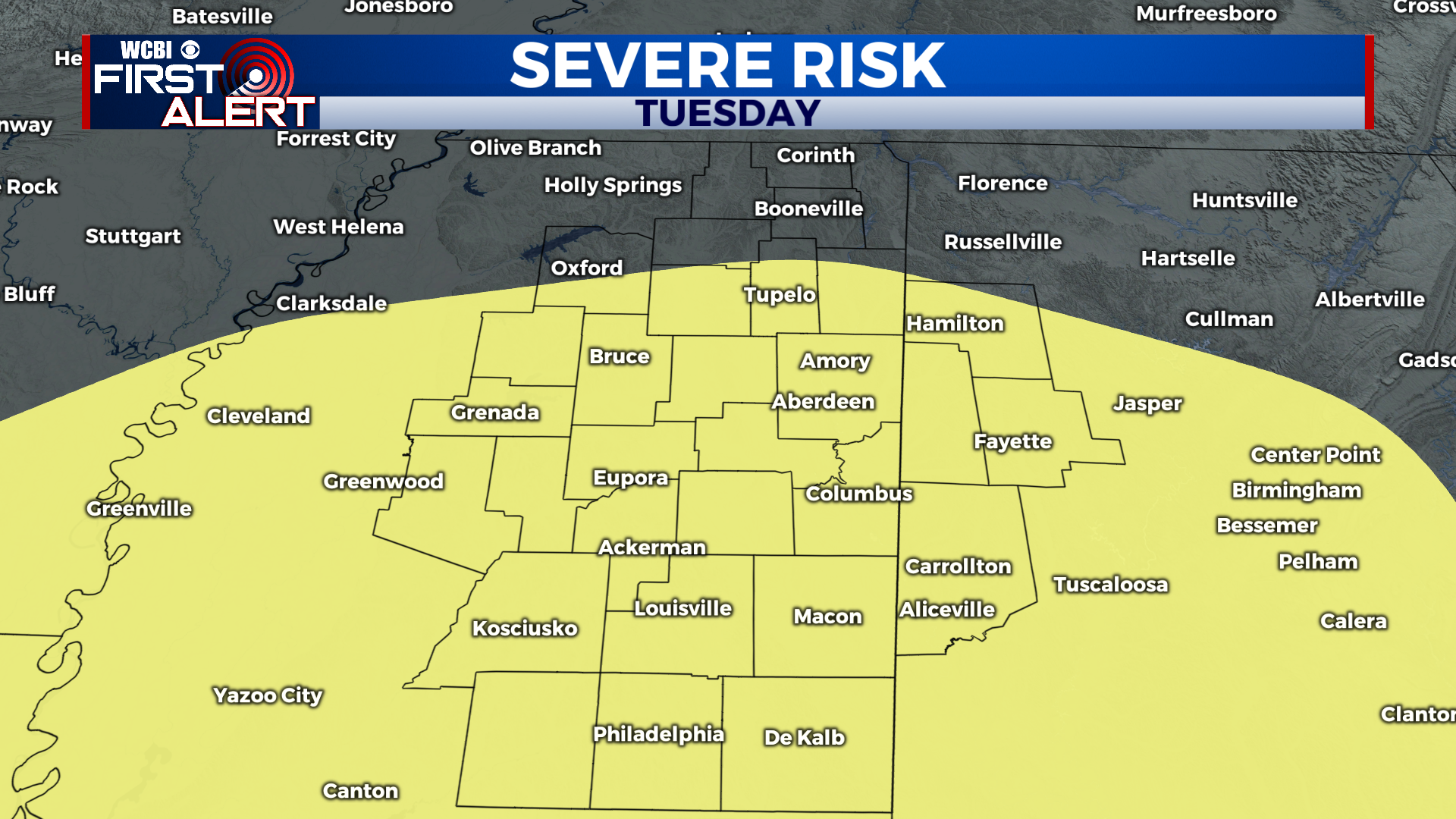
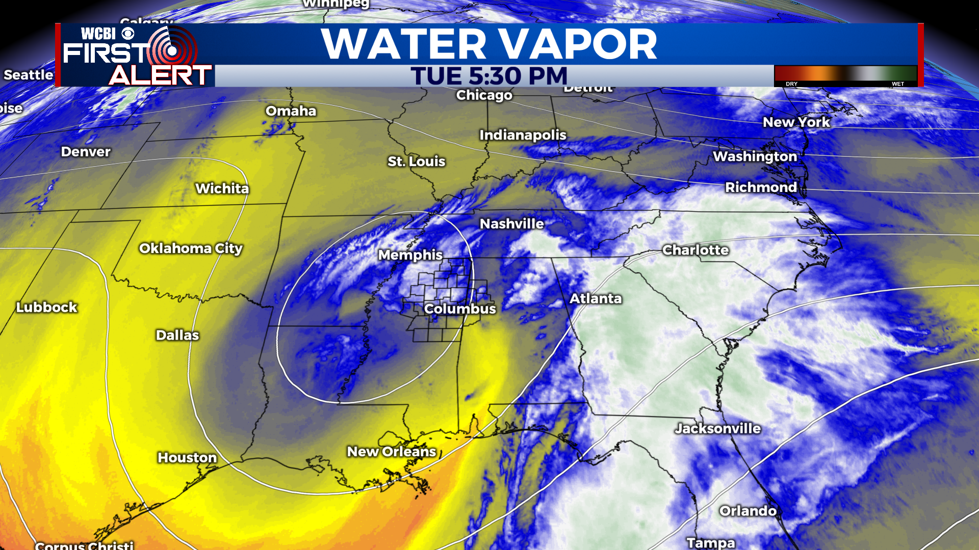
EXTENDED FORECAST: Another round of showers, and possibly a thunderstorm, will impact the region Thursday night and Friday morning. Rain should come to an end by the afternoon, and we will quickly warm into the upper-60s. Saturday and Sunday look great with copious sunshine and highs in the 60s and 70s. Our next chance of rain and storms will arrive Tuesday and it may carry the threat of severe weather. The Storm Prediction Center has issued a rare Day 8 Outlook for next Tuesday which includes most of our region. It is way too early for specifics, and model inconsistency is expectedly high for this far in advance. We will keep you updated as we progress through the week.