Rain ending & Fall beginning
A few scattered showers and thunderstorms continue across the region this evening. This activity is expected to diminish through the overnight. A strong cold front passes through the area tonight and with cooler weather ahead tomorrow. Let’s get into the details.
TONIGHT: Scattered showers and thunderstorms diminishing after sundown. Low temperatures in the mid-60s. Chance of rain: 60% before midnight, then 10% overnight.

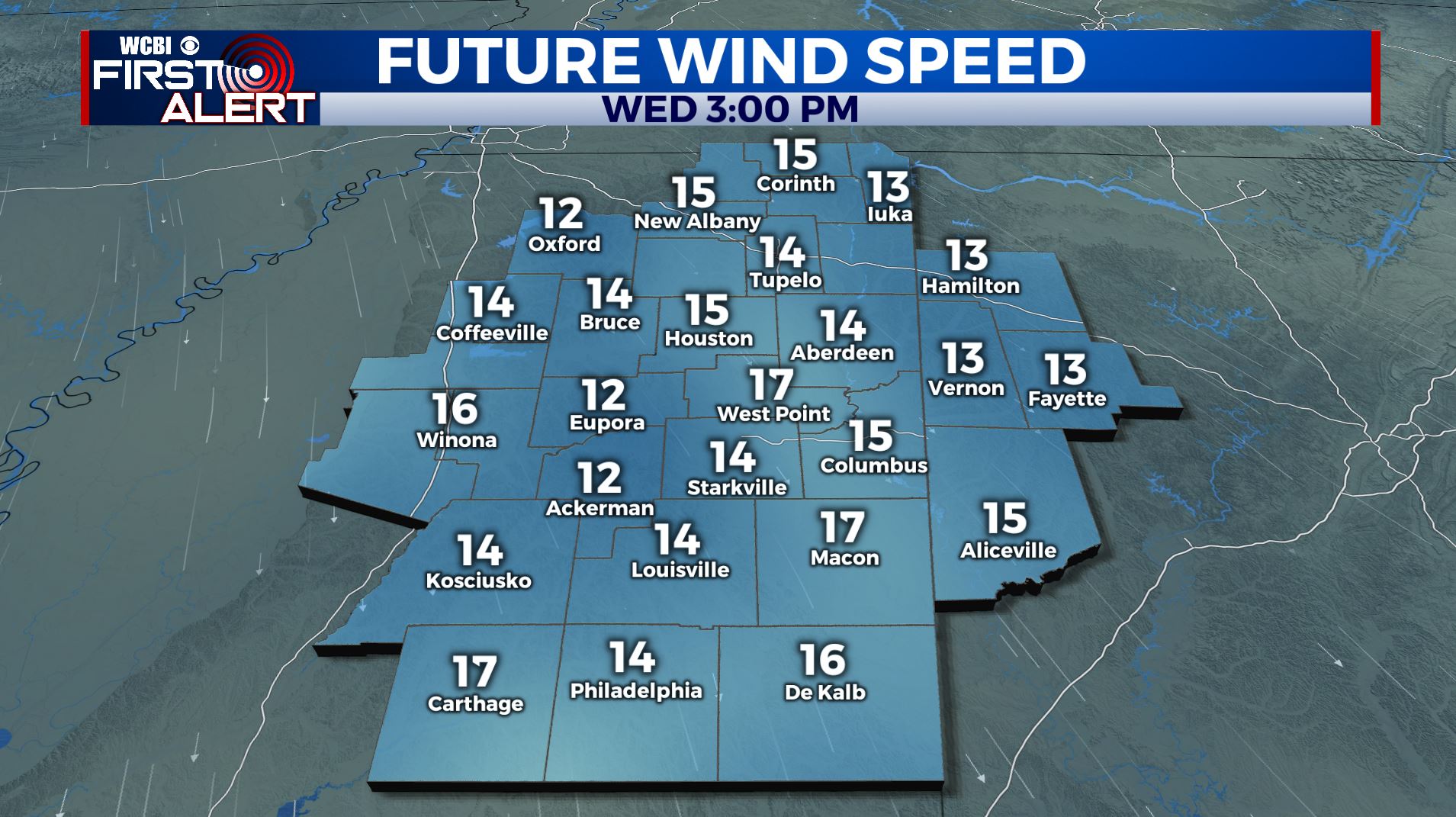
WEDNESDAY: Isolated showers and thunderstorms before 7am; otherwise, overcast start to the day followed by gradual clearing through the afternoon. Sustained winds 10-15 mph with gusts over 30 mph. High temperatures will be in the mid-to-upper 70s.
WEDNESDAY NIGHT: Clear and cooler with overnight lows in the low-50s.
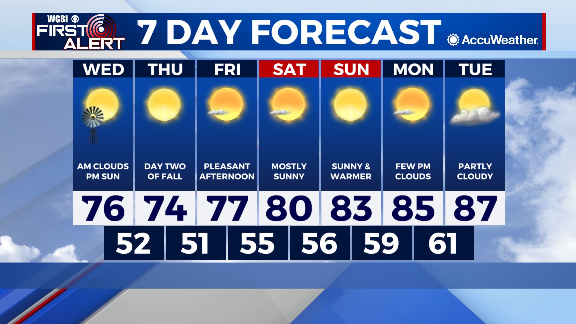
THIS WEEK: A strong cold front will deliver the best taste of Fall weather Wednesday… which also happens to be the start of Fall! Afternoon high temperatures will remain in the 70s through the end of the work week, before returning to the 80s next week. The pattern will remain calm with sunny skies after the front. A quick check of the tropics has a couple of tropical systems in the mid-Atlantic we are keeping our eye on; however, there is no threat to the U.S. at this time from any of them. Have a great rest of your evening!


