Rain returns, but with a warm week
COLUMBUS, Mississippi (WCBI)- Compared to last week’s cold and rainy conditions, this week is going to be a bit more mild. However, the rain chance makes a return mid-week.
MONDAY NIGHT: It is going to be a chilled evening and overnight. Temperatures will not be getting as cold, only dropping into the lower 40s. Cloud coverage will stay fairly light, but will begin to slowly fill in overnight and into Tuesday morning.
TUESDAY: Cloud coverage builds back in, also with a chance of seeing some spotty showers. High temperatures will be in the middle 60s. Overnight temperatures will be in the middle 50s, as cloud coverage holds in some of the warmth from the day.
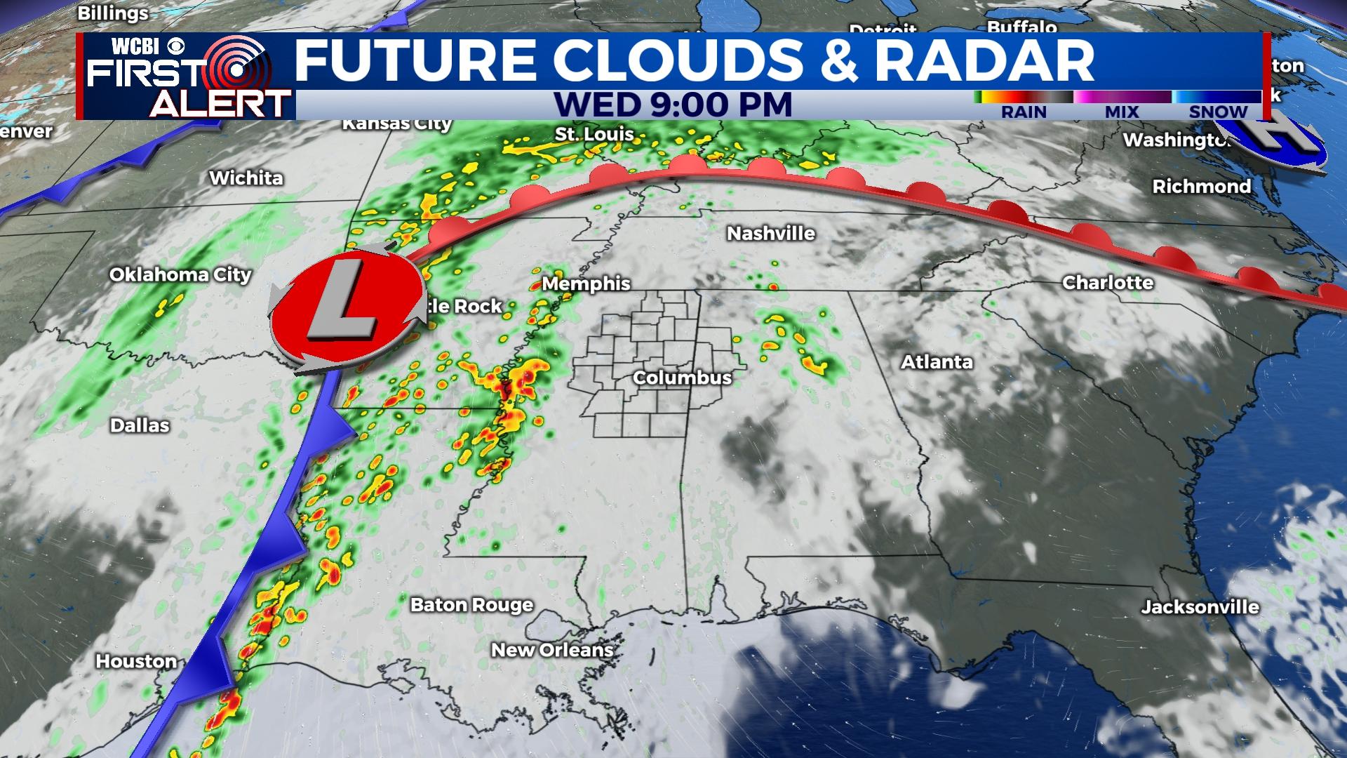
WEDNESDAY: Temperatures for the middle of the week may make it into the lower 70s, at least the upper 60s! Heavy clouds and spotty showers will continue through the morning and afternoon. By evening and overnight Wednesday into Thursday morning, heavy showers and storms will be moving across Mississippi from the West. Exact timing is still uncertain at this moment, as some models are moving this system across much faster than other models. There is a chance of having a severe risk along with this system, including damaging winds and possible tornadoes. This threat is possible for all of Louisiana and Mississippi, with also the majority of Alabama included. Stay updated with us as more details get lined up.
END OF WEEK: The temperatures are going to slowly be dropping by the end of the week. Thursday will be mild again, in the middle 60s, with a partly cloudy sky. Overnight temperature will be in the middle 40s. Also, Thursday evening at 6 PM, come to the Rent Auditorium on the MUW Campus and join us for the WCBI Weather Roadshow! By Friday, high temperature in the middle 50s and low temperatures in the lower 30s, with mostly cloudy coverage.


